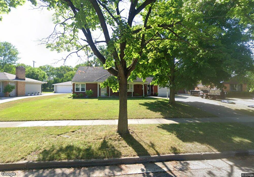
2532 Borglum Ave NE Grand Rapids, MI 49505
Creston NeighborhoodEstimated Value: $349,391 - $406,000
4
Beds
2
Baths
1
Sq Ft
$383,848/Sq Ft
Est. Value
About This Home
This home is located at 2532 Borglum Ave NE, Grand Rapids, MI 49505 and is currently estimated at $383,848, approximately $383,848 per square foot. 2532 Borglum Ave NE is a home located in Kent County with nearby schools including Riverside Middle School, Union High School, and All Saints Academy - Lower Campus.
Ownership History
Date
Name
Owned For
Owner Type
Purchase Details
Closed on
Feb 18, 2025
Sold by
Wideman Charles R and Wideman Joyce R
Bought by
Charles And Joyce Wideman Trust and Wideman
Current Estimated Value
Purchase Details
Closed on
May 23, 1996
Sold by
Dunn Dunn C C and Dunn Wideman C
Bought by
Wideman Wideman C and Wideman Charles R Joyce R
Purchase Details
Closed on
Feb 15, 1990
Sold by
Derby Derby R R and Derby Dunn C
Bought by
Wideman Charles R Joyce R
Purchase Details
Closed on
Jun 25, 1985
Bought by
Wideman Charles R Joyce R
Purchase Details
Closed on
Nov 30, 1983
Bought by
Wideman Charles R Joyce R
Create a Home Valuation Report for This Property
The Home Valuation Report is an in-depth analysis detailing your home's value as well as a comparison with similar homes in the area
Home Values in the Area
Average Home Value in this Area
Purchase History
| Date | Buyer | Sale Price | Title Company |
|---|---|---|---|
| Charles And Joyce Wideman Trust | -- | None Listed On Document | |
| Wideman Wideman C | $118,000 | -- | |
| Wideman Charles R Joyce R | $96,500 | -- | |
| Wideman Charles R Joyce R | $72,000 | -- | |
| Wideman Charles R Joyce R | $38,900 | -- |
Source: Public Records
Tax History Compared to Growth
Tax History
| Year | Tax Paid | Tax Assessment Tax Assessment Total Assessment is a certain percentage of the fair market value that is determined by local assessors to be the total taxable value of land and additions on the property. | Land | Improvement |
|---|---|---|---|---|
| 2025 | $2,813 | $165,900 | $0 | $0 |
| 2024 | $2,813 | $155,400 | $0 | $0 |
| 2023 | $2,854 | $132,800 | $0 | $0 |
| 2022 | $2,709 | $121,400 | $0 | $0 |
| 2021 | $2,649 | $120,200 | $0 | $0 |
| 2020 | $2,532 | $111,900 | $0 | $0 |
| 2019 | $2,652 | $104,600 | $0 | $0 |
| 2018 | $2,561 | $99,300 | $0 | $0 |
| 2017 | $2,493 | $89,200 | $0 | $0 |
| 2016 | $2,523 | $81,100 | $0 | $0 |
| 2015 | $2,347 | $81,100 | $0 | $0 |
| 2013 | -- | $72,600 | $0 | $0 |
Source: Public Records
Map
Nearby Homes
- 2550 Borglum Ave NE
- 661 Conger St NE
- 648 Russwood St NE
- 838 Aberdeen St NE
- 518 Russwood St NE
- 929 Ellsmere St NE
- 753 Halena St NE
- 2630 Oakwood Ave NE
- 2905 Remy Ct NE Unit 1
- 2480 Lafayette Ave NE
- 1116 Kelsey St NE
- 1110 Aberdeen St NE
- 483 Kenwood St NE
- 1139 Arlington St NE
- 465 Kenwood St NE
- 1115 Ecklund St NE
- 2033 Melita Ave NE
- 2031 Eastern Ave NE
- 741 Knapp St NE
- 240 Eleanor St NE
- 2524 Borglum Ave NE
- 2531 Foster Ave NE
- 2542 Borglum Ave NE
- 2518 Borglum Ave NE
- 2525 Foster Ave NE
- 2539 Foster Ave NE
- 2519 Foster Ave NE
- 2533 Borglum Ave NE
- 2545 Foster Ave NE
- 2529 Borglum Ave NE
- 2537 Borglum Ave NE
- 2525 Borglum Ave NE
- 2541 Borglum Ave NE
- 705 Sligh Blvd NE
- 2553 Foster Ave NE
- 721 Sligh Blvd NE
- 2558 Borglum Ave NE
- 2549 Borglum Ave NE
- 2515 Borglum Ave NE
- 2559 Foster Ave NE