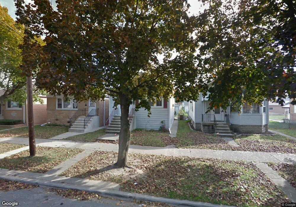
2533 Hessing St River Grove, IL 60171
Estimated Value: $249,000 - $314,000
2
Beds
2
Baths
864
Sq Ft
$336/Sq Ft
Est. Value
About This Home
This home is located at 2533 Hessing St, River Grove, IL 60171 and is currently estimated at $290,081, approximately $335 per square foot. 2533 Hessing St is a home located in Cook County with nearby schools including River Grove School and St. Francis Borgia School.
Ownership History
Date
Name
Owned For
Owner Type
Purchase Details
Closed on
Aug 4, 2000
Sold by
Biedron Stanley F
Bought by
Declaration Biedron Stanley F and Stanley F Bierdron Declaration Of Trust
Current Estimated Value
Purchase Details
Closed on
Apr 30, 1998
Sold by
Decastris James and Cipriani Elizabeth
Bought by
Biedron Stanley F
Home Financials for this Owner
Home Financials are based on the most recent Mortgage that was taken out on this home.
Original Mortgage
$50,000
Outstanding Balance
$8,716
Interest Rate
7.19%
Estimated Equity
$281,365
Purchase Details
Closed on
Oct 31, 1995
Sold by
Mckinley Joseph John and Mckinley Sandra A
Bought by
Decastris James P and Cipriani Elizabeth M
Home Financials for this Owner
Home Financials are based on the most recent Mortgage that was taken out on this home.
Original Mortgage
$104,500
Interest Rate
7.7%
Create a Home Valuation Report for This Property
The Home Valuation Report is an in-depth analysis detailing your home's value as well as a comparison with similar homes in the area
Home Values in the Area
Average Home Value in this Area
Purchase History
| Date | Buyer | Sale Price | Title Company |
|---|---|---|---|
| Declaration Biedron Stanley F | -- | -- | |
| Biedron Stanley F | $122,500 | Professional National Title | |
| Decastris James P | $110,000 | -- |
Source: Public Records
Mortgage History
| Date | Status | Borrower | Loan Amount |
|---|---|---|---|
| Open | Biedron Stanley F | $50,000 | |
| Previous Owner | Decastris James P | $104,500 |
Source: Public Records
Tax History Compared to Growth
Tax History
| Year | Tax Paid | Tax Assessment Tax Assessment Total Assessment is a certain percentage of the fair market value that is determined by local assessors to be the total taxable value of land and additions on the property. | Land | Improvement |
|---|---|---|---|---|
| 2025 | $3,206 | $25,001 | $4,688 | $20,313 |
| 2024 | $3,206 | $23,001 | $3,938 | $19,063 |
| 2023 | $3,243 | $23,001 | $3,938 | $19,063 |
| 2022 | $3,243 | $23,001 | $3,938 | $19,063 |
| 2021 | $4,997 | $16,620 | $2,812 | $13,808 |
| 2020 | $4,828 | $16,620 | $2,812 | $13,808 |
| 2019 | $4,826 | $18,823 | $2,812 | $16,011 |
| 2018 | $4,996 | $17,840 | $2,437 | $15,403 |
| 2017 | $4,957 | $17,840 | $2,437 | $15,403 |
| 2016 | $4,657 | $17,840 | $2,437 | $15,403 |
| 2015 | $3,994 | $14,969 | $2,156 | $12,813 |
| 2014 | $3,974 | $14,969 | $2,156 | $12,813 |
| 2013 | $3,794 | $14,969 | $2,156 | $12,813 |
Source: Public Records
Map
Nearby Homes
- 2542 Budd St
- 2504 Budd St
- 2521 N Thatcher Ave Unit 3A
- 8211 W Grand Ave
- 8250 W Grand Ave
- 2718 Budd St Unit 2S
- 2718 Budd St
- 2525 Davisson St
- 2400 Haymond St
- 8460 River Grove Ave
- 7929 W Grand Ave Unit 405
- 8522 Center St
- 8520 Center St
- 8524 Center Ave
- 8549 W Grand Ave Unit 3E
- 8625 Grand Ave Unit 24
- 2440 River Rd Unit 3E
- 8631 W Grand Ave Unit 4W
- 8233 Oconnor Dr
- 8045 Oconnor Dr Unit 6A
- 2535 Hessing St
- 2531 Hessing St
- 2537 Hessing St
- 2521 Hessing St
- 2541 Hessing St
- 2543 Hessing St
- 2532 Clinton St
- 2528 Clinton St
- 2517 Hessing St
- 2536 Clinton St
- 2518 Clinton St
- 2547 Hessing St
- 2520 Clinton St
- 2542 Clinton St
- 2515 Hessing St
- 2544 Clinton St
- 2514 Clinton St
- 2530 Hessing St
- 2534 Hessing St