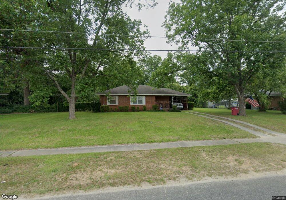
2534 Locksley Dr Macon, GA 31206
Estimated Value: $83,000 - $127,603
3
Beds
1
Bath
1,043
Sq Ft
$100/Sq Ft
Est. Value
About This Home
This home is located at 2534 Locksley Dr, Macon, GA 31206 and is currently estimated at $103,901, approximately $99 per square foot. 2534 Locksley Dr is a home located in Bibb County with nearby schools including Veterans Elementary School, Southwest High School, and Gilead Christian Academy.
Ownership History
Date
Name
Owned For
Owner Type
Purchase Details
Closed on
Jul 23, 2018
Sold by
Wilson T Darryl
Bought by
Leary Alphonso L
Current Estimated Value
Home Financials for this Owner
Home Financials are based on the most recent Mortgage that was taken out on this home.
Original Mortgage
$39,000
Outstanding Balance
$3,858
Interest Rate
4.6%
Mortgage Type
Seller Take Back
Estimated Equity
$100,043
Purchase Details
Closed on
Mar 1, 2010
Sold by
Cain Patricia Austin and Cain William Elba
Bought by
Cain Patricia A
Purchase Details
Closed on
Aug 27, 1955
Sold by
Freeman H L
Bought by
Cain William E
Create a Home Valuation Report for This Property
The Home Valuation Report is an in-depth analysis detailing your home's value as well as a comparison with similar homes in the area
Home Values in the Area
Average Home Value in this Area
Purchase History
| Date | Buyer | Sale Price | Title Company |
|---|---|---|---|
| Leary Alphonso L | $40,000 | None Available | |
| Wilson T Darryl | $25,500 | None Available | |
| Cain Patricia A | -- | None Available | |
| Cain William E | $10,800 | -- |
Source: Public Records
Mortgage History
| Date | Status | Borrower | Loan Amount |
|---|---|---|---|
| Open | Wilson T Darryl | $39,000 |
Source: Public Records
Tax History Compared to Growth
Tax History
| Year | Tax Paid | Tax Assessment Tax Assessment Total Assessment is a certain percentage of the fair market value that is determined by local assessors to be the total taxable value of land and additions on the property. | Land | Improvement |
|---|---|---|---|---|
| 2025 | $796 | $39,395 | $6,348 | $33,047 |
| 2024 | $786 | $37,962 | $6,072 | $31,890 |
| 2023 | $60 | $27,376 | $2,430 | $24,946 |
| 2022 | $527 | $22,212 | $3,344 | $18,868 |
| 2021 | $578 | $22,212 | $3,344 | $18,868 |
| 2020 | $387 | $16,968 | $3,009 | $13,959 |
| 2019 | $421 | $17,764 | $3,009 | $14,755 |
| 2018 | $406 | $17,668 | $3,009 | $14,659 |
| 2017 | $131 | $17,668 | $3,009 | $14,659 |
| 2016 | $111 | $17,668 | $3,009 | $14,659 |
| 2015 | $165 | $17,668 | $3,009 | $14,659 |
| 2014 | $151 | $20,764 | $4,414 | $16,351 |
Source: Public Records
Map
Nearby Homes
- 2443 Lambert Dr
- 2521 Rocky Creek Rd
- 4241 Pinedale Dr
- 2995 Virginia Dr
- 4249 Elkan Ave
- 2765 Alden St
- 2868 Barrett Ave
- 2770 Bonnie Ave
- 2769 Nancy Dr
- 2704 Reynolds Dr
- 2431 Vivian Dr
- 2768 Nancy Dr
- 4496 Thrasher Cir
- 5770 Satterfield Dr
- 4488 Thrasher Cir
- 2465 Thrasher Ave
- 5771 Satterfield Dr
- 5711 Sterling Place
- 2540 Locksley Dr
- 2528 Locksley Dr
- 2546 Locksley Dr
- 2522 Locksley Dr
- 2539 Wallace Dr
- 2531 Wallace Dr
- 2547 Wallace Dr
- 2533 Locksley Dr
- 2539 Locksley Dr
- 2527 Locksley Dr
- 2523 Wallace Dr
- 2555 Wallace Dr
- 2516 Locksley Dr
- 2554 Locksley Dr
- 2545 Locksley Dr
- 2521 Locksley Dr
- 0 Locksley Dr Unit 8643144
- 0 Locksley Dr Unit 8627163
- 0 Locksley Dr Unit 8641574
- 0 Locksley Dr Unit 7554959