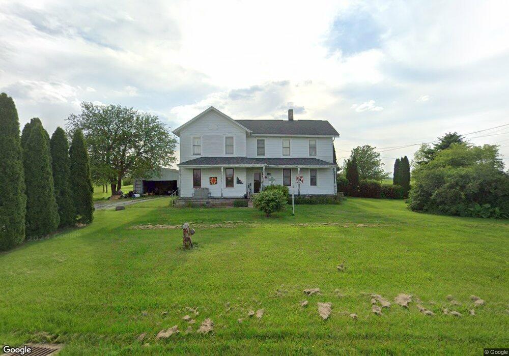
2534 N Elliston Trowbridge Rd Graytown, OH 43432
Estimated Value: $236,000 - $275,000
5
Beds
2
Baths
2,316
Sq Ft
$107/Sq Ft
Est. Value
About This Home
This home is located at 2534 N Elliston Trowbridge Rd, Graytown, OH 43432 and is currently estimated at $246,997, approximately $106 per square foot. 2534 N Elliston Trowbridge Rd is a home located in Ottawa County with nearby schools including Oak Harbor High School.
Ownership History
Date
Name
Owned For
Owner Type
Purchase Details
Closed on
May 15, 1995
Sold by
Robb Thomas F
Bought by
Schnapp Leo R and Schnapp Carolyn J
Current Estimated Value
Home Financials for this Owner
Home Financials are based on the most recent Mortgage that was taken out on this home.
Original Mortgage
$67,500
Interest Rate
8.39%
Mortgage Type
New Conventional
Create a Home Valuation Report for This Property
The Home Valuation Report is an in-depth analysis detailing your home's value as well as a comparison with similar homes in the area
Home Values in the Area
Average Home Value in this Area
Purchase History
| Date | Buyer | Sale Price | Title Company |
|---|---|---|---|
| Schnapp Leo R | $75,000 | -- |
Source: Public Records
Mortgage History
| Date | Status | Borrower | Loan Amount |
|---|---|---|---|
| Closed | Schnapp Leo R | $67,500 |
Source: Public Records
Tax History Compared to Growth
Tax History
| Year | Tax Paid | Tax Assessment Tax Assessment Total Assessment is a certain percentage of the fair market value that is determined by local assessors to be the total taxable value of land and additions on the property. | Land | Improvement |
|---|---|---|---|---|
| 2024 | $2,604 | $69,724 | $16,461 | $53,263 |
| 2023 | $2,604 | $56,525 | $10,969 | $45,556 |
| 2022 | $2,385 | $56,525 | $10,969 | $45,556 |
| 2021 | $2,402 | $56,530 | $10,970 | $45,560 |
| 2020 | $2,129 | $48,480 | $9,790 | $38,690 |
| 2019 | $2,065 | $48,480 | $9,790 | $38,690 |
| 2018 | $1,895 | $48,480 | $9,790 | $38,690 |
| 2017 | $1,418 | $40,580 | $7,960 | $32,620 |
| 2016 | $1,421 | $40,580 | $7,960 | $32,620 |
| 2015 | $1,406 | $40,150 | $7,960 | $32,190 |
| 2014 | $707 | $38,450 | $7,960 | $30,490 |
| 2013 | $1,381 | $38,450 | $7,960 | $30,490 |
Source: Public Records
Map
Nearby Homes
- 1861 N Opfer-Lentz Rd
- 3784 N Stange Rd
- 0 W Walbridge E Unit 6135427
- 19395 W Walbridge Rd
- 19433 W Walbridge Rd
- 0 W Walbridge Rd
- Track 1 W Walbridge Rd
- 19481 W Walbridge Rd
- 19367 W Walbridge Rd
- 14642 W 3rd St
- 14339 3rd St
- 21490 Holts Rd E
- 14339 & 14363 W 3rd St
- 19383 Courtland Ave
- 1615 N Thyre Dr
- 207 E 11th St
- 1301 West St
- 904 Main St
- 20876 W Camper Rd
- 7105 N Elliston Trowbridge Rd
- 2459 N Elliston Trowbridge Rd
- 2440 N Elliston Trowbridge Rd
- 2349 N Elliston-Trowbridge Rd
- 2251 N Elliston Trowbridge Rd
- 2798 N Elliston Trowbridge Rd
- 2791 N Elliston Trowbridge Rd
- 2237 N Elliston Trowbridge Rd
- 17945 W William St
- 2212 N Elliston Trowbridge Rd
- 2215 N Rice St
- 2200 N Elliston-Trowbridge Rd
- 2200 N Elliston Trowbridge Rd
- 2201 N Rice St
- 17869 W 3rd St
- 2169 N Elliston Trowbridge Rd
- 2160 N Elliston Trowbridge Rd
- 17940 W 3rd St
- 2172 N Witty St
- 2160 N Rice St
- 2165 N Rice St