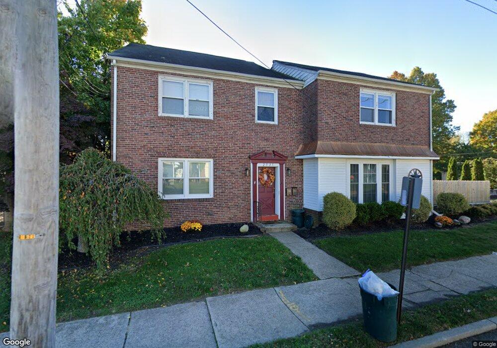
2535 Liberty St Trenton, NJ 08629
Estimated Value: $277,000 - $946,000
--
Bed
--
Bath
5,944
Sq Ft
$111/Sq Ft
Est. Value
About This Home
This home is located at 2535 Liberty St, Trenton, NJ 08629 and is currently estimated at $661,656, approximately $111 per square foot. 2535 Liberty St is a home located in Mercer County with nearby schools including Kuser Elementary School, Emily C. Reynolds Middle School, and Steinert - Hamilton High East.
Ownership History
Date
Name
Owned For
Owner Type
Purchase Details
Closed on
Jun 13, 2008
Sold by
Boyd Robert E and Boyd Carol L
Bought by
Dilissio Joseph C and Dilissio Lisa A
Current Estimated Value
Home Financials for this Owner
Home Financials are based on the most recent Mortgage that was taken out on this home.
Original Mortgage
$112,000
Outstanding Balance
$71,943
Interest Rate
6.07%
Mortgage Type
Commercial
Estimated Equity
$589,713
Create a Home Valuation Report for This Property
The Home Valuation Report is an in-depth analysis detailing your home's value as well as a comparison with similar homes in the area
Home Values in the Area
Average Home Value in this Area
Purchase History
| Date | Buyer | Sale Price | Title Company |
|---|---|---|---|
| Dilissio Joseph C | $140,000 | -- |
Source: Public Records
Mortgage History
| Date | Status | Borrower | Loan Amount |
|---|---|---|---|
| Open | Dilissio Joseph C | $112,000 |
Source: Public Records
Tax History Compared to Growth
Tax History
| Year | Tax Paid | Tax Assessment Tax Assessment Total Assessment is a certain percentage of the fair market value that is determined by local assessors to be the total taxable value of land and additions on the property. | Land | Improvement |
|---|---|---|---|---|
| 2025 | $10,917 | $309,800 | $110,100 | $199,700 |
| 2024 | $10,233 | $309,800 | $110,100 | $199,700 |
| 2023 | $10,233 | $309,800 | $110,100 | $199,700 |
| 2022 | $10,072 | $309,800 | $110,100 | $199,700 |
| 2021 | $11,565 | $309,800 | $110,100 | $199,700 |
| 2020 | $10,450 | $309,800 | $110,100 | $199,700 |
| 2019 | $10,177 | $309,800 | $110,100 | $199,700 |
| 2018 | $10,062 | $309,800 | $110,100 | $199,700 |
| 2017 | $9,548 | $309,800 | $110,100 | $199,700 |
| 2016 | $11,200 | $414,200 | $110,100 | $304,100 |
| 2015 | $13,042 | $268,400 | $59,300 | $209,100 |
| 2014 | $12,832 | $268,400 | $59,300 | $209,100 |
Source: Public Records
Map
Nearby Homes
- 1427 Hamilton Ave
- 235 Darcy Ave
- 20 Charlotte Ave
- 51 Charlotte Ave
- 144 Beal St
- 618 Atlantic Ave
- 1524 Elizabeth Ave
- 61 Leuckel Ave
- 480 S Logan Ave
- 448 Lynwood Ave
- 20 Leuckel Ave
- 25 Brook Ln
- 657 S Olden Ave
- 631 S Olden Ave
- 125 Edwin Ave
- 541 Emmett Ave
- 42 Bismarck Ave
- 365 Cleveland Ave
- 19 Scammel Ave
- 26 Bismarck Ave
- 2545 Liberty St
- 2551 Liberty St Unit 3
- 2551 Liberty St Unit 4
- 2551 Liberty St
- 2551 Liberty St Unit 2
- 36 Mason Ave
- 2511 Liberty St
- 25 Mason Ave
- 2538 Liberty St
- 2503 Liberty St
- 2544 Liberty St
- 2534 Liberty St
- 2520 Liberty St
- 2548 Liberty St
- 33 Mason Ave
- 2512 Liberty St
- 122 Camp Ave
- 2552 Liberty St
- 2465 Liberty St
- 2506 Liberty St