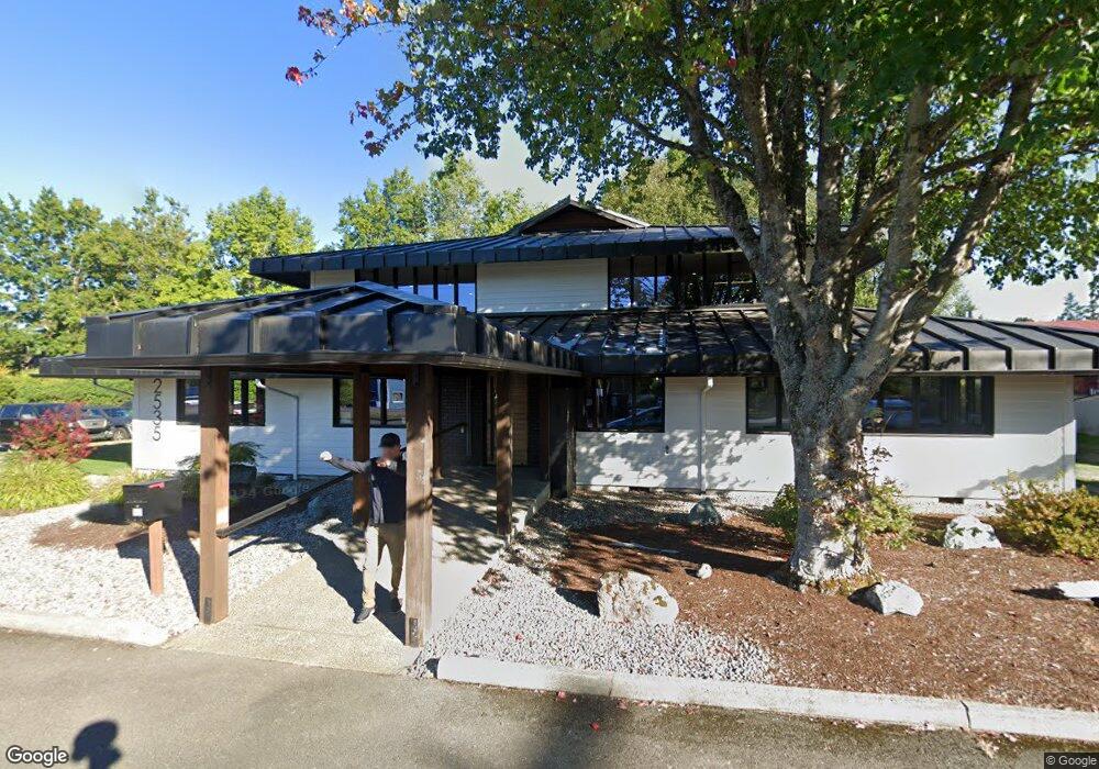
2535 Mitchell Rd SE Port Orchard, WA 98366
Estimated Value: $815,271
--
Bed
--
Bath
4,092
Sq Ft
$199/Sq Ft
Est. Value
About This Home
This home is located at 2535 Mitchell Rd SE, Port Orchard, WA 98366 and is currently estimated at $815,271, approximately $199 per square foot. 2535 Mitchell Rd SE is a home located in Kitsap County with nearby schools including East Port Orchard Elementary School, Marcus Whitman Middle School, and South Kitsap High School.
Ownership History
Date
Name
Owned For
Owner Type
Purchase Details
Closed on
Feb 3, 2022
Sold by
First Lutheran Church Of Port Orchard
Bought by
777 Paramount Street Llc
Current Estimated Value
Home Financials for this Owner
Home Financials are based on the most recent Mortgage that was taken out on this home.
Original Mortgage
$453,200
Outstanding Balance
$420,318
Interest Rate
3.45%
Mortgage Type
Credit Line Revolving
Estimated Equity
$394,953
Purchase Details
Closed on
Feb 10, 2004
Sold by
Rogers William Michael and Rogers Judith N
Bought by
First Lutheran Church Of Port Orchard
Home Financials for this Owner
Home Financials are based on the most recent Mortgage that was taken out on this home.
Original Mortgage
$1,225,000
Interest Rate
5.62%
Mortgage Type
Commercial
Create a Home Valuation Report for This Property
The Home Valuation Report is an in-depth analysis detailing your home's value as well as a comparison with similar homes in the area
Home Values in the Area
Average Home Value in this Area
Purchase History
| Date | Buyer | Sale Price | Title Company |
|---|---|---|---|
| 777 Paramount Street Llc | $753,250 | Land Title | |
| First Lutheran Church Of Port Orchard | $675,000 | First American Title Ins | |
| Rogers William Michael | -- | First American Title Ins |
Source: Public Records
Mortgage History
| Date | Status | Borrower | Loan Amount |
|---|---|---|---|
| Open | 777 Paramount Street Llc | $453,200 | |
| Previous Owner | First Lutheran Church Of Port Orchard | $1,225,000 |
Source: Public Records
Tax History Compared to Growth
Tax History
| Year | Tax Paid | Tax Assessment Tax Assessment Total Assessment is a certain percentage of the fair market value that is determined by local assessors to be the total taxable value of land and additions on the property. | Land | Improvement |
|---|---|---|---|---|
| 2026 | $5,889 | $675,000 | $287,520 | $387,480 |
| 2025 | $5,889 | $675,000 | $285,890 | $389,110 |
| 2024 | $5,685 | $675,000 | $272,280 | $402,720 |
| 2023 | $5,680 | $675,000 | $247,520 | $427,480 |
| 2022 | $0 | $628,650 | $247,520 | $381,130 |
| 2021 | $0 | $628,650 | $216,140 | $412,510 |
| 2020 | $0 | $590,040 | $216,140 | $373,900 |
| 2019 | $0 | $857,640 | $213,740 | $643,900 |
| 2018 | $0 | $857,640 | $200,610 | $657,030 |
| 2017 | $0 | $857,640 | $200,610 | $657,030 |
| 2016 | -- | $857,640 | $200,610 | $657,030 |
| 2015 | -- | $857,640 | $200,610 | $657,030 |
| 2014 | -- | $914,810 | $187,490 | $727,320 |
| 2013 | -- | $720,490 | $204,610 | $515,880 |
Source: Public Records
Map
Nearby Homes
- 2673 Harold Dr SE
- 1350 SE Shelton Ln
- 3132 Harris Rd SE
- 0 Lincoln Ave SE
- 2313 Lincoln Ave SE
- 2198 SE Galeel Ct
- 2235 Eisenhower Ave SE
- 2360 SE Plymouth Way
- 1408 West Ave
- 1325 Garrison Ave
- 2225 SE Kelby Cir
- 2315 SE Kelby Cir
- 1234 Garrison Ave
- 3922 Bethel Rd SE
- 1369 Sherman Ave
- 410 Kendall St
- 1743 SE Crawford Rd
- 0 Smith St
- 155 May St W
- 911 Hull Ave
- 2530 Hoover Ave SE
- 2508 Mitchell Rd SE
- 2522 Hoover Ave SE
- 2464 Mitchell Rd SE
- 2512 Hoover Ave SE
- 2497 Bethel Rd SE
- 2460 Mitchell Rd SE
- 2500 Hoover Ave SE
- 1081 1803 Beck
- 2444 Mitchell Rd SE
- 1812 Lincoln Ave SE
- 1830 Lincoln Ave SE
- 2486 Hoover Ave SE
- 1801 SE Beck St
- 2511 Hoover Ave SE
- 2914 Mitchell Rd SE
- 2822 Greendale Dr SE
- 2422 Mitchell Rd SE
- 2465 Bethel Rd SE
- 2501 Hoover Ave SE