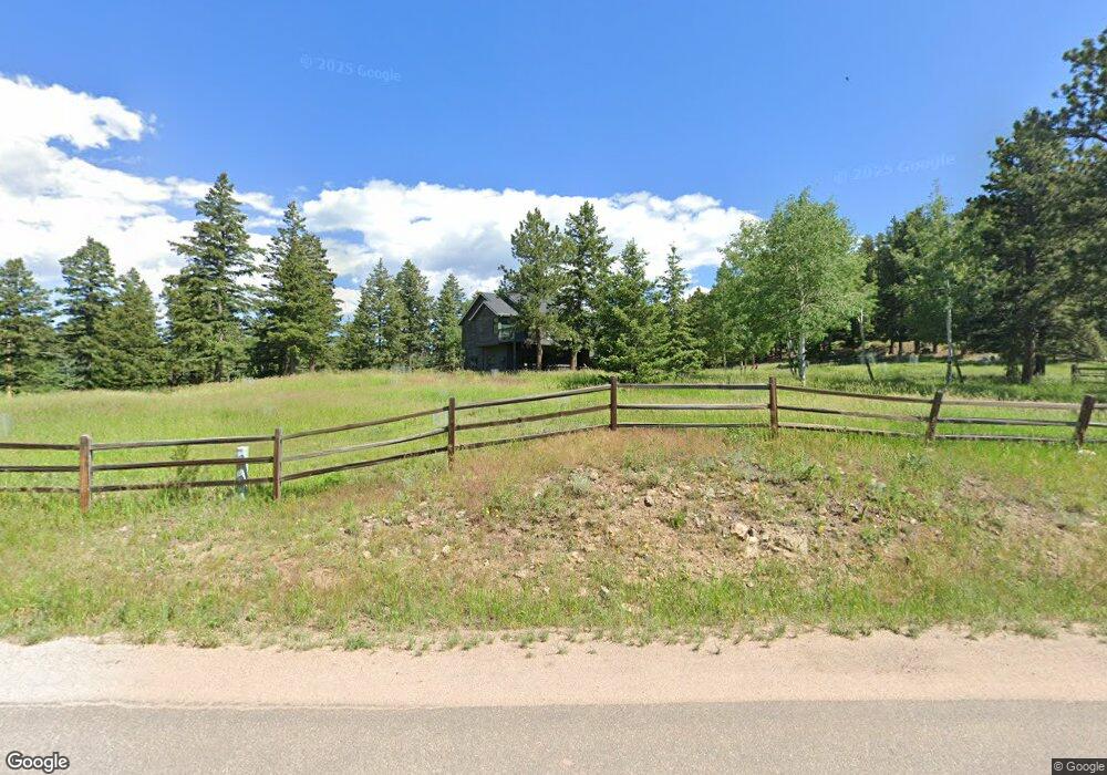
25357 Giant Gulch Rd Evergreen, CO 80439
North Turkey Creek NeighborhoodEstimated Value: $1,330,155 - $1,539,000
5
Beds
3
Baths
3,069
Sq Ft
$465/Sq Ft
Est. Value
About This Home
This home is located at 25357 Giant Gulch Rd, Evergreen, CO 80439 and is currently estimated at $1,427,539, approximately $465 per square foot. 25357 Giant Gulch Rd is a home located in Jefferson County with nearby schools including Wilmot Elementary School, Evergreen Middle School, and Evergreen High School.
Ownership History
Date
Name
Owned For
Owner Type
Purchase Details
Closed on
Jul 19, 2019
Sold by
Smith Suzanne E
Bought by
Smith Kevin M
Current Estimated Value
Home Financials for this Owner
Home Financials are based on the most recent Mortgage that was taken out on this home.
Original Mortgage
$488,000
Outstanding Balance
$427,532
Interest Rate
3.82%
Mortgage Type
New Conventional
Estimated Equity
$1,000,007
Purchase Details
Closed on
Nov 30, 2017
Sold by
Long Michael and Lynne Amy
Bought by
Smith Kevin M and Smith Suzanne E
Home Financials for this Owner
Home Financials are based on the most recent Mortgage that was taken out on this home.
Original Mortgage
$174,650
Interest Rate
3.88%
Mortgage Type
Credit Line Revolving
Purchase Details
Closed on
Jan 31, 2006
Sold by
Hartman Lawrence C and Obrien Mary E
Bought by
Long Michael and Long Amy Lynne
Home Financials for this Owner
Home Financials are based on the most recent Mortgage that was taken out on this home.
Original Mortgage
$516,000
Interest Rate
6.12%
Mortgage Type
Purchase Money Mortgage
Purchase Details
Closed on
Jun 4, 2001
Sold by
Kale Michael S and Kale Mary A
Bought by
Hartman Lawrence C and Obrien Mary E
Home Financials for this Owner
Home Financials are based on the most recent Mortgage that was taken out on this home.
Original Mortgage
$341,600
Interest Rate
6.65%
Purchase Details
Closed on
Dec 8, 2000
Sold by
Arthur Ralph W Arthur Paula D
Bought by
Kale Michael S and Kale Mary A
Home Financials for this Owner
Home Financials are based on the most recent Mortgage that was taken out on this home.
Original Mortgage
$258,000
Interest Rate
7.72%
Purchase Details
Closed on
Jun 15, 1999
Sold by
Janeczko Stanley B and Christine Janeczko
Bought by
Arthur Ralph W and Arthur Paula D
Home Financials for this Owner
Home Financials are based on the most recent Mortgage that was taken out on this home.
Original Mortgage
$240,000
Interest Rate
7.02%
Create a Home Valuation Report for This Property
The Home Valuation Report is an in-depth analysis detailing your home's value as well as a comparison with similar homes in the area
Home Values in the Area
Average Home Value in this Area
Purchase History
| Date | Buyer | Sale Price | Title Company |
|---|---|---|---|
| Smith Kevin M | -- | Fidelity National Title | |
| Smith Kevin M | $835,000 | Land Title Guarantee Co | |
| Long Michael | $647,000 | Land Title | |
| Hartman Lawrence C | $427,000 | -- | |
| Kale Michael S | $398,000 | -- | |
| Arthur Ralph W | $347,900 | -- |
Source: Public Records
Mortgage History
| Date | Status | Borrower | Loan Amount |
|---|---|---|---|
| Open | Smith Kevin M | $488,000 | |
| Closed | Smith Kevin M | $174,650 | |
| Previous Owner | Long Michael | $516,000 | |
| Previous Owner | Hartman Lawrence C | $341,600 | |
| Previous Owner | Kale Michael S | $258,000 | |
| Previous Owner | Arthur Ralph W | $240,000 |
Source: Public Records
Tax History Compared to Growth
Tax History
| Year | Tax Paid | Tax Assessment Tax Assessment Total Assessment is a certain percentage of the fair market value that is determined by local assessors to be the total taxable value of land and additions on the property. | Land | Improvement |
|---|---|---|---|---|
| 2024 | $6,123 | $66,760 | $20,317 | $46,443 |
| 2023 | $6,123 | $66,760 | $20,317 | $46,443 |
| 2022 | $4,988 | $52,795 | $12,350 | $40,445 |
| 2021 | $5,039 | $54,315 | $12,706 | $41,609 |
| 2020 | $4,759 | $50,900 | $12,264 | $38,636 |
| 2019 | $4,693 | $50,900 | $12,264 | $38,636 |
| 2018 | $4,072 | $42,722 | $9,416 | $33,306 |
| 2017 | $3,708 | $42,722 | $9,416 | $33,306 |
| 2016 | $3,869 | $41,668 | $11,898 | $29,770 |
| 2015 | $3,194 | $41,668 | $11,898 | $29,770 |
| 2014 | $3,194 | $33,374 | $14,031 | $19,343 |
Source: Public Records
Map
Nearby Homes
- 5166 Bear Mountain Dr
- 5166 Bear Mountain Dr Unit 1
- 25553 Mountain Moss Ct
- 5197 Bear Mountain Dr
- 5237 Bear Mountain Dr
- 5236 Bear Mountain Dr
- 5003 Snowberry Ln
- 25187 Stanley Park Rd
- 25728 Stanley Park Rd
- 0 Fern Gulch Unit REC6395499
- 5525 S Twin Spruce Dr
- 5720 Northwood Dr
- 5020 Liberty Dr
- 26178 Bell Park Dr Unit 4A
- 26367 Bell Park Dr
- 25925 Lost Cabin Trail Unit 39-43
- 5825 High Dr
- 23924 Matterhorn Dr
- 23891 Supai Rd
- 0 Tbd Mountain Park Rd
- 0 Lot 1 Independence Trail Unit 7666975
- 25533 Independence Trail
- 25107 Giant Gulch Rd
- 25504 Independence Trail
- 5057 Bear Mountain Dr
- 5057 S Bear Mountain Dr
- 4873 Denver View Dr
- 5007 Bear Mountain Dr
- 5077 Bear Mountain Dr
- 4994 Grouse Ct
- 25623 Independence Trail
- 4992 Grouse Ct
- 4722 Denver View Dr
- 25057 Giant Gulch Rd
- 5107 Bear Mountain Dr
- 4987 Bear Mountain Dr
- 4987 S Bear Mountain Dr
- 4996 Bear Mountian Dr
- 4996 S Bear Mountain Dr
- 4833 Denver View Dr