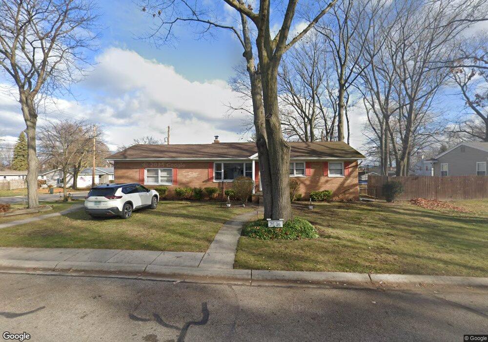
2536 16th Ave Port Huron, MI 48060
Estimated Value: $185,000 - $221,495
4
Beds
2
Baths
1,260
Sq Ft
$162/Sq Ft
Est. Value
About This Home
This home is located at 2536 16th Ave, Port Huron, MI 48060 and is currently estimated at $203,624, approximately $161 per square foot. 2536 16th Ave is a home located in St. Clair County with nearby schools including H.D. Crull Elementary School, Holland Woods Middle School, and Port Huron Northern High School.
Ownership History
Date
Name
Owned For
Owner Type
Purchase Details
Closed on
Aug 29, 2025
Sold by
Slyford Pamela
Bought by
Slyford Pamela and Slyford William
Current Estimated Value
Purchase Details
Closed on
Nov 27, 2024
Sold by
Slyford Steven George and Slyford Pamela
Bought by
Slyford Pamela
Purchase Details
Closed on
Jun 30, 2011
Sold by
Mccollam William Richard and Ryan Julie L
Bought by
Slyford Steven G
Home Financials for this Owner
Home Financials are based on the most recent Mortgage that was taken out on this home.
Original Mortgage
$57,016
Interest Rate
5.25%
Mortgage Type
FHA
Purchase Details
Closed on
Dec 30, 2010
Sold by
Mccollam William Richard and Mccollman Cheryl L
Bought by
Mccollam William Richard and Ryan Julie L
Create a Home Valuation Report for This Property
The Home Valuation Report is an in-depth analysis detailing your home's value as well as a comparison with similar homes in the area
Home Values in the Area
Average Home Value in this Area
Purchase History
| Date | Buyer | Sale Price | Title Company |
|---|---|---|---|
| Slyford Pamela | -- | None Listed On Document | |
| Slyford Pamela | -- | None Listed On Document | |
| Slyford Steven G | $68,500 | None Available | |
| Mccollam William Richard | -- | None Available |
Source: Public Records
Mortgage History
| Date | Status | Borrower | Loan Amount |
|---|---|---|---|
| Previous Owner | Slyford Steven G | $57,016 |
Source: Public Records
Tax History Compared to Growth
Tax History
| Year | Tax Paid | Tax Assessment Tax Assessment Total Assessment is a certain percentage of the fair market value that is determined by local assessors to be the total taxable value of land and additions on the property. | Land | Improvement |
|---|---|---|---|---|
| 2025 | $2,514 | $95,300 | $0 | $0 |
| 2024 | $2,154 | $87,900 | $0 | $0 |
| 2023 | $2,035 | $79,700 | $0 | $0 |
| 2022 | $2,156 | $71,700 | $0 | $0 |
| 2021 | $2,046 | $66,500 | $0 | $0 |
| 2020 | $2,069 | $63,100 | $63,100 | $0 |
| 2019 | $2,032 | $50,100 | $0 | $0 |
| 2018 | $1,987 | $50,100 | $0 | $0 |
| 2017 | $1,774 | $45,000 | $0 | $0 |
| 2016 | $1,520 | $45,000 | $0 | $0 |
| 2015 | $1,492 | $43,300 | $43,300 | $0 |
| 2014 | $1,492 | $43,600 | $43,600 | $0 |
| 2013 | -- | $42,600 | $0 | $0 |
Source: Public Records
Map
Nearby Homes
- 2215 Hancock St
- 2812 19th Ave
- 1434 Schumaker St
- 1531 Robinson St
- 1907 Riverside Dr
- 1819 Riverside Dr
- 2913 11th Ave
- 1218 Garfield St
- 1116 Hancock St
- 2549 Riverwood Dr
- 2857 Riverside Dr
- 2806 Woodstock Dr
- 3208 Mount Vernon Rd
- 2838 Elmwood St
- 2400 Stone St Unit 2414
- 1649 Whipple St
- 1620 McBrady St
- 1202 Palmer Ct
- 909 Elmwood St
- 2419 Cherry St
- 2528 16th Ave
- 2541 15th Ave
- 2000 Hancock St
- 2533 16th Ave
- 2524 16th Ave
- 1919 Hancock St
- 2010 Hancock St Unit Bldg-Unit
- 2010 Hancock St
- 2529 15th Ave
- 2612 16th Ave
- 2523 15th Ave
- 1905 Hancock St
- 2514 16th Ave
- 2609 16th Ave
- 2517 15th Ave
- 2517 16th Ave
- 2014 Hancock St
- 2515 15th Ave
- 2509 16th Ave
- 2525 16th Ave