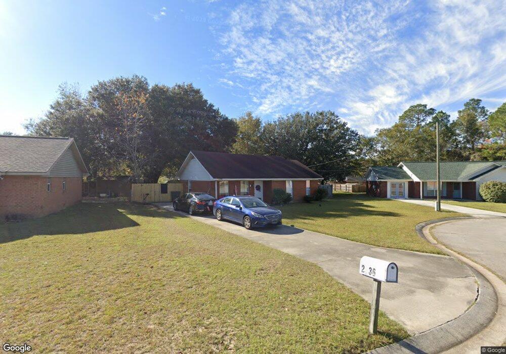
2536 Cove St Hinesville, GA 31313
Estimated Value: $183,000 - $207,000
3
Beds
2
Baths
1,181
Sq Ft
$167/Sq Ft
Est. Value
About This Home
This home is located at 2536 Cove St, Hinesville, GA 31313 and is currently estimated at $197,360, approximately $167 per square foot. 2536 Cove St is a home located in Liberty County with nearby schools including Waldo Pafford Elementary School, Lewis Frasier Middle School, and Bradwell Institute.
Ownership History
Date
Name
Owned For
Owner Type
Purchase Details
Closed on
Jul 14, 2003
Sold by
Bankers Trust Company
Bought by
Livingston Marvin T
Current Estimated Value
Purchase Details
Closed on
Dec 19, 2002
Sold by
Kindley Len
Bought by
Bankers Trust Company
Purchase Details
Closed on
Apr 8, 2002
Sold by
Bankers Trust Company
Bought by
Bankers Trust Company
Purchase Details
Closed on
Aug 23, 2000
Sold by
Sec Of V A
Bought by
Kindley Len
Purchase Details
Closed on
Aug 3, 1999
Sold by
Old Kent Mortgage Se
Bought by
Sec Of V A
Purchase Details
Closed on
Sep 29, 1997
Bought by
Mcnair Jolinda Hixon
Create a Home Valuation Report for This Property
The Home Valuation Report is an in-depth analysis detailing your home's value as well as a comparison with similar homes in the area
Home Values in the Area
Average Home Value in this Area
Purchase History
| Date | Buyer | Sale Price | Title Company |
|---|---|---|---|
| Livingston Marvin T | $54,900 | -- | |
| Bankers Trust Company | $57,300 | -- | |
| Bankers Trust Company | $60,000 | -- | |
| Kindley Len | $60,000 | -- | |
| Sec Of V A | -- | -- | |
| Old Kent Mortgage Se | $53,700 | -- | |
| Mcnair Jolinda Hixon | $61,400 | -- |
Source: Public Records
Tax History Compared to Growth
Tax History
| Year | Tax Paid | Tax Assessment Tax Assessment Total Assessment is a certain percentage of the fair market value that is determined by local assessors to be the total taxable value of land and additions on the property. | Land | Improvement |
|---|---|---|---|---|
| 2024 | $2,978 | $60,535 | $12,000 | $48,535 |
| 2023 | $2,978 | $54,763 | $12,000 | $42,763 |
| 2022 | $2,135 | $45,746 | $10,000 | $35,746 |
| 2021 | $1,763 | $36,999 | $8,000 | $28,999 |
| 2020 | $1,675 | $34,808 | $8,000 | $26,808 |
| 2019 | $1,584 | $33,139 | $6,000 | $27,139 |
| 2018 | $1,590 | $33,470 | $6,000 | $27,470 |
| 2017 | $1,113 | $33,801 | $6,000 | $27,801 |
| 2016 | $1,508 | $32,792 | $6,000 | $26,792 |
| 2015 | $1,659 | $32,792 | $6,000 | $26,792 |
| 2014 | $1,659 | $36,268 | $8,000 | $28,268 |
| 2013 | -- | $33,264 | $8,000 | $25,264 |
Source: Public Records
Map
Nearby Homes
- 2716 Java Ct
- 2563 Zachary Ct
- 0 Airport Rd Unit 325633
- 269 Brightleaf Cir
- 0 Curtis Rd Unit 163007
- 0 Curtis Rd Unit SA339536
- 1.17 ACRES Elam Rd
- 307 Lumpkin Ln
- 225 Rendell Ln
- 851 Lyndsi Ln
- 164 Glynn Ct
- 303 Camden Ct
- 201 Slayton Cir
- 302 Largo Ct
- 33 Bryan Way
- 104 Shallowford Cir
- 776 Burnt Pines Rd NE
- 644 Piedmont Ave
- 219 Augusta Way