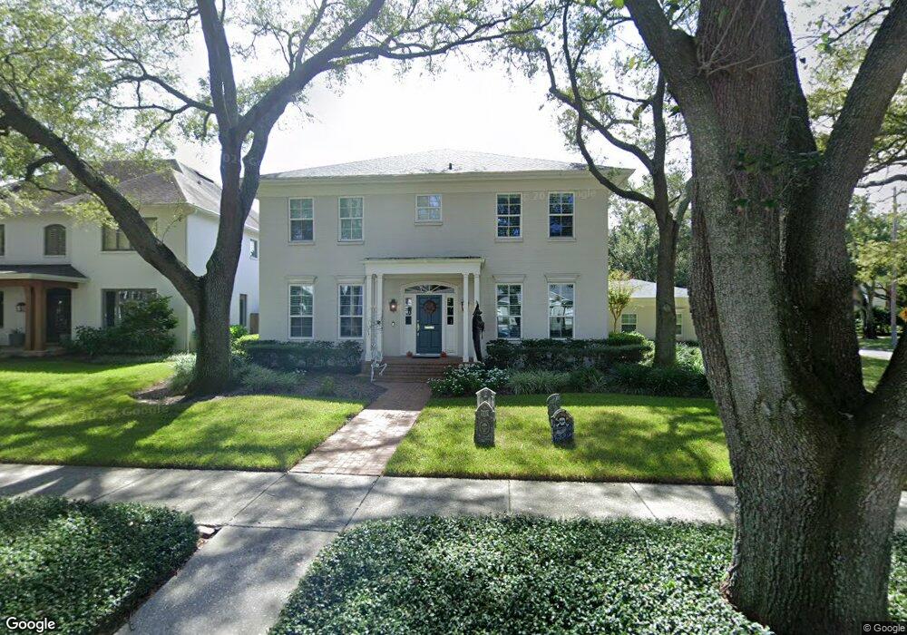
2536 W Simms Blvd Tampa, FL 33609
Parkland Estates NeighborhoodEstimated Value: $2,461,345 - $2,545,000
5
Beds
4
Baths
3,884
Sq Ft
$647/Sq Ft
Est. Value
About This Home
This home is located at 2536 W Simms Blvd, Tampa, FL 33609 and is currently estimated at $2,512,086, approximately $646 per square foot. 2536 W Simms Blvd is a home located in Hillsborough County with nearby schools including Mitchell Elementary School, Wilson Middle School, and Plant High School.
Ownership History
Date
Name
Owned For
Owner Type
Purchase Details
Closed on
May 19, 2021
Sold by
Brannan Anthony N and Brannan Jane M
Bought by
Hardee William Baker and Hardee Lindsey Crown
Current Estimated Value
Home Financials for this Owner
Home Financials are based on the most recent Mortgage that was taken out on this home.
Original Mortgage
$1,500,000
Outstanding Balance
$1,351,839
Interest Rate
2.75%
Mortgage Type
New Conventional
Estimated Equity
$1,160,247
Create a Home Valuation Report for This Property
The Home Valuation Report is an in-depth analysis detailing your home's value as well as a comparison with similar homes in the area
Home Values in the Area
Average Home Value in this Area
Purchase History
| Date | Buyer | Sale Price | Title Company |
|---|---|---|---|
| Hardee William Baker | $1,875,000 | Bayshore Title |
Source: Public Records
Mortgage History
| Date | Status | Borrower | Loan Amount |
|---|---|---|---|
| Open | Hardee William Baker | $1,500,000 |
Source: Public Records
Tax History Compared to Growth
Tax History
| Year | Tax Paid | Tax Assessment Tax Assessment Total Assessment is a certain percentage of the fair market value that is determined by local assessors to be the total taxable value of land and additions on the property. | Land | Improvement |
|---|---|---|---|---|
| 2024 | $29,463 | $1,575,077 | -- | -- |
| 2023 | $28,817 | $1,529,201 | $0 | $0 |
| 2022 | $28,130 | $1,484,661 | $0 | $0 |
| 2021 | $11,214 | $597,025 | $0 | $0 |
| 2020 | $11,117 | $588,782 | $0 | $0 |
| 2019 | $10,934 | $575,544 | $0 | $0 |
| 2018 | $10,869 | $564,813 | $0 | $0 |
| 2017 | $10,731 | $989,588 | $0 | $0 |
| 2016 | $10,429 | $541,818 | $0 | $0 |
| 2015 | $10,465 | $538,052 | $0 | $0 |
| 2014 | $10,368 | $533,782 | $0 | $0 |
| 2013 | -- | $525,894 | $0 | $0 |
Source: Public Records
Map
Nearby Homes
- 2522 W Watrous Ave
- 2807 W Parkland Blvd
- 2442 W Prospect Rd
- 2630 W Sunset Dr
- 1011 S Moody Ave Unit 11
- 3107 W Watrous Ave
- 2402 W Parkland Blvd
- 2308 W Jetton Ave
- 2311 W Morrison Ave Unit 1
- 3102 W Fountain Blvd
- 2807 W Sitios St
- 1301 S Howard Ave Unit A9
- 1301 S Howard Ave Unit A22
- 1301 S Howard Ave Unit A6
- 1600 S Macdill Ave Unit 204
- 2240 Soho Bay Ct
- 2403 W Chicago Ave
- 2402 Victoria Gardens Ln
- 2217 Soho Bay Ct
- 1409 S Moody Ave
- 2534 W Simms Blvd
- 908 S Forest Dr
- 2535 W Simms Blvd
- 2611 W Morrison Ave
- 901 S Forest Dr
- 2530 W Simms Blvd
- 2703 W Morrison Ave
- 2533 W Simms Blvd
- 2609 W Morrison Ave
- 2730 W Parkland Blvd
- 2629 W Edgewood Rd
- 2526 W Simms Blvd
- 2607 W Morrison Ave
- 2614 W Parkland Blvd
- 2614 W Morrison Ave
- 2616 W Morrison Ave
- 2707 W Morrison Ave
- 2612 W Morrison Ave
- 2620 W Morrison Ave
- 2610 W Morrison Ave