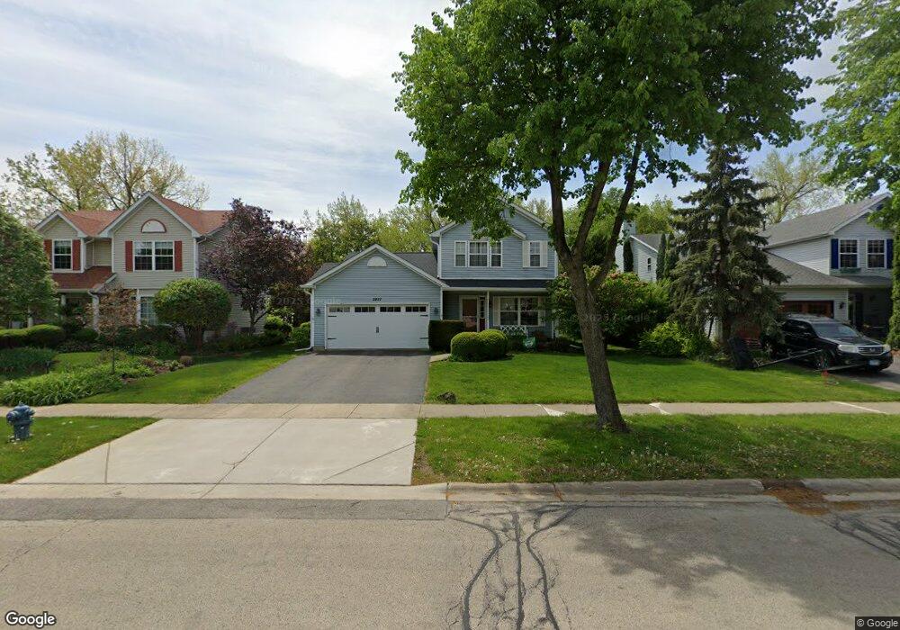
2537 Silver Rock Dr Crest Hill, IL 60403
Estimated Value: $297,000 - $339,000
3
Beds
2
Baths
1,534
Sq Ft
$205/Sq Ft
Est. Value
About This Home
This home is located at 2537 Silver Rock Dr, Crest Hill, IL 60403 and is currently estimated at $314,183, approximately $204 per square foot. 2537 Silver Rock Dr is a home located in Will County with nearby schools including Grand Prairie Elementary School, Timber Ridge Middle School, and Plainfield Central High School.
Ownership History
Date
Name
Owned For
Owner Type
Purchase Details
Closed on
Jun 14, 2005
Sold by
Nlsb
Bought by
Kenyon Jared and Kenyon Gina
Current Estimated Value
Home Financials for this Owner
Home Financials are based on the most recent Mortgage that was taken out on this home.
Original Mortgage
$174,400
Outstanding Balance
$90,637
Interest Rate
5.69%
Mortgage Type
Stand Alone First
Estimated Equity
$223,546
Purchase Details
Closed on
Apr 8, 2005
Sold by
Kaupas Paul J and National City Mortgage Co
Bought by
Nlsb Bank and Trust #2795
Purchase Details
Closed on
Mar 24, 2005
Sold by
Vince Michael A and Kostecka Regina
Bought by
New Lenox State Bank Land Trust 2795
Purchase Details
Closed on
Jun 5, 2002
Sold by
Vince Michael A
Bought by
Vince Regina
Create a Home Valuation Report for This Property
The Home Valuation Report is an in-depth analysis detailing your home's value as well as a comparison with similar homes in the area
Home Values in the Area
Average Home Value in this Area
Purchase History
| Date | Buyer | Sale Price | Title Company |
|---|---|---|---|
| Kenyon Jared | $218,000 | Atg | |
| Nlsb Bank | -- | -- | |
| New Lenox State Bank Land Trust 2795 | $169,100 | -- | |
| Vince Regina | -- | -- |
Source: Public Records
Mortgage History
| Date | Status | Borrower | Loan Amount |
|---|---|---|---|
| Open | Kenyon Jared | $174,400 |
Source: Public Records
Tax History Compared to Growth
Tax History
| Year | Tax Paid | Tax Assessment Tax Assessment Total Assessment is a certain percentage of the fair market value that is determined by local assessors to be the total taxable value of land and additions on the property. | Land | Improvement |
|---|---|---|---|---|
| 2024 | $6,013 | $85,406 | $24,233 | $61,173 |
| 2023 | $6,013 | $77,137 | $21,887 | $55,250 |
| 2022 | $5,376 | $69,279 | $19,657 | $49,622 |
| 2021 | $5,066 | $64,747 | $18,371 | $46,376 |
| 2020 | $4,995 | $62,910 | $17,850 | $45,060 |
| 2019 | $4,762 | $59,943 | $17,008 | $42,935 |
| 2018 | $4,542 | $56,320 | $15,980 | $40,340 |
| 2017 | $4,394 | $53,521 | $15,186 | $38,335 |
| 2016 | $4,285 | $51,046 | $14,484 | $36,562 |
| 2015 | $3,962 | $47,818 | $13,568 | $34,250 |
| 2014 | $3,962 | $46,130 | $13,089 | $33,041 |
| 2013 | $3,962 | $46,130 | $13,089 | $33,041 |
Source: Public Records
Map
Nearby Homes
- 2528 Silver Rock Dr
- 2703 Oak Ridge Ln
- 1810 Foxfield Dr
- 2533 Waterford Dr
- 1802 Maserati Dr
- 1804 Maserati Dr
- 1874 Corregidor St
- 2516 Lotus Ln
- 2505 Lotus Ln
- 2304 Carnation Dr
- 2390 Bicentennial Ave
- 1521 Pioneer Rd Unit 7
- 1219 Cedarwood Dr Unit B
- 3001 Theodore St
- 7 Rock Run Dr
- 1921 Cecily Dr
- 2508 Meer Park Ct Unit 151
- 8 Rock Run Dr
- 2812 Vimy Ridge Dr
- 2385 Jorie Ct
- 2533 Silver Rock Dr
- 2541 Silver Rock Dr
- 2529 Silver Rock Dr
- 2545 Silver Rock Dr
- 1817 Springside Dr
- 2525 Silver Rock Dr
- 2532 Silver Rock Dr
- 1825 Springside Dr
- 2602 Silver Rock Dr
- 2521 Silver Rock Dr
- 1829 Springside Dr
- 1802 Wake Island Dr
- 1830 Springside Dr
- 1806 Wake Island Dr
- 1804 Wake Island Dr
- 1810 Wake Island Dr
- 1810 Wake Island Dr
- 2520 Silver Rock Dr
- 1800 Wake Island Dr
- 2517 Silver Rock Dr