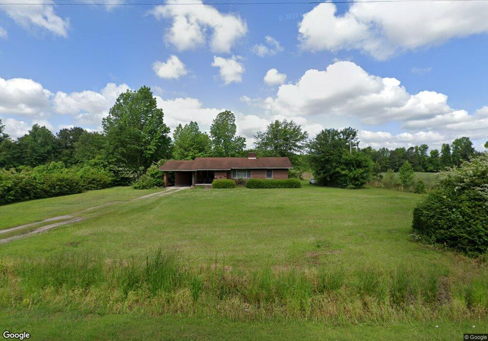
2538 Raccoon Rd Manning, SC 29102
Estimated Value: $111,586 - $185,000
--
Bed
--
Bath
1,296
Sq Ft
$117/Sq Ft
Est. Value
About This Home
This home is located at 2538 Raccoon Rd, Manning, SC 29102 and is currently estimated at $151,147, approximately $116 per square foot. 2538 Raccoon Rd is a home with nearby schools including Manning Early Childhood Center, Manning Elementary School, and Manning Primary School.
Ownership History
Date
Name
Owned For
Owner Type
Purchase Details
Closed on
Aug 21, 2020
Sold by
Hamilton Edmond and Estate Ot Miriam L Hamilton
Bought by
Hamilton Edmond
Current Estimated Value
Home Financials for this Owner
Home Financials are based on the most recent Mortgage that was taken out on this home.
Original Mortgage
$6,500
Outstanding Balance
$5,755
Interest Rate
2.9%
Mortgage Type
Seller Take Back
Estimated Equity
$145,392
Purchase Details
Closed on
Feb 25, 2013
Sold by
Hamilton Miriam Leola
Bought by
Hamilton Miriam Leola
Create a Home Valuation Report for This Property
The Home Valuation Report is an in-depth analysis detailing your home's value as well as a comparison with similar homes in the area
Home Values in the Area
Average Home Value in this Area
Purchase History
| Date | Buyer | Sale Price | Title Company |
|---|---|---|---|
| Hamilton Edmond | -- | None Available | |
| Hamilton Miriam Leola | -- | None Available |
Source: Public Records
Mortgage History
| Date | Status | Borrower | Loan Amount |
|---|---|---|---|
| Open | Hamilton Edmond | $6,500 |
Source: Public Records
Tax History Compared to Growth
Tax History
| Year | Tax Paid | Tax Assessment Tax Assessment Total Assessment is a certain percentage of the fair market value that is determined by local assessors to be the total taxable value of land and additions on the property. | Land | Improvement |
|---|---|---|---|---|
| 2024 | $610 | $2,796 | $788 | $2,008 |
| 2023 | $599 | $2,796 | $788 | $2,008 |
| 2022 | $592 | $2,796 | $788 | $2,008 |
| 2021 | $642 | $3,060 | $1,000 | $2,060 |
| 2020 | $1,596 | $4,590 | $0 | $0 |
| 2019 | $541 | $3,060 | $0 | $0 |
| 2018 | $508 | $3,060 | $0 | $0 |
| 2017 | $508 | $3,060 | $0 | $0 |
| 2016 | $492 | $3,060 | $0 | $0 |
| 2015 | $517 | $3,168 | $1,000 | $2,168 |
| 2014 | $509 | $3,168 | $1,000 | $2,168 |
| 2013 | -- | $4,752 | $1,500 | $3,252 |
Source: Public Records
Map
Nearby Homes
- 2695 Paxville Hwy
- TBD Branchview Dr
- 22 W End St
- TBD Barnwell St
- 1000 Carolina Way Unit Lot 80
- 1000 Carolina Way
- 209 Peterson Ln
- 633 Sykes St
- W Huggins St
- 111 Richard St
- 409 W Boyce St
- TBD Old Georgetown Rd @ I95
- 1111 Foxbrook Ln
- 408 Toccoa Dr
- 218 Breedin St
- 380 Old Georgetown Rd
- 200 W Boyce St
- 107 Sumter St
- 101 Sumter St
- 40 W Rigby St
- 2449 Raccoon Rd
- 2284 Raccoon Rd
- 2867 Paxville Hwy
- 2742 Raccoon Rd
- 2862 Raccoon Rd
- 2660 Paxville Hwy
- 1161 Rockbridge Rd
- 2527 Paxville Hwy
- 2520 Paxville Hwy
- 945 Branchview Dr
- TBD Paxville Hwy
- 0 Paxville Hwy
- 57 Westend St
- 933 Branchview Dr
- 55 W End St
- 929 Branchview Dr
- 936 Branchview Dr
- 925 Branchview Dr
- 53 Westend St
- 930 Branchview Dr