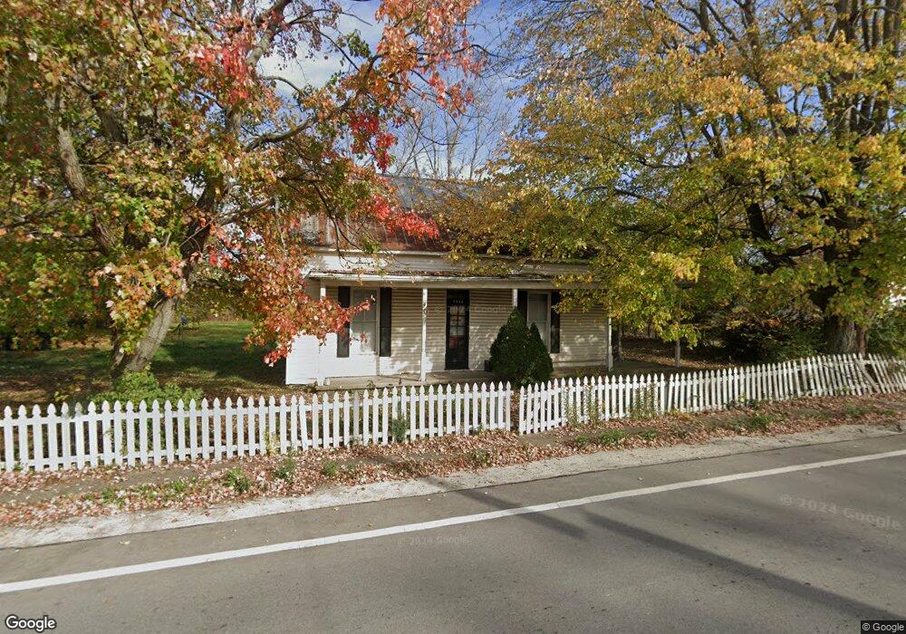
2538 State Route 134 Mount Orab, OH 45154
Estimated Value: $58,000 - $125,937
4
Beds
1
Bath
1,582
Sq Ft
$65/Sq Ft
Est. Value
About This Home
This home is located at 2538 State Route 134, Mount Orab, OH 45154 and is currently estimated at $103,234, approximately $65 per square foot. 2538 State Route 134 is a home located in Highland County with nearby schools including Lynchburg-Clay Elementary School, Lynchburg-Clay Middle School, and Lynchburg-Clay High School.
Ownership History
Date
Name
Owned For
Owner Type
Purchase Details
Closed on
Mar 20, 2009
Sold by
Curtiss Jeffrey
Bought by
Massett Kimberly A
Current Estimated Value
Purchase Details
Closed on
Dec 30, 2008
Sold by
Us Bank National Association Nd
Bought by
Curtiss Jeffrey
Purchase Details
Closed on
Oct 24, 2008
Sold by
Williamson David M
Bought by
Us Bank National Association Nd
Purchase Details
Closed on
Jan 1, 1990
Bought by
Dehart Robert C
Create a Home Valuation Report for This Property
The Home Valuation Report is an in-depth analysis detailing your home's value as well as a comparison with similar homes in the area
Home Values in the Area
Average Home Value in this Area
Purchase History
| Date | Buyer | Sale Price | Title Company |
|---|---|---|---|
| Massett Kimberly A | $12,900 | Lawyers Title Of Cincinnati | |
| Curtiss Jeffrey | $8,500 | Progressive Land Title Agenc | |
| Us Bank National Association Nd | $30,000 | None Available | |
| Dehart Robert C | -- | -- |
Source: Public Records
Tax History Compared to Growth
Tax History
| Year | Tax Paid | Tax Assessment Tax Assessment Total Assessment is a certain percentage of the fair market value that is determined by local assessors to be the total taxable value of land and additions on the property. | Land | Improvement |
|---|---|---|---|---|
| 2024 | $992 | $33,430 | $5,040 | $28,390 |
| 2023 | $992 | $23,040 | $4,380 | $18,660 |
| 2022 | $742 | $23,040 | $4,380 | $18,660 |
| 2021 | $742 | $23,040 | $4,380 | $18,660 |
| 2020 | $617 | $18,410 | $3,500 | $14,910 |
| 2019 | $622 | $18,410 | $3,500 | $14,910 |
| 2018 | $585 | $18,410 | $3,500 | $14,910 |
| 2017 | $536 | $16,630 | $4,340 | $12,290 |
| 2016 | $540 | $16,630 | $4,340 | $12,290 |
| 2015 | $546 | $16,630 | $4,340 | $12,290 |
| 2014 | $564 | $16,630 | $4,340 | $12,290 |
| 2013 | $565 | $16,630 | $4,340 | $12,290 |
Source: Public Records
Map
Nearby Homes
- 1982 Starr Rd
- 5176 E Greenbush Rd
- 0 Lindsey Rd Unit 1819033
- 5092 County Highway 8-C
- 3846 Hereford Rd
- 15503 Crawford-Day Rd
- 0 Duncanson Rd Unit 24555971
- 0 Duncanson Rd Unit 24557375
- 15516 Hillcrest Rd
- AC Frye Rd
- 3517 Bardwell Buford Rd
- 689 Duncanson Rd
- 500 Frye Rd
- 0 Duncanson Rd Unit 5150881
- 0 Duncanson Rd Unit 5150848
- 15422 U S 68
- 505 Linda Way
- 14663 Day Rd
- 13602 Robbins Rd
- 0 Bardwell W Unit 1854344
- 2538 St Rt 134
- 2532 State Route 134
- 2550 State Route 134
- 2534 State Route 134
- 2516 State Route 134
- 2545 State Route 134
- 2541 State Route 134
- 2533 State Route 134
- 2559 Ohio 134
- 2560 State Route 134
- 2524 St Rt 134
- 2559 State Route 134
- 2561 Ohio 134
- 2527 State Route 134
- 2527 St Rt 134
- 2561 State Route 134
- 2524 State Route 134
- 2513 State Route 134
- 2567 Sr 134
- 2567 St Rt 134