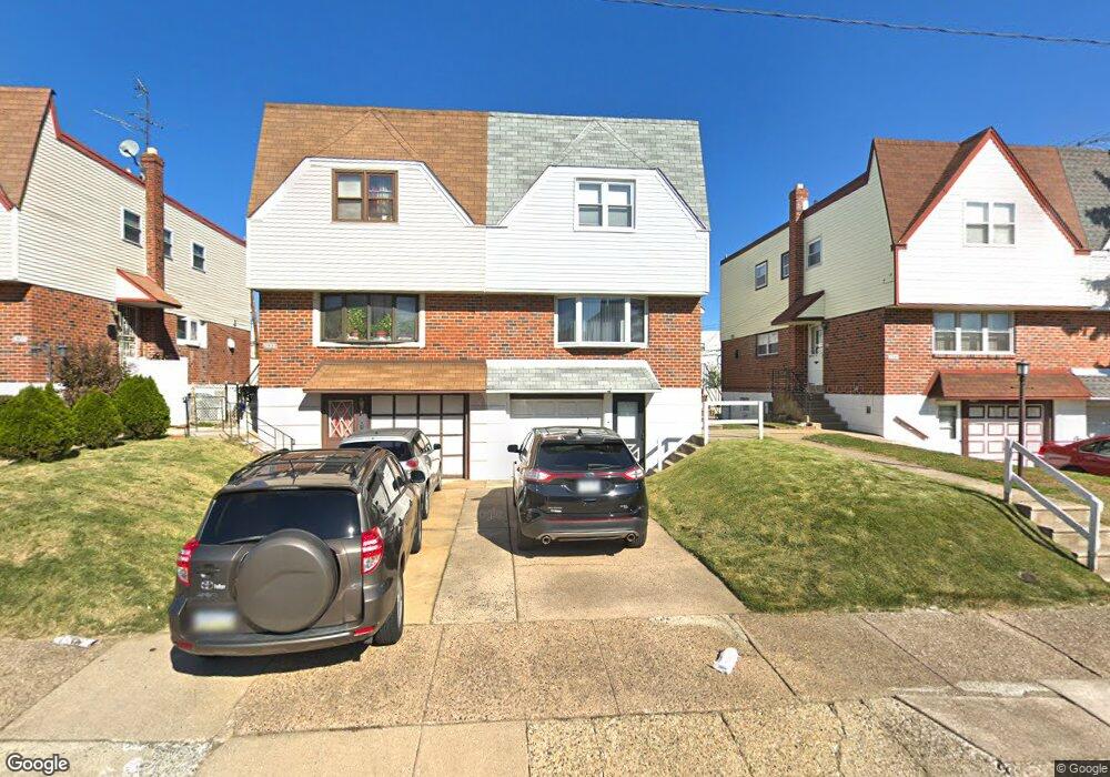
2539 Maxwell St Philadelphia, PA 19152
Pennypack NeighborhoodEstimated Value: $350,788 - $367,000
3
Beds
2
Baths
1,332
Sq Ft
$271/Sq Ft
Est. Value
About This Home
This home is located at 2539 Maxwell St, Philadelphia, PA 19152 and is currently estimated at $360,947, approximately $270 per square foot. 2539 Maxwell St is a home located in Philadelphia County with nearby schools including Lincoln High School, Robert B. Pollock School, and Meehan Austin Middle School.
Ownership History
Date
Name
Owned For
Owner Type
Purchase Details
Closed on
Feb 4, 2009
Sold by
Fierimonte Daniel J and Fierimonte Kristin M
Bought by
Fierimonte Daniel J
Current Estimated Value
Purchase Details
Closed on
Sep 29, 2003
Sold by
Shawcroft Robyn L
Bought by
Fierimonte Daniel I and Fierimonte Kristin M
Home Financials for this Owner
Home Financials are based on the most recent Mortgage that was taken out on this home.
Original Mortgage
$156,614
Outstanding Balance
$73,787
Interest Rate
6.35%
Mortgage Type
FHA
Estimated Equity
$287,161
Purchase Details
Closed on
Mar 31, 1998
Sold by
Elia Vincent T and Elia Susan R
Bought by
Shawcroft Robyn L
Create a Home Valuation Report for This Property
The Home Valuation Report is an in-depth analysis detailing your home's value as well as a comparison with similar homes in the area
Home Values in the Area
Average Home Value in this Area
Purchase History
| Date | Buyer | Sale Price | Title Company |
|---|---|---|---|
| Fierimonte Daniel J | $35,000 | None Available | |
| Fierimonte Daniel I | $157,900 | -- | |
| Shawcroft Robyn L | $90,000 | -- |
Source: Public Records
Mortgage History
| Date | Status | Borrower | Loan Amount |
|---|---|---|---|
| Open | Fierimonte Daniel I | $156,614 |
Source: Public Records
Tax History Compared to Growth
Tax History
| Year | Tax Paid | Tax Assessment Tax Assessment Total Assessment is a certain percentage of the fair market value that is determined by local assessors to be the total taxable value of land and additions on the property. | Land | Improvement |
|---|---|---|---|---|
| 2025 | $3,403 | $308,000 | $61,600 | $246,400 |
| 2024 | $3,403 | $308,000 | $61,600 | $246,400 |
| 2023 | $3,403 | $243,100 | $48,620 | $194,480 |
| 2022 | $2,150 | $198,100 | $48,620 | $149,480 |
| 2021 | $2,780 | $0 | $0 | $0 |
| 2020 | $2,780 | $0 | $0 | $0 |
| 2019 | $2,618 | $0 | $0 | $0 |
| 2018 | $2,455 | $0 | $0 | $0 |
| 2017 | $2,455 | $0 | $0 | $0 |
| 2016 | $2,035 | $0 | $0 | $0 |
| 2015 | $1,948 | $0 | $0 | $0 |
| 2014 | -- | $175,400 | $58,432 | $116,968 |
| 2012 | -- | $23,296 | $3,089 | $20,207 |
Source: Public Records
Map
Nearby Homes
- 9044 Brous Ave
- 9028 Brous Ave
- 8920 Maxwell Place
- 9109 Revere St
- 8817 R Danbury St
- 8945 Haven Place
- 8800 Danbury St
- 2633 Maxwell St
- 8860 Manchester St
- 2678 Tremont St
- 2648 Maxwell St
- 2777 Welsh Rd
- 2742 Welsh Rd
- 2651 Tremont St
- 2630 Taunton St
- 8853 Calvert St
- 2831 Chase Rd
- 8718 Hargrave St
- 2713 Clayton St
- 8908 Fairfield St
- 2537 Maxwell St
- 2541 Maxwell St
- 2543 Maxwell St
- 2535 Maxwell St
- 2533 Maxwell St
- 9041 Brous Ave
- 9043 Brous Ave
- 9039 Brous Ave
- 2531 Maxwell St
- 9045 Brous Ave
- 9037 Brous Ave
- 2529 Maxwell St
- 9035 Brous Ave
- 2536 Maxwell St
- 2527 Maxwell St
- 2534 Maxwell St
- 2530 Maxwell St
- 8907 Dewees St
- 2532 Maxwell St
- 9031 Brous Ave