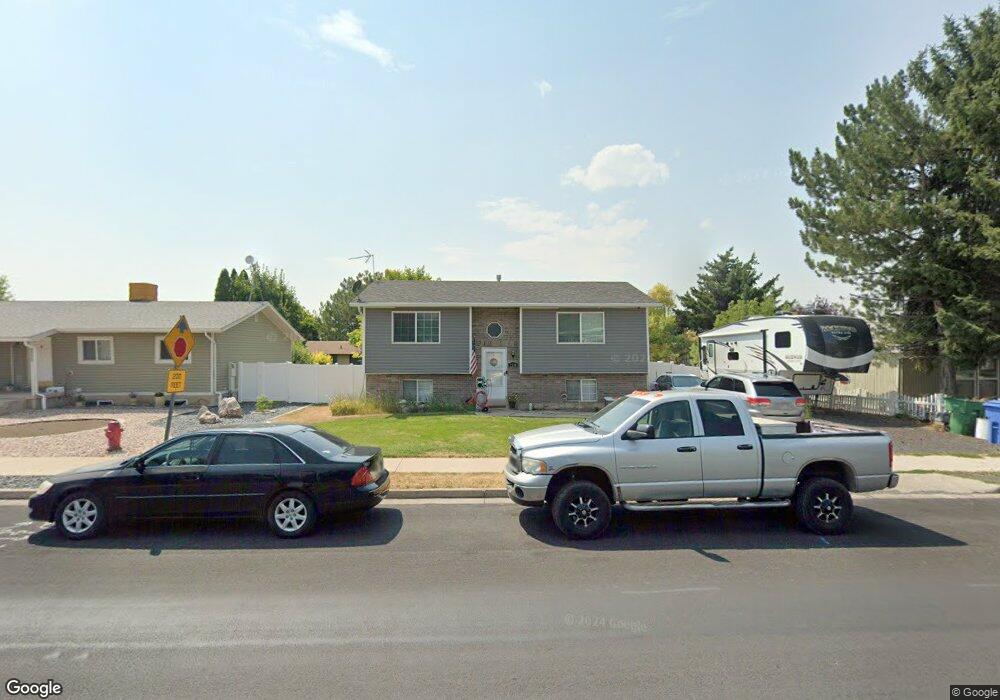
2539 N 400 E North Logan, UT 84341
Estimated Value: $364,000 - $429,000
4
Beds
2
Baths
1,788
Sq Ft
$218/Sq Ft
Est. Value
About This Home
This home is located at 2539 N 400 E, North Logan, UT 84341 and is currently estimated at $389,940, approximately $218 per square foot. 2539 N 400 E is a home located in Cache County with nearby schools including Greenville School, Cedar Ridge School, and North Cache Middle School.
Ownership History
Date
Name
Owned For
Owner Type
Purchase Details
Closed on
Oct 11, 2013
Sold by
Brown Matthew S
Bought by
Brown Matthew S and Brown Laura B
Current Estimated Value
Home Financials for this Owner
Home Financials are based on the most recent Mortgage that was taken out on this home.
Original Mortgage
$98,697
Outstanding Balance
$73,689
Interest Rate
4.49%
Mortgage Type
FHA
Estimated Equity
$316,251
Purchase Details
Closed on
Oct 9, 2013
Sold by
Broadbent Clinton L and Broadbent Abigail J
Bought by
Brown Matthew S
Home Financials for this Owner
Home Financials are based on the most recent Mortgage that was taken out on this home.
Original Mortgage
$98,697
Outstanding Balance
$73,689
Interest Rate
4.49%
Mortgage Type
FHA
Estimated Equity
$316,251
Purchase Details
Closed on
Mar 26, 2010
Sold by
Lyman James D and Lyman Jennifer H
Bought by
Broadbent Clinton L and Broadbent Abigail J
Home Financials for this Owner
Home Financials are based on the most recent Mortgage that was taken out on this home.
Original Mortgage
$134,310
Interest Rate
5.5%
Mortgage Type
FHA
Create a Home Valuation Report for This Property
The Home Valuation Report is an in-depth analysis detailing your home's value as well as a comparison with similar homes in the area
Home Values in the Area
Average Home Value in this Area
Purchase History
| Date | Buyer | Sale Price | Title Company |
|---|---|---|---|
| Brown Matthew S | -- | American Secure Title Logan | |
| Brown Matthew S | -- | American Secure Title Logan | |
| Broadbent Clinton L | -- | Hickman Land Title Company |
Source: Public Records
Mortgage History
| Date | Status | Borrower | Loan Amount |
|---|---|---|---|
| Open | Brown Matthew S | $98,697 | |
| Previous Owner | Broadbent Clinton L | $134,310 |
Source: Public Records
Tax History
| Year | Tax Paid | Tax Assessment Tax Assessment Total Assessment is a certain percentage of the fair market value that is determined by local assessors to be the total taxable value of land and additions on the property. | Land | Improvement |
|---|---|---|---|---|
| 2025 | $1,365 | $191,065 | $0 | $0 |
| 2024 | $1,472 | $191,705 | $0 | $0 |
| 2023 | $1,588 | $191,230 | $0 | $0 |
| 2022 | $1,375 | $158,230 | $0 | $0 |
| 2021 | $1,347 | $240,155 | $50,000 | $190,155 |
| 2020 | $1,207 | $201,674 | $50,000 | $151,674 |
| 2019 | $1,264 | $201,673 | $50,000 | $151,673 |
| 2018 | $1,178 | $181,890 | $50,000 | $131,890 |
| 2017 | $1,069 | $86,845 | $0 | $0 |
| 2016 | $1,086 | $86,845 | $0 | $0 |
| 2015 | $916 | $72,995 | $0 | $0 |
| 2014 | $895 | $72,995 | $0 | $0 |
| 2013 | -- | $72,995 | $0 | $0 |
Source: Public Records
Map
Nearby Homes
- 623 E 2475 N Unit 5
- 645 E 2475 N
- 667 E 2475 N
- 2592 N 330 E
- 2640 N Aspen Park Ln
- 2700 N 300 E
- 2452 N 200 E
- 2469 N 620 E Unit 3
- 2477 N 620 E Unit 4
- 385 E 2280 N Unit D
- 650 E 2450 N
- Somerley Plan at Smiling H Ranch
- Viewside Plan at Smiling H Ranch
- Willow Plan at Smiling H Ranch
- Northfield Plan at Smiling H Ranch
- Westbrook Plan at Smiling H Ranch
- Hamilton Plan at Smiling H Ranch
- Foxhill Plan at Smiling H Ranch
- Chamberlain Plan at Smiling H Ranch
- Fairway Plan at Smiling H Ranch