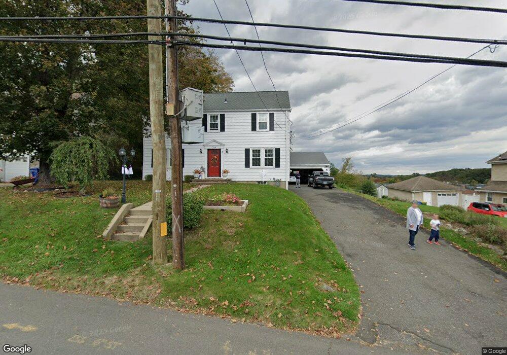
254 Bradley Ave Waterbury, CT 06708
West End District NeighborhoodEstimated Value: $325,000 - $358,000
3
Beds
2
Baths
1,632
Sq Ft
$212/Sq Ft
Est. Value
About This Home
This home is located at 254 Bradley Ave, Waterbury, CT 06708 and is currently estimated at $345,244, approximately $211 per square foot. 254 Bradley Ave is a home located in New Haven County with nearby schools including B.W. Tinker School, West Side Middle School, and John F. Kennedy High School.
Ownership History
Date
Name
Owned For
Owner Type
Purchase Details
Closed on
Jan 11, 2024
Sold by
Mattaboni Daniel and Mattaboni Nancy
Bought by
Mattaboni
Current Estimated Value
Purchase Details
Closed on
Jan 11, 2005
Sold by
Travaglin Diane
Bought by
Mattaboni Daniel and Mattaboni Nancy
Home Financials for this Owner
Home Financials are based on the most recent Mortgage that was taken out on this home.
Original Mortgage
$170,000
Interest Rate
5.75%
Mortgage Type
Purchase Money Mortgage
Purchase Details
Closed on
Feb 1, 2002
Sold by
Swatt Ronald E and Swatt Theresa
Bought by
Travaglin Diane and Malone Craig D
Purchase Details
Closed on
Mar 22, 1991
Sold by
Carpinella Ent
Bought by
Mattaboni Daniel and Mattaboni Lucille
Purchase Details
Closed on
Jul 18, 1990
Sold by
Malaspina Mark J
Bought by
Swatt Ronald E
Create a Home Valuation Report for This Property
The Home Valuation Report is an in-depth analysis detailing your home's value as well as a comparison with similar homes in the area
Home Values in the Area
Average Home Value in this Area
Purchase History
| Date | Buyer | Sale Price | Title Company |
|---|---|---|---|
| Mattaboni | -- | None Available | |
| Mattaboni Daniel | $214,000 | -- | |
| Travaglin Diane | $175,000 | -- | |
| Mattaboni Daniel | $61,900 | -- | |
| Swatt Ronald E | $145,000 | -- |
Source: Public Records
Mortgage History
| Date | Status | Borrower | Loan Amount |
|---|---|---|---|
| Previous Owner | Swatt Ronald E | $132,300 | |
| Previous Owner | Swatt Ronald E | $30,000 | |
| Previous Owner | Swatt Ronald E | $170,000 |
Source: Public Records
Tax History Compared to Growth
Tax History
| Year | Tax Paid | Tax Assessment Tax Assessment Total Assessment is a certain percentage of the fair market value that is determined by local assessors to be the total taxable value of land and additions on the property. | Land | Improvement |
|---|---|---|---|---|
| 2025 | $8,095 | $179,970 | $25,690 | $154,280 |
| 2024 | $8,673 | $175,420 | $25,690 | $149,730 |
| 2023 | $9,506 | $175,420 | $25,690 | $149,730 |
| 2022 | $6,902 | $114,640 | $25,670 | $88,970 |
| 2021 | $6,902 | $114,640 | $25,670 | $88,970 |
| 2020 | $6,902 | $114,640 | $25,670 | $88,970 |
| 2019 | $6,902 | $114,640 | $25,670 | $88,970 |
| 2018 | $6,902 | $114,640 | $25,670 | $88,970 |
| 2017 | $6,530 | $108,450 | $25,680 | $82,770 |
| 2016 | $6,530 | $108,450 | $25,680 | $82,770 |
| 2015 | $6,314 | $108,450 | $25,680 | $82,770 |
| 2014 | $6,314 | $108,450 | $25,680 | $82,770 |
Source: Public Records
Map
Nearby Homes
- 81 Esther Ave
- 372 Anna Ave
- 35 Hewey St
- 100 Hans Ave
- 132 Hans Ave
- 127 Fairfield Ave
- 26 Oakleaf Dr
- 782 Oronoke Rd Unit 27
- 197 Hickory Hill Dr
- 67 Barrington Ln
- 827 Oronoke Rd Unit 2-3
- 48 Macnamara St
- 62 Rosemount Ave
- 34 Katie Ln
- 207 Nichols Dr
- 1159 Highland Ave Unit 35A
- 1159 Highland Ave Unit 28B
- 855 Oronoke Rd Unit 2
- 87 Highland Dr
- 59 Addison St