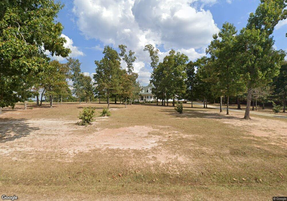
254 Cannafax Rd Barnesville, GA 30204
Estimated Value: $372,000 - $408,000
3
Beds
2
Baths
2,368
Sq Ft
$164/Sq Ft
Est. Value
About This Home
This home is located at 254 Cannafax Rd, Barnesville, GA 30204 and is currently estimated at $388,373, approximately $164 per square foot. 254 Cannafax Rd is a home located in Lamar County with nearby schools including Lamar County Primary School, Lamar County Elementary School, and Lamar County Middle School.
Ownership History
Date
Name
Owned For
Owner Type
Purchase Details
Closed on
Feb 19, 2021
Sold by
Executor Rose Paula
Bought by
Rose Paula
Current Estimated Value
Purchase Details
Closed on
Jan 11, 2002
Sold by
First National Bank Of Barnesv
Bought by
Rose David and Rose Paula
Purchase Details
Closed on
May 2, 2001
Sold by
Laney John R
Bought by
First National Bank Of Barnesville
Purchase Details
Closed on
Mar 13, 2000
Sold by
Faulkner Justin A
Bought by
Laney John R
Purchase Details
Closed on
Jul 16, 1998
Sold by
Reg Prop
Bought by
Faulkner Justin A
Create a Home Valuation Report for This Property
The Home Valuation Report is an in-depth analysis detailing your home's value as well as a comparison with similar homes in the area
Home Values in the Area
Average Home Value in this Area
Purchase History
| Date | Buyer | Sale Price | Title Company |
|---|---|---|---|
| Rose Paula | -- | -- | |
| Rose David | $200,000 | -- | |
| First National Bank Of Barnesville | -- | -- | |
| Laney John R | $24,500 | -- | |
| Faulkner Justin A | $17,900 | -- |
Source: Public Records
Tax History Compared to Growth
Tax History
| Year | Tax Paid | Tax Assessment Tax Assessment Total Assessment is a certain percentage of the fair market value that is determined by local assessors to be the total taxable value of land and additions on the property. | Land | Improvement |
|---|---|---|---|---|
| 2025 | $3,246 | $151,522 | $16,726 | $134,796 |
| 2024 | $3,246 | $128,713 | $16,726 | $111,987 |
| 2023 | $3,281 | $120,747 | $16,726 | $104,021 |
| 2022 | $2,846 | $104,986 | $10,415 | $94,571 |
| 2021 | $2,018 | $69,018 | $7,733 | $61,285 |
| 2020 | $2,125 | $69,018 | $7,733 | $61,285 |
| 2019 | $2,130 | $69,018 | $7,733 | $61,285 |
| 2018 | $2,045 | $69,018 | $7,733 | $61,285 |
| 2017 | $2,034 | $69,018 | $7,733 | $61,285 |
| 2016 | $2,165 | $73,297 | $12,012 | $61,285 |
| 2015 | $2,159 | $73,297 | $12,012 | $61,285 |
| 2014 | $2,092 | $73,297 | $12,012 | $61,285 |
| 2013 | -- | $81,036 | $12,012 | $69,024 |
Source: Public Records
Map
Nearby Homes
- 746 Highway 18 W
- 0 Old Milner Rd Unit 10630085
- 0 Piedmont Rd Unit 10600733
- 967 Five Points Rd
- 0 Washington Cir
- 295 Grove St
- 13 Brown St
- 254 Needleleaf Dr
- 500 Rose Ave
- 420 Zebulon St
- 818 Cannafax Rd
- 113 Heatherwood Ln
- 339 Atlanta St
- 245 Atlanta St
- 125 Byrd St
- 531 Thomaston St
- 144 Berry Rd
- 150 Berry Rd
- 146 Berry Rd
- 148 Berry Rd
- 840 Highway 18 W
- 865 Highway 18 W
- 873 Georgia 18
- 284 Cannafax Rd
- 227 Cannafax Rd
- 825 Highway 18 W
- 217 Cannafax Rd
- 810 Highway 18 W
- 294 Cannafax Rd
- 293 Cannafax Rd
- 213 Cannafax Rd
- 798 Georgia 18
- 302 Cannafax Rd
- 798 Highway 18 W
- 894 Highway 18 W
- 208 Cannafax Rd
- 301 Cannafax Rd
- 801 Highway 18 W
- 897 Highway 18 W
- 790 Highway 18 W