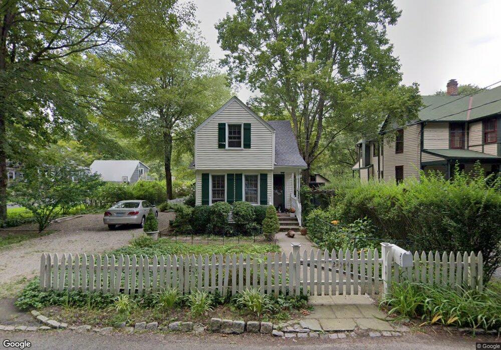
254 Cedar Rd Southport, CT 06890
Estimated Value: $624,000 - $891,000
2
Beds
2
Baths
867
Sq Ft
$823/Sq Ft
Est. Value
About This Home
This home is located at 254 Cedar Rd, Southport, CT 06890 and is currently estimated at $713,160, approximately $822 per square foot. 254 Cedar Rd is a home located in Fairfield County with nearby schools including Dwight Elementary School, Roger Ludlowe Middle School, and Fairfield Ludlowe High School.
Ownership History
Date
Name
Owned For
Owner Type
Purchase Details
Closed on
Jul 9, 2002
Sold by
Restrepo Luis F and Restrepo Christine S
Bought by
Strong Robinson G
Current Estimated Value
Home Financials for this Owner
Home Financials are based on the most recent Mortgage that was taken out on this home.
Original Mortgage
$290,400
Outstanding Balance
$124,066
Interest Rate
6.82%
Estimated Equity
$589,094
Purchase Details
Closed on
Jun 29, 1995
Sold by
Leddick Matthew S and Kennedy Patricia
Bought by
Restrepo Luis F and Restrepo Christine S
Purchase Details
Closed on
Jun 21, 1991
Sold by
Beaudin Raymond T and Beaudin Lillian R
Bought by
Leddick Matthew S and Kennedy Patricia
Create a Home Valuation Report for This Property
The Home Valuation Report is an in-depth analysis detailing your home's value as well as a comparison with similar homes in the area
Home Values in the Area
Average Home Value in this Area
Purchase History
| Date | Buyer | Sale Price | Title Company |
|---|---|---|---|
| Strong Robinson G | $363,000 | -- | |
| Strong Robinson G | $363,000 | -- | |
| Restrepo Luis F | $200,100 | -- | |
| Restrepo Luis F | $200,100 | -- | |
| Leddick Matthew S | $160,000 | -- |
Source: Public Records
Mortgage History
| Date | Status | Borrower | Loan Amount |
|---|---|---|---|
| Open | Leddick Matthew S | $148,000 | |
| Closed | Leddick Matthew S | $130,000 | |
| Open | Leddick Matthew S | $290,400 |
Source: Public Records
Tax History Compared to Growth
Tax History
| Year | Tax Paid | Tax Assessment Tax Assessment Total Assessment is a certain percentage of the fair market value that is determined by local assessors to be the total taxable value of land and additions on the property. | Land | Improvement |
|---|---|---|---|---|
| 2025 | $8,597 | $302,820 | $269,640 | $33,180 |
| 2024 | $8,449 | $302,820 | $269,640 | $33,180 |
| 2023 | $8,331 | $302,820 | $269,640 | $33,180 |
| 2022 | $8,249 | $302,820 | $269,640 | $33,180 |
| 2021 | $8,170 | $302,820 | $269,640 | $33,180 |
| 2020 | $8,006 | $298,830 | $266,840 | $31,990 |
| 2019 | $8,006 | $298,830 | $266,840 | $31,990 |
| 2018 | $7,877 | $298,830 | $266,840 | $31,990 |
| 2017 | $7,716 | $298,830 | $266,840 | $31,990 |
| 2016 | $7,605 | $298,830 | $266,840 | $31,990 |
| 2015 | $8,034 | $324,100 | $296,380 | $27,720 |
| 2014 | $7,908 | $324,100 | $296,380 | $27,720 |
Source: Public Records
Map
Nearby Homes
- 1135 Mill Hill Rd
- 254 Sherwood Farm Rd
- 688 Hulls Farm Rd
- 476 Mill Hill Terrace
- 2683 Bronson Rd
- 232 Pell Meadow Dr
- 646 Mill Hill Terrace
- 844 Mill Hill Terrace
- 1213 Cedar Rd
- 360 Duck Farm Rd
- 647 Bronson Rd
- 56 Drake Ln
- 1001 Hulls Farm Rd
- 179 Verna Hill Rd
- 53 Hilltop Dr
- 105 Charter Oak Rd
- 153 Pease Ave
- 33 Middlebrook Place
- 21 Queens Grant Dr
- 28 Mill Hill Rd Unit 28