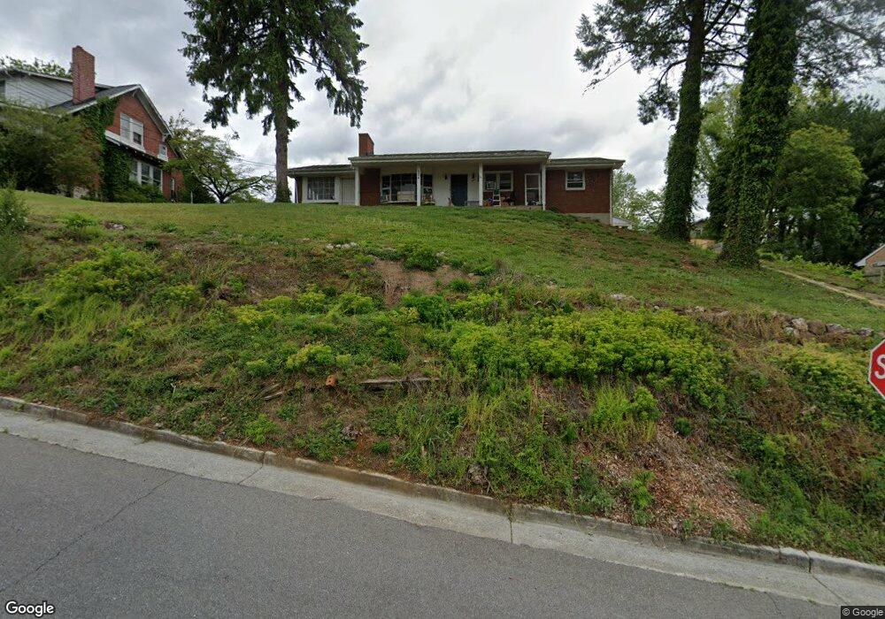
254 Gunn Ave Vinton, VA 24179
Estimated Value: $199,000 - $248,000
3
Beds
1
Bath
1,463
Sq Ft
$151/Sq Ft
Est. Value
About This Home
This home is located at 254 Gunn Ave, Vinton, VA 24179 and is currently estimated at $221,000, approximately $151 per square foot. 254 Gunn Ave is a home located in Roanoke County with nearby schools including Herman L. Horn Elementary School, William Byrd Middle School, and William Byrd High School.
Ownership History
Date
Name
Owned For
Owner Type
Purchase Details
Closed on
Jun 24, 2020
Sold by
Bush Malora and Long Veronica Louise
Bought by
Bht Properties Llc
Current Estimated Value
Purchase Details
Closed on
Mar 18, 2011
Sold by
Stinnett Judith S
Bought by
Smith Vickie L
Home Financials for this Owner
Home Financials are based on the most recent Mortgage that was taken out on this home.
Original Mortgage
$79,921
Interest Rate
5.07%
Mortgage Type
FHA
Create a Home Valuation Report for This Property
The Home Valuation Report is an in-depth analysis detailing your home's value as well as a comparison with similar homes in the area
Home Values in the Area
Average Home Value in this Area
Purchase History
| Date | Buyer | Sale Price | Title Company |
|---|---|---|---|
| Bht Properties Llc | $75,000 | Priority Title And Setmnt | |
| Smith Vickie L | $82,000 | None Available |
Source: Public Records
Mortgage History
| Date | Status | Borrower | Loan Amount |
|---|---|---|---|
| Previous Owner | Smith Vickie L | $79,921 |
Source: Public Records
Tax History
| Year | Tax Paid | Tax Assessment Tax Assessment Total Assessment is a certain percentage of the fair market value that is determined by local assessors to be the total taxable value of land and additions on the property. | Land | Improvement |
|---|---|---|---|---|
| 2025 | $1,983 | $192,500 | $39,900 | $152,600 |
| 2024 | $1,828 | $175,800 | $35,200 | $140,600 |
| 2023 | $1,656 | $156,200 | $30,400 | $125,800 |
| 2022 | $1,499 | $137,500 | $30,400 | $107,100 |
| 2021 | $1,324 | $121,500 | $25,700 | $95,800 |
| 2020 | $1,260 | $115,600 | $24,700 | $90,900 |
| 2019 | $1,219 | $111,800 | $22,800 | $89,000 |
| 2018 | $1,178 | $110,100 | $22,800 | $87,300 |
| 2017 | $1,178 | $108,100 | $22,800 | $85,300 |
| 2016 | $1,154 | $105,900 | $22,800 | $83,100 |
| 2015 | $1,136 | $104,200 | $20,900 | $83,300 |
| 2014 | $1,125 | $103,200 | $20,900 | $82,300 |
Source: Public Records
Map
Nearby Homes
- 344 Elm St
- 0 Vinyard Ave NE
- 508 E Cleveland Ave
- 0 S Maple St
- 44 W Cleveland Ave
- 801 Bedford Rd
- 425 Jefferson Ave
- 0 Breezewood Cir
- 116 Cedar Ave
- 625 Vinton Mill Ct NE
- TBD Chestnut St
- 0 Chestnut St
- 624 S Maple St
- 0 Moir St NE
- 2141 Kings Walk Dr NE
- 434 Dale Ave
- 2145 Kings Walk Dr NE
- 3111 Belle Ave NE
- 216 W Augusta Ave
- 2165 Kings Walk Dr NE
Your Personal Tour Guide
Ask me questions while you tour the home.