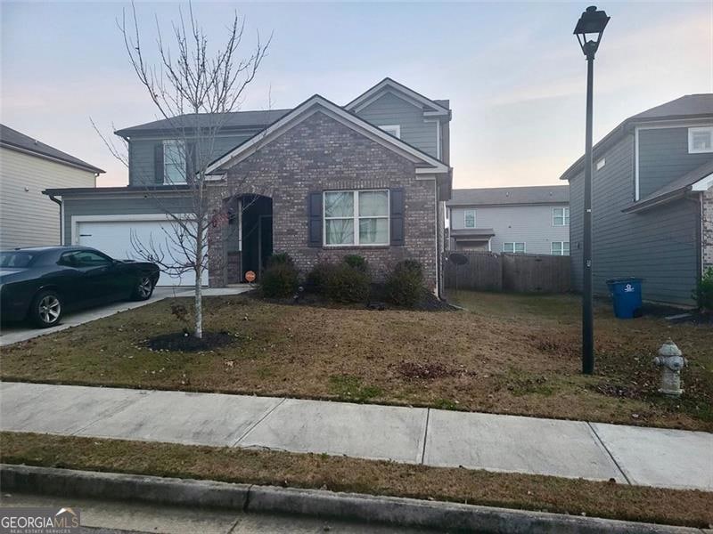
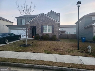
254 Hamilton Pointe Dr McDonough, GA 30253
Estimated payment $1,873/month
Highlights
- Traditional Architecture
- Community Pool
- Patio
- High Ceiling
- Breakfast Room
- Forced Air Heating and Cooling System
About This Home
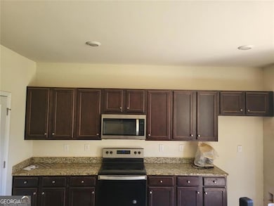
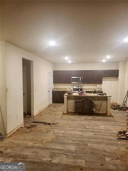
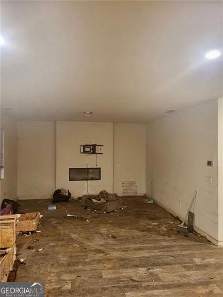
INVESTOR SPECIAL!! SHORT SALE, SHORT SALE, SHORT SALE!! Fantastic opportunity in the Hamilton Pointe community of McDonough! This spacious 4-bedroom, 3-bath home built in 2020 offers 2,634 sq ft of living space and is perfect for investors, flippers, or buyers looking for a property with great potential. The home features an open floor plan, generously sized rooms, and modern construction, providing a solid foundation for your renovation vision. With some updates and repairs, this property can truly shine again. Located close to schools, shopping, restaurants, and major highways, this home offers convenience and long-term value. Short sale is NOT approved and will require bank approval. Don't miss this chance to secure a promising investment in a desirable area!
Listing Agent
Atlanta Communities Brokerage Phone: 1706239973 License #371434 Listed on: 11/21/2025

Home Details
Home Type
- Single Family
Est. Annual Taxes
- $5,502
Year Built
- Built in 2020
Lot Details
- 6,098 Sq Ft Lot
- Privacy Fence
- Back Yard Fenced
- Level Lot
HOA Fees
- $41 Monthly HOA Fees
Home Design
- Traditional Architecture
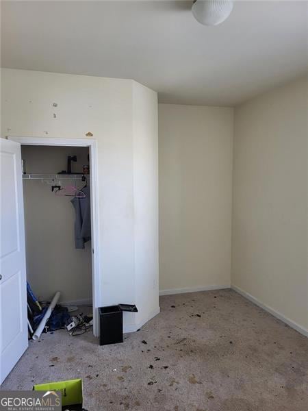
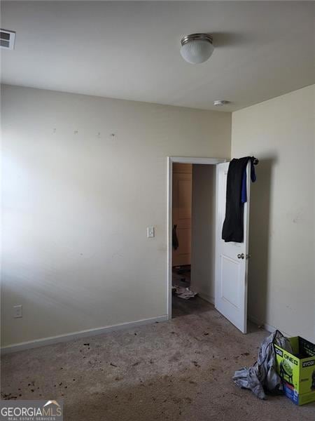
- Fixer Upper
- Brick Exterior Construction
- Slab Foundation
- Composition Roof
- Concrete Siding
Interior Spaces
- 2,634 Sq Ft Home
- 2-Story Property
- Roommate Plan
- High Ceiling
- Family Room
- Living Room with Fireplace
- Breakfast Room
Flooring
- Carpet
- Vinyl
Bedrooms and Bathrooms
Parking
- 2 Car Garage
- Parking Accessed On Kitchen Level
- Garage Door Opener
Schools
- Walnut Creek Elementary School
- Eagles Landing Middle School
- Eagles Landing High School
Additional Features
- Patio
- Forced Air Heating and Cooling System
Community Details
Overview
- Association fees include ground maintenance
- Hamilton Pointe Subdivision
Amenities
- Laundry Facilities
Recreation
- Community Pool
Map
Home Values in the Area
Average Home Value in this Area
Tax History
| Year | Tax Paid | Tax Assessment Tax Assessment Total Assessment is a certain percentage of the fair market value that is determined by local assessors to be the total taxable value of land and additions on the property. | Land | Improvement |
|---|---|---|---|---|
| 2025 | $5,262 | $142,440 | $20,000 | $122,440 |
| 2024 | $5,262 | $148,120 | $20,000 | $128,120 |
| 2023 | $5,459 | $146,960 | $18,000 | $128,960 |
| 2022 | $3,666 | $96,560 | $16,000 | $80,560 |
| 2021 | $3,923 | $101,320 | $17,832 | $83,488 |
| 2020 | $595 | $18,000 | $18,000 | $0 |
| 2019 | $641 | $16,000 | $16,000 | $0 |
| 2018 | $532 | $13,300 | $13,300 | $0 |
| 2016 | $481 | $14,000 | $14,000 | $0 |
| 2015 | $205 | $3,920 | $3,920 | $0 |
| 2014 | $162 | $3,920 | $3,920 | $0 |
Property History
| Date | Event | Price | List to Sale | Price per Sq Ft |
|---|---|---|---|---|
| 11/21/2025 11/21/25 | For Sale | $260,000 | -- | $99 / Sq Ft |
Purchase History
| Date | Type | Sale Price | Title Company |
|---|---|---|---|
| Quit Claim Deed | -- | -- | |
| Warranty Deed | $253,240 | -- | |
| Limited Warranty Deed | $2,745,000 | -- | |
| Limited Warranty Deed | $608,000 | -- |
Mortgage History
| Date | Status | Loan Amount | Loan Type |
|---|---|---|---|
| Previous Owner | $262,356 | VA |
Source: Georgia MLS
MLS Number: 10647729
APN: 090C-01-210-000
Disclaimer: Certain information contained herein is derived from information provided by parties other than Homes.com. All information provided is deemed reliable, but is not guaranteed to be accurate and should be independently verified.
![]() The data relating to real estate for sale on this web site comes in part from the Broker Reciprocity Program of Georgia MLS. Real estate listings held by brokerage firms other than Redfin are marked with the Broker Reciprocity logo and detailed information about them includes the name of the listing brokers. Information deemed reliable but not guaranteed. Copyright 2025 Georgia MLS. All rights reserved.
The data relating to real estate for sale on this web site comes in part from the Broker Reciprocity Program of Georgia MLS. Real estate listings held by brokerage firms other than Redfin are marked with the Broker Reciprocity logo and detailed information about them includes the name of the listing brokers. Information deemed reliable but not guaranteed. Copyright 2025 Georgia MLS. All rights reserved.
- 179 Hamilton Pointe Dr
- 212 Wimberly Ridge
- 456 Culloden Moor Dr
- 105 Hamilton Pointe Dr
- 351 Hamilton Pointe Dr
- 424 Ivey Edwards Ln
- 338 Chandler Ridge
- 110 Woodcrest Way
- 0 Ivey Edwards Ln Unit 10409448
- 0 Ivey Edwards Ln Unit 10246400
- 386 Waterfront Dr
- 128 Brookhaven Ln
- 133 Brookhaven Ln
- 204 Rankin Cir
- 686 Dailey Mill Rd
- 1244 Faye Ct
- 7030 Kingston Ln
- 60 Micah Dr
- 8110 Lakemont Close
- 621 Moorings Ave
- 520 Overo Dr
- 504 Overo Dr
- 199 Hamilton Pointe Dr
- 195 Hamilton Pointe Dr
- 327 Hamilton Pointe Dr
- 149 Hamilton Pointe Dr
- 188 Leland Ln
- 113 Tyre Dr
- 120 Leland Ln
- 100 Woodcrest Way
- 180 Rankin Cir
- 115 Brookhaven Ln
- 117 Brookhaven Ln
- 1138 Dunaway Dr
- 1130 Dunaway Dr
- 1240 Faye Ct
- 25 Den Ric Ct
- 7011 Regency Ln
- 6031 Ambassador Dr