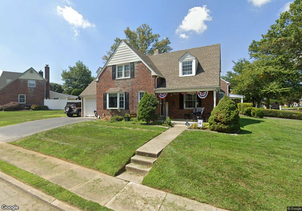
254 Kent Rd Springfield, PA 19064
Estimated Value: $452,608 - $483,000
3
Beds
2
Baths
1,520
Sq Ft
$310/Sq Ft
Est. Value
About This Home
This home is located at 254 Kent Rd, Springfield, PA 19064 and is currently estimated at $471,402, approximately $310 per square foot. 254 Kent Rd is a home located in Delaware County with nearby schools including Springfield High School, Holy Cross School, and St Francis Of Assisi School.
Ownership History
Date
Name
Owned For
Owner Type
Purchase Details
Closed on
Jun 19, 2002
Sold by
Mclaughlin Elizabeth J
Bought by
Dougherty Brian J and Dougherty Kathleen M
Current Estimated Value
Home Financials for this Owner
Home Financials are based on the most recent Mortgage that was taken out on this home.
Original Mortgage
$151,050
Outstanding Balance
$63,867
Interest Rate
6.81%
Estimated Equity
$407,535
Purchase Details
Closed on
Apr 2, 1998
Sold by
Mclaughlin James J and Mclaughlin Elizabeth J
Bought by
Mclaughlin Elizabeth J
Create a Home Valuation Report for This Property
The Home Valuation Report is an in-depth analysis detailing your home's value as well as a comparison with similar homes in the area
Home Values in the Area
Average Home Value in this Area
Purchase History
| Date | Buyer | Sale Price | Title Company |
|---|---|---|---|
| Dougherty Brian J | $159,000 | Commonwealth Land Title Ins | |
| Mclaughlin Elizabeth J | -- | -- |
Source: Public Records
Mortgage History
| Date | Status | Borrower | Loan Amount |
|---|---|---|---|
| Open | Dougherty Brian J | $151,050 |
Source: Public Records
Tax History Compared to Growth
Tax History
| Year | Tax Paid | Tax Assessment Tax Assessment Total Assessment is a certain percentage of the fair market value that is determined by local assessors to be the total taxable value of land and additions on the property. | Land | Improvement |
|---|---|---|---|---|
| 2025 | $7,280 | $259,020 | $94,650 | $164,370 |
| 2024 | $7,280 | $259,020 | $94,650 | $164,370 |
| 2023 | $7,010 | $259,020 | $94,650 | $164,370 |
| 2022 | $6,858 | $259,020 | $94,650 | $164,370 |
| 2021 | $10,622 | $259,020 | $94,650 | $164,370 |
| 2020 | $5,850 | $129,100 | $45,500 | $83,600 |
| 2019 | $5,713 | $129,100 | $45,500 | $83,600 |
| 2018 | $5,631 | $129,100 | $0 | $0 |
| 2017 | $5,501 | $129,100 | $0 | $0 |
| 2016 | $709 | $129,100 | $0 | $0 |
| 2015 | $709 | $129,100 | $0 | $0 |
| 2014 | $723 | $129,100 | $0 | $0 |
Source: Public Records
Map
Nearby Homes
- 306 E Springfield Rd
- 342 E Springfield Rd
- 230 Ridgewood Rd
- 142 Rambling Way
- 30 Wayne Ave
- 158 Hillview Dr
- 324 Valley View Rd
- 487 E Springfield Rd
- 225 Lynbrooke Rd
- 449 Hawarden Rd
- 214 Lynbrooke Rd
- 243 Rambling Way
- 89 Saxer Ave
- 140 N Rolling Rd
- 72 Colonial Park Dr
- 165 Summit Rd
- 224 Ballymore Rd
- 624 E Springfield Rd
- 637 Hawarden Rd
- 240 Beechwood Rd
- 250 Kent Rd
- 255 E Springfield Rd
- 246 Kent Rd
- 249 E Springfield Rd
- 262 School Ln
- 273 School Ln
- 281 School Ln
- 277 School Ln
- 285 School Ln
- 242 Kent Rd
- 243 E Springfield Rd
- 258 School Ln
- 261 E Springfield Rd
- 239 Kent Rd
- 238 Kent Rd
- 254 School Ln
- 265 School Ln
- 261 School Ln
- 235 Kent Rd
- 258 E Springfield Rd