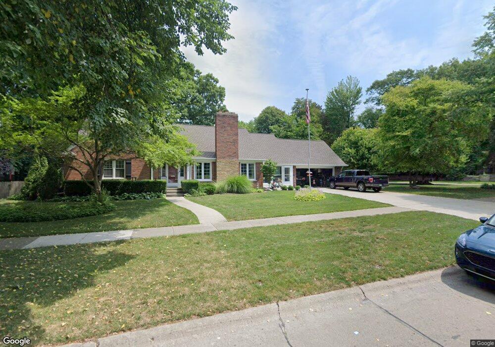
254 Lothrop Rd Grosse Pointe Farms, MI 48236
Estimated Value: $696,670 - $755,000
5
Beds
2
Baths
2,743
Sq Ft
$262/Sq Ft
Est. Value
About This Home
This home is located at 254 Lothrop Rd, Grosse Pointe Farms, MI 48236 and is currently estimated at $719,668, approximately $262 per square foot. 254 Lothrop Rd is a home located in Wayne County with nearby schools including Kerby Elementary School, Brownell Middle School, and Grosse Pointe South High School.
Ownership History
Date
Name
Owned For
Owner Type
Purchase Details
Closed on
Jan 20, 2015
Sold by
Lauscher Terry N and Lauscher Mary Jo R
Bought by
Lauscher Revocable Trust
Current Estimated Value
Purchase Details
Closed on
Jan 8, 2010
Sold by
Amlin Martha A Hair
Bought by
Lauscher Terry N
Purchase Details
Closed on
Jun 9, 2006
Sold by
Higbee David B and Higbee Janet S
Bought by
Hair Martha A and The Martha A Hair Amlin Revocable Trust
Create a Home Valuation Report for This Property
The Home Valuation Report is an in-depth analysis detailing your home's value as well as a comparison with similar homes in the area
Home Values in the Area
Average Home Value in this Area
Purchase History
| Date | Buyer | Sale Price | Title Company |
|---|---|---|---|
| Lauscher Revocable Trust | -- | None Available | |
| Lauscher Terry N | $259,000 | Greco | |
| Amlin Martha A Hair | -- | Greco | |
| Hair Martha A | $356,000 | Greco |
Source: Public Records
Tax History Compared to Growth
Tax History
| Year | Tax Paid | Tax Assessment Tax Assessment Total Assessment is a certain percentage of the fair market value that is determined by local assessors to be the total taxable value of land and additions on the property. | Land | Improvement |
|---|---|---|---|---|
| 2025 | $4,220 | $339,600 | $0 | $0 |
| 2024 | $4,220 | $313,400 | $0 | $0 |
| 2023 | $3,866 | $290,300 | $0 | $0 |
| 2022 | $3,866 | $266,200 | $0 | $0 |
| 2021 | $7,095 | $253,900 | $0 | $0 |
| 2019 | $6,976 | $232,900 | $0 | $0 |
| 2018 | $3,570 | $221,700 | $0 | $0 |
| 2017 | $6,194 | $216,900 | $0 | $0 |
| 2016 | $6,493 | $208,200 | $0 | $0 |
| 2015 | $12,862 | $143,200 | $0 | $0 |
| 2013 | $12,460 | $124,600 | $0 | $0 |
| 2012 | $3,251 | $122,200 | $51,300 | $70,900 |
Source: Public Records
Map
Nearby Homes
- 259 Mount Vernon Ave
- 218 Merriweather Rd
- 302 Mount Vernon Ave
- 314 Mount Vernon Ave
- 194 Charlevoix Ave
- 216 Ridge Rd
- 317 Mount Vernon Ave
- 189 Cloverly Rd
- 343 Mount Vernon Ave
- 257 Ridge Rd
- 276 Lewiston Rd
- 341 Mcmillan Rd
- 380 Merriweather Rd
- 352 Mckinley Ave
- 130 Merriweather Rd
- 273 Ridge Rd
- 166 Lewiston Rd
- 265 Williams Ave
- 351 Moselle Place
- 415 Lothrop Rd
- 233 Charlevoix Ave
- 262 Lothrop Rd
- 251 Lothrop Rd
- 266 Lothrop Rd
- 235 Charlevoix Ave
- 255 Lothrop Rd
- 245 Stephens Rd
- 261 Lothrop Rd
- 261 Stephens Rd
- 270 Lothrop Rd
- 225 Charlevoix Ave
- 265 Lothrop Rd
- 269 Lothrop Rd
- 267 Stephens Rd
- 256 Mount Vernon Ave
- 260 Mount Vernon Ave
- 256 Mt Vernon
- 233 Stephens Rd
- 254 Mount Vernon Ave
- 246 Stephens Rd