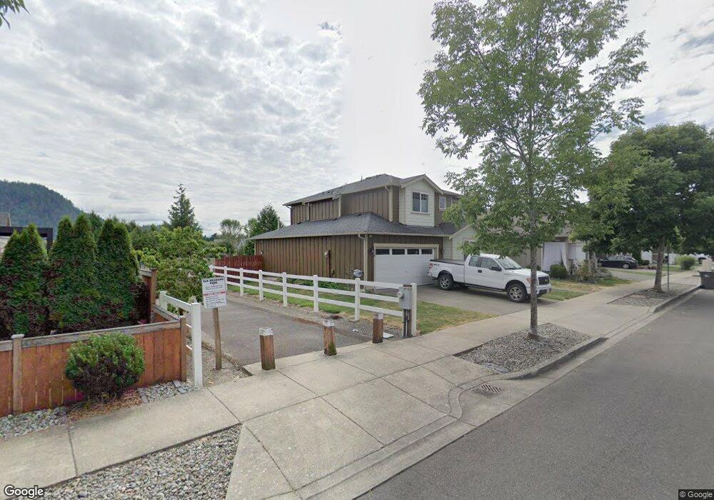
254 Riggs Dr E Enumclaw, WA 98022
Estimated Value: $608,002 - $636,000
4
Beds
3
Baths
1,965
Sq Ft
$315/Sq Ft
Est. Value
About This Home
This home is located at 254 Riggs Dr E, Enumclaw, WA 98022 and is currently estimated at $618,501, approximately $314 per square foot. 254 Riggs Dr E is a home located in King County with nearby schools including Southwood Elementary School, Enumclaw Middle School, and Enumclaw Senior High School.
Ownership History
Date
Name
Owned For
Owner Type
Purchase Details
Closed on
Aug 3, 2011
Sold by
Hall Clay E and Flippen Shelley A
Bought by
Hall Clay E and Hall Shelley A
Current Estimated Value
Home Financials for this Owner
Home Financials are based on the most recent Mortgage that was taken out on this home.
Original Mortgage
$198,400
Outstanding Balance
$136,663
Interest Rate
4.46%
Estimated Equity
$481,838
Purchase Details
Closed on
Mar 26, 2010
Sold by
High Country Homes Inc
Bought by
Hall Clay E and Flippen Shelley A
Home Financials for this Owner
Home Financials are based on the most recent Mortgage that was taken out on this home.
Original Mortgage
$204,000
Interest Rate
3.75%
Purchase Details
Closed on
May 27, 2009
Sold by
Elk Meadows Investors Llc
Bought by
High Country Homes Inc
Home Financials for this Owner
Home Financials are based on the most recent Mortgage that was taken out on this home.
Original Mortgage
$200,000
Interest Rate
4.8%
Create a Home Valuation Report for This Property
The Home Valuation Report is an in-depth analysis detailing your home's value as well as a comparison with similar homes in the area
Home Values in the Area
Average Home Value in this Area
Purchase History
| Date | Buyer | Sale Price | Title Company |
|---|---|---|---|
| Hall Clay E | -- | Chicago Title | |
| Hall Clay E | $255,000 | The Talon Grou | |
| High Country Homes Inc | $85,000 | Ticor Title |
Source: Public Records
Mortgage History
| Date | Status | Borrower | Loan Amount |
|---|---|---|---|
| Open | Hall Clay E | $198,400 | |
| Previous Owner | Hall Clay E | $204,000 | |
| Previous Owner | High Country Homes Inc | $200,000 |
Source: Public Records
Tax History
| Year | Tax Paid | Tax Assessment Tax Assessment Total Assessment is a certain percentage of the fair market value that is determined by local assessors to be the total taxable value of land and additions on the property. | Land | Improvement |
|---|---|---|---|---|
| 2024 | $5,090 | $530,000 | $216,000 | $314,000 |
| 2023 | $4,722 | $455,000 | $186,000 | $269,000 |
| 2022 | $4,228 | $519,000 | $213,000 | $306,000 |
| 2021 | $4,089 | $421,000 | $184,000 | $237,000 |
| 2020 | $3,733 | $371,000 | $147,000 | $224,000 |
| 2018 | $3,790 | $341,000 | $135,000 | $206,000 |
| 2017 | $3,363 | $309,000 | $123,000 | $186,000 |
| 2016 | $3,308 | $283,000 | $113,000 | $170,000 |
| 2015 | $3,001 | $274,000 | $107,000 | $167,000 |
| 2014 | -- | $238,000 | $101,000 | $137,000 |
| 2013 | -- | $183,000 | $81,000 | $102,000 |
Source: Public Records
Map
Nearby Homes
- 103 Jewell St
- 385 Bruhn Ln N
- 176 Love Dr
- 111 Love Dr
- 311 Hogan Dr
- 413 Becky Ave E
- 643 Barquist Ln N
- 657 Barquist Ln N
- 723 Thompson Dr
- 527 Thompson (Lot 2) Dr
- 508 Thompson (Lot 22) Dr
- 571 Thompson (Lot 4) Dr
- 574 Thompson (Lot 19) Dr
- 721 Weaver Dr E
- 732 Weaver Dr E
- 746 Weaver Dr E
- 755 Weaver Dr E
- 769 Weaver Dr E
- 797 Weaver Dr E
- Orchid Plan at Sunrise Vista
- 242 Riggs Dr E
- 278 Bruhn Ln N
- 256 Bruhn Ln N
- 220 Riggs Dr E
- 255 Riggs Dr E
- 224 Bruhn Ln N
- 245 Riggs Dr E
- 243 Riggs Dr E
- 277 Riggs Dr E
- 208 Riggs Dr E
- 285 Riggs Dr E
- 209 Riggs Dr E
- 2 Asmundson Ln N
- 302 Sigrist Dr E
- 204 Riggs Dr E
- 243 Bruhn Ln N
- 256 Petersen Dr E
- 297 Bruhn Ln N
- 244 Petersen Dr E
- 278 Petersen Dr E
Your Personal Tour Guide
Ask me questions while you tour the home.
