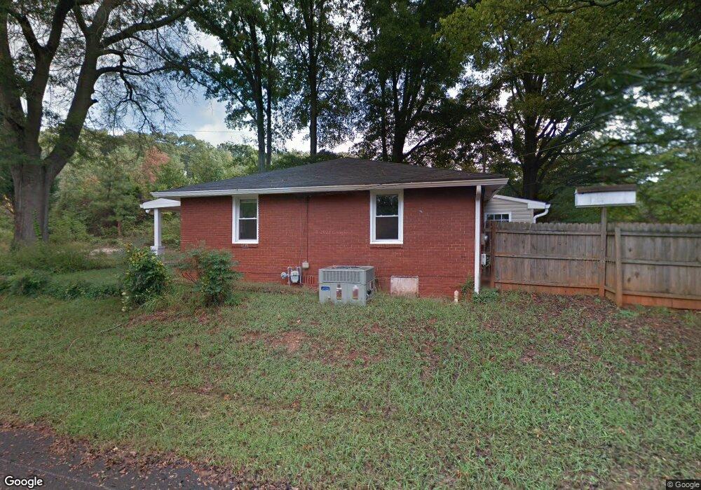
254 S Dixie Ave Cartersville, GA 30120
Estimated Value: $121,000 - $252,000
2
Beds
2
Baths
1,050
Sq Ft
$197/Sq Ft
Est. Value
About This Home
This home is located at 254 S Dixie Ave, Cartersville, GA 30120 and is currently estimated at $206,766, approximately $196 per square foot. 254 S Dixie Ave is a home located in Bartow County with nearby schools including Cartersville Primary School, Cartersville Elementary School, and Cartersville Middle School.
Ownership History
Date
Name
Owned For
Owner Type
Purchase Details
Closed on
Jun 26, 2012
Sold by
Brown Rose
Bought by
Rxr Holdings Llc
Current Estimated Value
Purchase Details
Closed on
Dec 12, 2011
Sold by
Brown Rose
Bought by
Brown Rose
Purchase Details
Closed on
Jan 6, 2009
Sold by
Chalk Michael A
Bought by
Deutsche Bank Co America
Create a Home Valuation Report for This Property
The Home Valuation Report is an in-depth analysis detailing your home's value as well as a comparison with similar homes in the area
Home Values in the Area
Average Home Value in this Area
Purchase History
| Date | Buyer | Sale Price | Title Company |
|---|---|---|---|
| Rxr Holdings Llc | -- | -- | |
| Brown Rose | -- | -- | |
| Brown Rose | -- | -- | |
| Deutsche Bank Co America | $34,425 | -- |
Source: Public Records
Tax History
| Year | Tax Paid | Tax Assessment Tax Assessment Total Assessment is a certain percentage of the fair market value that is determined by local assessors to be the total taxable value of land and additions on the property. | Land | Improvement |
|---|---|---|---|---|
| 2025 | $1,438 | $58,527 | $16,000 | $42,527 |
| 2024 | $1,438 | $58,527 | $16,000 | $42,527 |
| 2023 | $1,467 | $58,435 | $16,000 | $42,435 |
| 2022 | $1,165 | $44,097 | $16,000 | $28,097 |
| 2021 | $831 | $30,595 | $12,000 | $18,595 |
| 2020 | $750 | $26,595 | $8,000 | $18,595 |
| 2019 | $790 | $27,240 | $8,000 | $19,240 |
| 2018 | $679 | $23,240 | $4,000 | $19,240 |
| 2017 | $693 | $23,240 | $4,000 | $19,240 |
| 2016 | $704 | $23,240 | $4,000 | $19,240 |
| 2015 | $587 | $19,800 | $4,000 | $15,800 |
| 2014 | -- | $31,560 | $12,000 | $19,560 |
| 2013 | -- | $27,800 | $10,000 | $17,800 |
Source: Public Records
Map
Nearby Homes
- 210 McCanless St
- 207 Edna Trail
- 120 Maybelle St
- 119 Maybelle St
- 109 Forrest Ave
- 213 Cook St
- 14 Larkwood Cir
- 309 West Ave
- 704 S Bartow St
- 178 W Main St Unit 205
- 178 W Main St Unit 204
- 178 W Main St Unit 102
- 12 Allison Cir
- 00 N Morningside Dr
- 16 Walker St
- 26 Herring St
- 150 Old Mill Rd Unit 406
- 150 Old Mill Rd Unit 205
- 150 Old Mill Rd Unit 314
- 150 Old Mill Rd Unit 329
- 256 S Dixie Ave
- 128 Brook Dr
- 106 Brook Dr
- 165 Brook Dr
- 217 S Morningside Dr
- 213 S Morningside Dr
- 215 S Morningside Dr
- 51 Ridge Row Dr
- 215 S Dixie Ave
- 110 Central Ave
- 416 S Tennessee St
- 14 Brook Dr Unit 1
- 14 Brook Dr
- 22 Brookside Ct
- 22 Brookside Ct Unit 1
- 20 Brookside Ct
- 26 Brookside Ct
- 191 S Morningside Dr
- 18 Brookside Ct
- 30 Brookside Ct
Your Personal Tour Guide
Ask me questions while you tour the home.