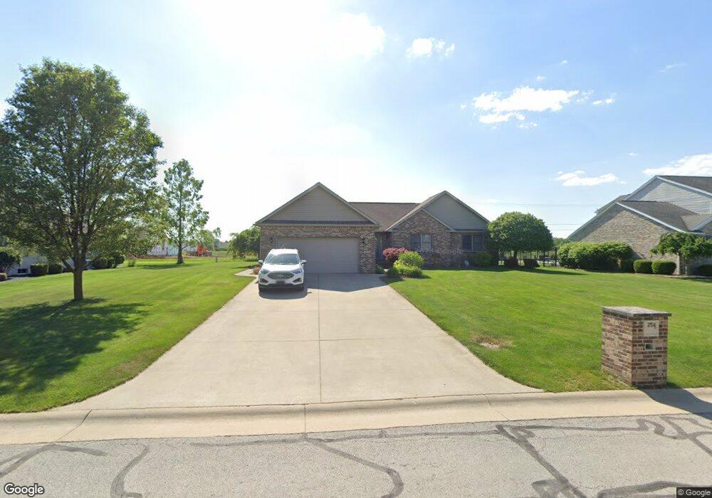
254 Saint Paul Dr Fremont, OH 43420
Estimated Value: $296,916 - $360,000
3
Beds
2
Baths
1,876
Sq Ft
$168/Sq Ft
Est. Value
About This Home
This home is located at 254 Saint Paul Dr, Fremont, OH 43420 and is currently estimated at $315,729, approximately $168 per square foot. 254 Saint Paul Dr is a home located in Sandusky County with nearby schools including Fremont Ross High School, Sacred Heart School, and Temple Christian Academy.
Ownership History
Date
Name
Owned For
Owner Type
Purchase Details
Closed on
Jun 7, 2022
Sold by
Woodruff Living Trust
Bought by
Woodruff James L and Woodruff Margaret S
Current Estimated Value
Purchase Details
Closed on
May 18, 2004
Sold by
St Thomas Associates
Bought by
Woodruff James L and Woodruff Margaret S
Create a Home Valuation Report for This Property
The Home Valuation Report is an in-depth analysis detailing your home's value as well as a comparison with similar homes in the area
Home Values in the Area
Average Home Value in this Area
Purchase History
| Date | Buyer | Sale Price | Title Company |
|---|---|---|---|
| Woodruff James L | -- | Bowlus Law Firm Ltd | |
| Woodruff James L | $17,850 | Midland Title |
Source: Public Records
Tax History Compared to Growth
Tax History
| Year | Tax Paid | Tax Assessment Tax Assessment Total Assessment is a certain percentage of the fair market value that is determined by local assessors to be the total taxable value of land and additions on the property. | Land | Improvement |
|---|---|---|---|---|
| 2024 | $3,104 | $93,590 | $19,390 | $74,200 |
| 2023 | $3,104 | $77,350 | $16,030 | $61,320 |
| 2022 | $2,673 | $77,350 | $16,030 | $61,320 |
| 2021 | $2,760 | $77,350 | $16,030 | $61,320 |
| 2020 | $2,718 | $75,290 | $16,030 | $59,260 |
| 2019 | $2,714 | $75,290 | $16,030 | $59,260 |
| 2018 | $2,719 | $75,290 | $16,030 | $59,260 |
| 2017 | $2,508 | $69,900 | $16,030 | $53,870 |
| 2016 | $2,202 | $69,900 | $16,030 | $53,870 |
| 2015 | $2,151 | $69,900 | $16,030 | $53,870 |
| 2014 | $1,997 | $62,860 | $16,030 | $46,830 |
| 2013 | $1,953 | $62,860 | $16,030 | $46,830 |
Source: Public Records
Map
Nearby Homes
- 251 Saint Paul Dr
- 315 Ethan Dr
- 263 Saint Paul Dr
- 318 Ethan Dr
- 199 Saint Thomas Dr
- 2248 E State St
- 1526 Sunrise Blvd
- 230 N Pennsylvania Ave
- 800 Lawndale Dr
- 546 Oaklawn Ave
- 314 S Collinwood Blvd
- 1014 S County Road 198
- 714 E State St
- 906 Amsden Blvd
- 0 S Buchanan St
- 600 S Buchanan St
- 322 4th St
- 612 2nd St
- 533 Sandusky Ave Unit 535
- 433 Sandusky Ave
- 260 Saint Paul Dr
- 248 Saint Paul Dr
- 0 Saint Paul Dr
- 242 Saint Paul Dr
- 266 Saint Paul Dr
- 239 Saint Paul Dr
- 303 Caleb Dr
- 257 Saint Paul Dr
- 316 Caleb Dr
- 272 Saint Paul Dr
- 236 Saint Paul Dr
- 252 Saint Thomas Dr
- 246 Saint Thomas Dr
- 246 St Thomas Dr
- 258 Saint Thomas Dr
- 233 Saint Paul Dr
- 240 Saint Thomas Dr
- 230 Saint Paul Dr
- 278 Saint Paul Dr
- 231 Saint Paul Dr