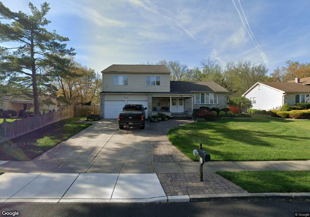
254 Sandringham Rd Cherry Hill, NJ 08003
Estimated Value: $607,000 - $657,000
4
Beds
3
Baths
2,599
Sq Ft
$243/Sq Ft
Est. Value
About This Home
This home is located at 254 Sandringham Rd, Cherry Hill, NJ 08003 and is currently estimated at $631,463, approximately $242 per square foot. 254 Sandringham Rd is a home located in Camden County with nearby schools including Joseph D. Sharp Elementary School, Henry C. Beck Middle School, and Cherry Hill High-East High School.
Ownership History
Date
Name
Owned For
Owner Type
Purchase Details
Closed on
Jul 9, 2008
Sold by
Levy Jeffrey S and Levy Lauren Rae
Bought by
Chacker Robert and Chacker Patricia
Current Estimated Value
Home Financials for this Owner
Home Financials are based on the most recent Mortgage that was taken out on this home.
Original Mortgage
$175,000
Interest Rate
6.4%
Mortgage Type
New Conventional
Purchase Details
Closed on
Aug 31, 2006
Sold by
Klaiss Randy
Bought by
Levy Jeffrey S and Levy Lauren Rae
Home Financials for this Owner
Home Financials are based on the most recent Mortgage that was taken out on this home.
Original Mortgage
$304,000
Interest Rate
6.52%
Purchase Details
Closed on
Nov 23, 2005
Sold by
Alan M Katz Est Of
Bought by
Klaiss Randy and Lovenduski Dean T
Home Financials for this Owner
Home Financials are based on the most recent Mortgage that was taken out on this home.
Original Mortgage
$171,000
Interest Rate
6.28%
Create a Home Valuation Report for This Property
The Home Valuation Report is an in-depth analysis detailing your home's value as well as a comparison with similar homes in the area
Home Values in the Area
Average Home Value in this Area
Purchase History
| Date | Buyer | Sale Price | Title Company |
|---|---|---|---|
| Chacker Robert | $375,000 | -- | |
| Levy Jeffrey S | $380,000 | -- | |
| Klaiss Randy | $190,000 | -- |
Source: Public Records
Mortgage History
| Date | Status | Borrower | Loan Amount |
|---|---|---|---|
| Open | Chacker Robert | $175,000 | |
| Previous Owner | Levy Jeffrey S | $304,000 | |
| Previous Owner | Klaiss Randy | $171,000 |
Source: Public Records
Tax History Compared to Growth
Tax History
| Year | Tax Paid | Tax Assessment Tax Assessment Total Assessment is a certain percentage of the fair market value that is determined by local assessors to be the total taxable value of land and additions on the property. | Land | Improvement |
|---|---|---|---|---|
| 2025 | $11,620 | $260,600 | $72,200 | $188,400 |
| 2024 | $10,950 | $260,600 | $72,200 | $188,400 |
| 2023 | $10,950 | $260,600 | $72,200 | $188,400 |
| 2022 | $10,648 | $260,600 | $72,200 | $188,400 |
| 2021 | $10,682 | $260,600 | $72,200 | $188,400 |
| 2020 | $10,552 | $260,600 | $72,200 | $188,400 |
| 2019 | $10,546 | $260,600 | $72,200 | $188,400 |
| 2018 | $10,518 | $260,600 | $72,200 | $188,400 |
| 2017 | $10,374 | $260,600 | $72,200 | $188,400 |
| 2016 | $10,236 | $260,600 | $72,200 | $188,400 |
| 2015 | $10,075 | $260,600 | $72,200 | $188,400 |
| 2014 | $9,863 | $260,600 | $72,200 | $188,400 |
Source: Public Records
Map
Nearby Homes
- 625 Route 73 S
- 1525 Squire Ln
- 18 Goshawk Ct
- 18 Sandpiper Dr
- 732 E Evesham Rd
- 209 Henfield Ave
- 44 Acadia Dr
- 8 Sequoia Ct
- 35 Euston Rd W
- 20 Euston Rd
- 13 Progress Place
- 75 Euston Rd S
- 800 Marlowe Rd
- 7 Quaker St
- 61 S Maple Ave
- 2 Split Rail Ln
- 405 Hazelwood Ln
- 1 Pawtucket Dr
- 3 Redwood Ct
- 24 Brookstone Dr
- 307 Stoney Brook Ln
- 252 Sandringham Rd
- 305 Stoney Brook Ln
- 248 Sandringham Rd
- 250 Sandringham Rd
- 309 Stoney Brook Ln
- 227 Nathaniel Ave
- 303 Stoney Brook Ln
- 306 Stoney Brook Ln
- 201 Woodbine Dr
- 308 Stoney Brook Ln
- 301 Stoney Brook Ln
- 311 Stoney Brook Ln
- 246 Sandringham Rd
- 235 Sandringham Rd
- 203 Woodbine Dr
- 310 Stoney Brook Ln
- 304 Stoney Brook Ln
- 242 Sandringham Rd
- 244 Sandringham Rd