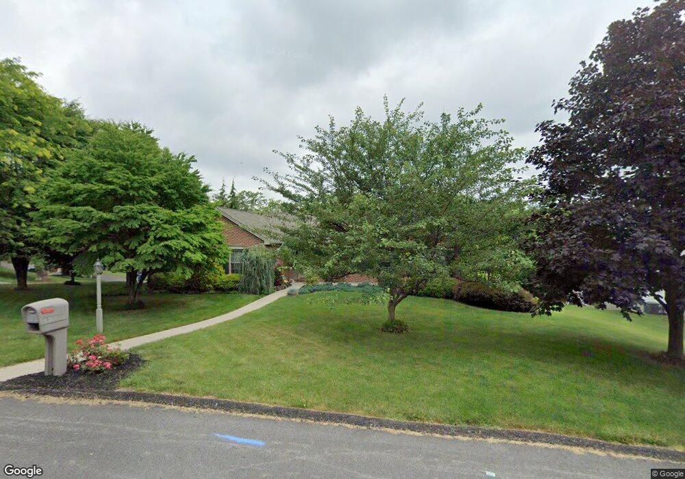
254 Sunset Cir Red Lion, PA 17356
Estimated Value: $378,203 - $440,000
3
Beds
2
Baths
2,030
Sq Ft
$200/Sq Ft
Est. Value
About This Home
This home is located at 254 Sunset Cir, Red Lion, PA 17356 and is currently estimated at $406,301, approximately $200 per square foot. 254 Sunset Cir is a home located in York County with nearby schools including Larry J. Macaluso Elementary School, Red Lion Area Junior High School, and Red Lion Area Senior High School.
Ownership History
Date
Name
Owned For
Owner Type
Purchase Details
Closed on
Jun 7, 2001
Sold by
Timothy F Pasch Inc
Bought by
Laird Mark A and Laird Darla L
Current Estimated Value
Home Financials for this Owner
Home Financials are based on the most recent Mortgage that was taken out on this home.
Original Mortgage
$156,000
Interest Rate
7.08%
Purchase Details
Closed on
Mar 3, 1997
Bought by
Pasch Timothy F Inc
Create a Home Valuation Report for This Property
The Home Valuation Report is an in-depth analysis detailing your home's value as well as a comparison with similar homes in the area
Home Values in the Area
Average Home Value in this Area
Purchase History
| Date | Buyer | Sale Price | Title Company |
|---|---|---|---|
| Laird Mark A | $38,500 | -- | |
| Pasch Timothy F Inc | $22,100 | -- |
Source: Public Records
Mortgage History
| Date | Status | Borrower | Loan Amount |
|---|---|---|---|
| Closed | Laird Mark A | $156,000 |
Source: Public Records
Tax History Compared to Growth
Tax History
| Year | Tax Paid | Tax Assessment Tax Assessment Total Assessment is a certain percentage of the fair market value that is determined by local assessors to be the total taxable value of land and additions on the property. | Land | Improvement |
|---|---|---|---|---|
| 2025 | $7,040 | $225,210 | $45,290 | $179,920 |
| 2024 | $6,763 | $225,210 | $45,290 | $179,920 |
| 2023 | $6,763 | $225,210 | $45,290 | $179,920 |
| 2022 | $6,763 | $225,210 | $45,290 | $179,920 |
| 2021 | $6,571 | $225,210 | $45,290 | $179,920 |
| 2020 | $6,571 | $225,210 | $45,290 | $179,920 |
| 2019 | $6,549 | $225,210 | $45,290 | $179,920 |
| 2018 | $6,515 | $225,210 | $45,290 | $179,920 |
| 2017 | $6,459 | $225,210 | $45,290 | $179,920 |
| 2016 | $0 | $225,210 | $45,290 | $179,920 |
| 2015 | -- | $225,210 | $45,290 | $179,920 |
| 2014 | -- | $225,210 | $45,290 | $179,920 |
Source: Public Records
Map
Nearby Homes
- 306 Mohawk Dr
- 375 Barclay Dr
- Lot #10 Barclay Dr
- 325 Barclay Dr
- 1012 Woodridge Rd
- 44 Hunters Run Ct Unit 8
- 60 Indian Springs Rd
- 413 Appaloosa Way
- 0 Cape Horn Rd
- 3366 Cape Horn Rd
- 415 N Main St
- 265 Winners Cir Unit 265
- 705 Danbury Dr
- 327 Robin Dr
- 270 N Main St
- 137 Furlong Way
- 127 W Gay St
- 400 Carriage Ln Unit 400
- 27 Steeple Ave
- 2855 Springwood Rd
- 2038 Parkview Dr
- 252 Sunset Cir
- 2035 Parkview Dr
- 2037 Parkview Dr
- 2033 Parkview Dr
- 2034 Parkview Dr
- 2039 Parkview Dr
- 250 Sunset Cir
- 2031 Parkview Dr
- 2032 Parkview Dr
- 300 Mohawk Dr
- 302 Mohawk Dr
- 2029 Parkview Dr
- 304 Mohawk Dr
- 2041 Parkview Dr
- 248 Sunset Cir
- 405 Sarah Woods Dr
- 2030 Parkview Dr
- 407 Sarah Woods Dr
- 409 Sarah Woods Dr