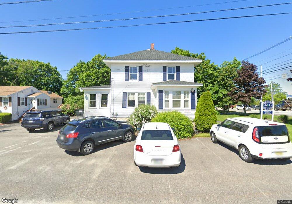
254 U S Route One Scarborough, ME 04074
4
Beds
1
Bath
1,552
Sq Ft
8,712
Sq Ft Lot
About This Home
This home is located at 254 U S Route One, Scarborough, ME 04074. 254 U S Route One is a home located in Cumberland County with nearby schools including Scarborough High School and Cornerstone Baptist Academy.
Ownership History
Date
Name
Owned For
Owner Type
Purchase Details
Closed on
Jan 31, 2017
Sold by
Sholl Benjamin R
Bought by
Mlre Holdings Llc
Home Financials for this Owner
Home Financials are based on the most recent Mortgage that was taken out on this home.
Original Mortgage
$234,000
Outstanding Balance
$193,525
Interest Rate
4.16%
Mortgage Type
Commercial
Purchase Details
Closed on
Oct 19, 2011
Sold by
W & G Realty Inc
Bought by
Sholl Benjamin R and Sholl Kimberly S
Create a Home Valuation Report for This Property
The Home Valuation Report is an in-depth analysis detailing your home's value as well as a comparison with similar homes in the area
Home Values in the Area
Average Home Value in this Area
Purchase History
| Date | Buyer | Sale Price | Title Company |
|---|---|---|---|
| Mlre Holdings Llc | -- | -- | |
| Mlre Holdings Llc | -- | -- | |
| Sholl Benjamin R | -- | -- | |
| Sholl Benjamin R | -- | -- | |
| Sholl Benjamin R | -- | -- |
Source: Public Records
Mortgage History
| Date | Status | Borrower | Loan Amount |
|---|---|---|---|
| Open | Mlre Holdings Llc | $234,000 | |
| Closed | Sholl Benjamin R | $234,000 | |
| Closed | Sholl Benjamin R | $0 |
Source: Public Records
Tax History Compared to Growth
Tax History
| Year | Tax Paid | Tax Assessment Tax Assessment Total Assessment is a certain percentage of the fair market value that is determined by local assessors to be the total taxable value of land and additions on the property. | Land | Improvement |
|---|---|---|---|---|
| 2024 | $4,441 | $406,300 | $229,200 | $177,100 |
| 2023 | $3,973 | $248,800 | $144,100 | $104,700 |
| 2022 | $3,829 | $248,800 | $144,100 | $104,700 |
| 2021 | $3,737 | $248,800 | $144,100 | $104,700 |
| 2020 | $3,697 | $248,800 | $144,100 | $104,700 |
| 2019 | $3,657 | $248,800 | $144,100 | $104,700 |
| 2017 | $3,145 | $190,700 | $109,000 | $81,700 |
| 2016 | $3,036 | $190,700 | $109,000 | $81,700 |
| 2015 | $2,954 | $190,700 | $109,000 | $81,700 |
| 2014 | $2,880 | $190,700 | $109,000 | $81,700 |
| 2013 | $2,817 | $190,700 | $109,000 | $81,700 |
Source: Public Records
Map
Nearby Homes
- 11 Westwood Ave
- 14 Herbert Dr
- 5 Traditional St
- 8 Ballantyne Dr
- 30 Stratton Rd Unit 30
- 29 Stratton Rd
- 1 Stratton Rd Unit 1
- 1 Teal Point Dr Unit 1
- 5 Estate Dr
- 19 Millbrook Rd
- 24 Bayberry Ln
- 14 Oakdale Dr Unit 14
- 12 Bayberry Ln
- 46 Pacer Way
- 32 Pacer Way Unit 336
- 4 Perennial Way
- 14 Holbrook Farms Way Unit 1
- 73 Maple Ave
- Lot 6 Trestle Way
- Lot 5 Trestle Way