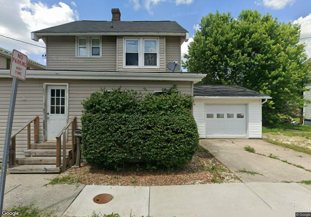
254 W Garrett St Somerset, PA 15501
Estimated Value: $114,000 - $144,000
3
Beds
1
Bath
1,264
Sq Ft
$103/Sq Ft
Est. Value
About This Home
This home is located at 254 W Garrett St, Somerset, PA 15501 and is currently estimated at $130,228, approximately $103 per square foot. 254 W Garrett St is a home located in Somerset County with nearby schools including Maple Ridge Elementary School, Eagle View Elementary School, and Somerset Area Junior/Senior High School.
Ownership History
Date
Name
Owned For
Owner Type
Purchase Details
Closed on
Jul 29, 2010
Sold by
Nichols Stephen K and Nichols Lori L
Bought by
Nichols Stephen K
Current Estimated Value
Purchase Details
Closed on
May 19, 2006
Sold by
Barclay Christine A and Barclay David W
Bought by
Nichols Stephen K
Home Financials for this Owner
Home Financials are based on the most recent Mortgage that was taken out on this home.
Original Mortgage
$85,500
Outstanding Balance
$54,690
Interest Rate
8.3%
Mortgage Type
Adjustable Rate Mortgage/ARM
Estimated Equity
$75,538
Create a Home Valuation Report for This Property
The Home Valuation Report is an in-depth analysis detailing your home's value as well as a comparison with similar homes in the area
Home Values in the Area
Average Home Value in this Area
Purchase History
| Date | Buyer | Sale Price | Title Company |
|---|---|---|---|
| Nichols Stephen K | -- | None Available | |
| Nichols Stephen K | $70,000 | None Available |
Source: Public Records
Mortgage History
| Date | Status | Borrower | Loan Amount |
|---|---|---|---|
| Open | Nichols Stephen K | $85,500 |
Source: Public Records
Tax History Compared to Growth
Tax History
| Year | Tax Paid | Tax Assessment Tax Assessment Total Assessment is a certain percentage of the fair market value that is determined by local assessors to be the total taxable value of land and additions on the property. | Land | Improvement |
|---|---|---|---|---|
| 2025 | $2,309 | $29,020 | $0 | $0 |
| 2024 | $2,309 | $29,020 | $0 | $0 |
| 2023 | $2,258 | $29,020 | $0 | $0 |
| 2022 | $2,147 | $29,020 | $0 | $0 |
| 2021 | $2,103 | $29,020 | $0 | $0 |
| 2020 | $2,074 | $29,020 | $0 | $0 |
| 2019 | $2,074 | $29,020 | $0 | $0 |
| 2018 | $2,044 | $29,020 | $7,880 | $21,140 |
| 2017 | $2,030 | $29,020 | $7,880 | $21,140 |
| 2016 | -- | $29,020 | $7,880 | $21,140 |
| 2015 | -- | $28,300 | $7,875 | $20,425 |
| 2014 | -- | $28,300 | $7,875 | $20,425 |
Source: Public Records
Map
Nearby Homes
- 344 W Garrett St
- 336 W Sanner St
- 129 W Sanner St
- 611 S Ankeny Ave
- 908 S Park Ave
- 152 E Garrett St
- 0 E Garrett St
- 331 W Main St
- 127 W Main St
- 0 Patton St
- 0 1607 Unit 96037617
- 158 W Union St
- 742 S Edgewood Ave (Rear)
- 506 Tayman Ave
- 549 W Race St
- 348 W Catherine St
- 120 W Catherine St
- 527 N Edgewood Ave
- 260 W Garrett St
- 242 W Garrett St
- 264 W Garrett St
- 238 W Garrett St
- 525 S Rosina Ave
- 270 W Garrett St
- 251 W Garrett St
- 519 S Rosina Ave
- 259 W Garrett St
- 232 W Garrett St
- 235 W Garrett St
- 267 W Garrett St
- 228 W Garrett St
- 302 W Garrett St
- 257 W Sanner St
- 253 W Sanner St
- 265 W Sanner St
- 222 W Garrett St
- 243 W Sanner St
- 269 W Sanner St