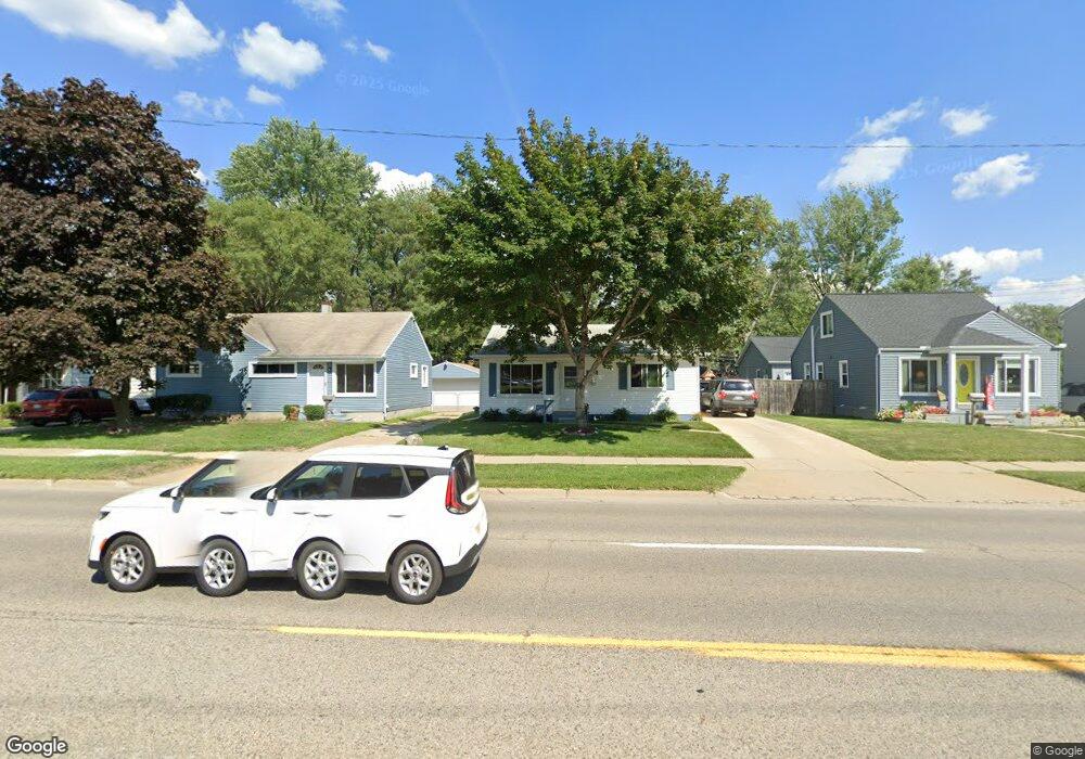
2540 Greenfield Rd Berkley, MI 48072
Estimated Value: $209,000 - $284,000
2
Beds
1
Bath
779
Sq Ft
$311/Sq Ft
Est. Value
About This Home
This home is located at 2540 Greenfield Rd, Berkley, MI 48072 and is currently estimated at $242,020, approximately $310 per square foot. 2540 Greenfield Rd is a home located in Oakland County with nearby schools including Angell Elementary School, Anderson Middle School, and Berkley High School.
Ownership History
Date
Name
Owned For
Owner Type
Purchase Details
Closed on
Sep 20, 2022
Sold by
Cole Leonard L and Cole Rebecca S
Bought by
Cole Family Living Trust
Current Estimated Value
Purchase Details
Closed on
Dec 19, 2003
Sold by
Cole Leonard and Cole Rebecca
Bought by
Cole Leonard and Cole Rebecca
Home Financials for this Owner
Home Financials are based on the most recent Mortgage that was taken out on this home.
Original Mortgage
$88,500
Interest Rate
5.74%
Mortgage Type
New Conventional
Purchase Details
Closed on
Jan 22, 2001
Sold by
Cole Leonard L
Bought by
Leonard L Cole Tr
Purchase Details
Closed on
Jan 15, 2001
Sold by
Leonard L Cole Tr
Bought by
Cole Leonard L
Create a Home Valuation Report for This Property
The Home Valuation Report is an in-depth analysis detailing your home's value as well as a comparison with similar homes in the area
Home Values in the Area
Average Home Value in this Area
Purchase History
| Date | Buyer | Sale Price | Title Company |
|---|---|---|---|
| Cole Family Living Trust | -- | -- | |
| Cole Leonard | -- | First American Title Ins Co | |
| Leonard L Cole Tr | -- | -- | |
| Cole Leonard L | -- | -- |
Source: Public Records
Mortgage History
| Date | Status | Borrower | Loan Amount |
|---|---|---|---|
| Previous Owner | Cole Leonard | $88,500 |
Source: Public Records
Tax History Compared to Growth
Tax History
| Year | Tax Paid | Tax Assessment Tax Assessment Total Assessment is a certain percentage of the fair market value that is determined by local assessors to be the total taxable value of land and additions on the property. | Land | Improvement |
|---|---|---|---|---|
| 2024 | $1,215 | $87,110 | $0 | $0 |
| 2023 | $1,095 | $81,690 | $0 | $0 |
| 2022 | $1,095 | $70,420 | $0 | $0 |
| 2021 | $1,071 | $62,240 | $0 | $0 |
| 2020 | $1,024 | $56,400 | $0 | $0 |
| 2019 | $1,076 | $51,270 | $0 | $0 |
| 2018 | $1,029 | $42,350 | $0 | $0 |
| 2017 | $1,016 | $40,330 | $0 | $0 |
| 2016 | $1,026 | $35,760 | $0 | $0 |
| 2015 | -- | $31,730 | $0 | $0 |
| 2014 | -- | $25,810 | $0 | $0 |
| 2011 | -- | $47,910 | $0 | $0 |
Source: Public Records
Map
Nearby Homes
- 2464 Greenfield Rd
- 2376 Thomas Ave
- 2716 Thomas Ave
- 15840 Catalpa Dr
- 2843 Ellwood Ave
- 28110 Marshall St
- 2650 Cummings Ave
- 27426 Marshall St
- 2400 Bacon Ave
- 2678 Bacon Ave
- 2519 Phillips Ave
- 28466 Brentwood St
- 28115 Everett St
- 28060 Aberdeen St
- 28530 Fairfax St
- 1845 Thomas Ave
- 3153 Cummings Ave
- 3012 Phillips Ave
- 2540 Royal Ave
- 28316 Sutherland St
- 2520 Greenfield Rd
- 2550 Greenfield Rd
- 2482 Greenfield Rd
- 2564 Greenfield Rd
- 2539 Ellwood Ave
- 2551 Ellwood Ave
- 2574 Greenfield Rd
- 2567 Ellwood Ave
- 2481 Ellwood Ave
- 2463 Ellwood Ave
- 2446 Greenfield Rd
- 28164 Greenfield Rd
- 2445 Ellwood Ave
- 2428 Greenfield Rd
- 2620 Greenfield Rd
- 2427 Ellwood Ave
- 2630 Greenfield Rd
- 4138 Catalpa Dr
- 2538 Ellwood Ave
- 2409 Ellwood Ave