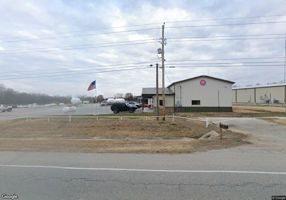
25405 E Highway 51 Broken Arrow, OK 74014
Estimated Value: $336,332
Studio
--
Bath
1,824
Sq Ft
$184/Sq Ft
Est. Value
About This Home
This home is located at 25405 E Highway 51, Broken Arrow, OK 74014 and is currently estimated at $336,332, approximately $184 per square foot. 25405 E Highway 51 is a home located in Wagoner County with nearby schools including Rosewood Elementary School, Oneta Ridge Middle School, and Broken Arrow Freshman Academy.
Ownership History
Date
Name
Owned For
Owner Type
Purchase Details
Closed on
Jun 21, 2012
Sold by
Ferrellgas Lp
Bought by
Reliable Propane Llc
Current Estimated Value
Home Financials for this Owner
Home Financials are based on the most recent Mortgage that was taken out on this home.
Original Mortgage
$347,588
Interest Rate
3.8%
Mortgage Type
FHA
Purchase Details
Closed on
May 7, 1997
Sold by
Ferrellgas Lp
Purchase Details
Closed on
Apr 21, 1997
Sold by
Mcneal Keith E/Gloria Trust
Purchase Details
Closed on
Aug 30, 1993
Sold by
Rodgers Ozella
Create a Home Valuation Report for This Property
The Home Valuation Report is an in-depth analysis detailing your home's value as well as a comparison with similar homes in the area
Home Values in the Area
Average Home Value in this Area
Purchase History
| Date | Buyer | Sale Price | Title Company |
|---|---|---|---|
| Reliable Propane Llc | $65,000 | None Available | |
| -- | -- | -- | |
| -- | $200,000 | -- | |
| -- | $95,000 | -- |
Source: Public Records
Mortgage History
| Date | Status | Borrower | Loan Amount |
|---|---|---|---|
| Closed | Reliable Propane Llc | $347,588 |
Source: Public Records
Tax History
| Year | Tax Paid | Tax Assessment Tax Assessment Total Assessment is a certain percentage of the fair market value that is determined by local assessors to be the total taxable value of land and additions on the property. | Land | Improvement |
|---|---|---|---|---|
| 2025 | $3,114 | $31,227 | $22,396 | $8,831 |
| 2024 | $2,956 | $29,917 | $22,396 | $7,521 |
| 2023 | $2,966 | $30,023 | $22,396 | $7,627 |
| 2022 | $3,597 | $36,242 | $22,396 | $13,846 |
| 2021 | $2,858 | $28,647 | $16,834 | $11,813 |
| 2020 | $2,780 | $27,283 | $15,583 | $11,700 |
| 2019 | $2,679 | $25,984 | $14,329 | $11,655 |
| 2018 | $2,506 | $24,747 | $13,092 | $11,655 |
| 2017 | $2,385 | $23,568 | $11,530 | $12,038 |
| 2016 | $2,266 | $22,446 | $10,430 | $12,016 |
| 2015 | -- | $21,377 | $9,390 | $11,987 |
| 2014 | -- | $20,359 | $8,400 | $11,959 |
Source: Public Records
Map
Nearby Homes
- 10459 S 257th East Ave
- 25901 E 51 Hwy
- 2807 E Liberty Place
- 2923 E Portland St
- 24408 E 97th St S
- 25203 E 111th St S
- 9333 S 255th East Ave
- 25344 E 93rd St S
- 25409 E 93rd Place S
- 9239 S 256th East Ave
- 23805 E 103rd Place S
- 23810 E 103rd St S
- 9248 S 254th East Ave
- 9225 S 258th East Ave
- 24878 E 93rd Ct S
- 4 E 96th St
- 26175 E 93rd St S
- 11391 S 213th East Ave
- 11354 S 213th East Ave
- 22613 E 102nd St S
- 0 Arkansas St Unit 2224676
- 10261 Arkansas St
- 10295 S State Highway 51
- 10210 S 257th East Ave
- 25501 E Highway 51
- 10200 S 257th East Ave
- 10320 S 257th East Ave
- 10345 S State Highway 51
- 10160 S 257th East Ave
- 10280 S 258th East Ave
- 10220 S 258th East Ave
- 10330 S 258th East Ave
- 10330 S 258th Ave E
- 10220 S 258th Ave E
- 25510 E 101st St S
- 10217 S 257th East Ave
- 25757 E 102nd St S
- 11362 S 215th East Ave
- 24725 E Hwy 51
Your Personal Tour Guide
Ask me questions while you tour the home.
