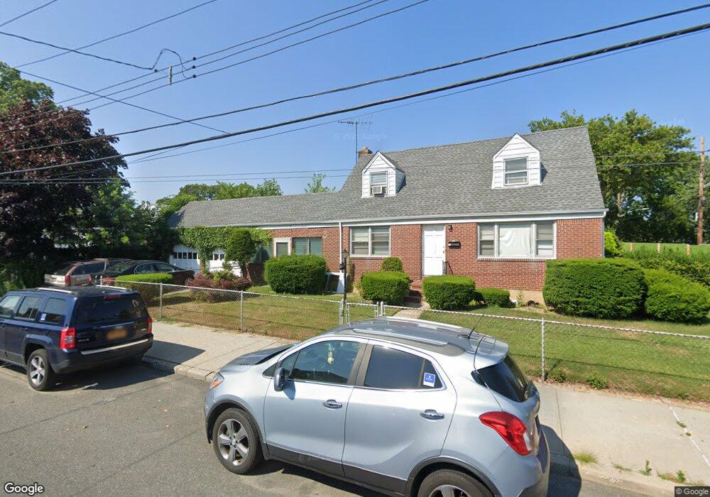
25417 Memphis Ave Rosedale, NY 11422
Rosedale NeighborhoodEstimated Value: $657,153 - $986,000
--
Bed
--
Bath
1,520
Sq Ft
$557/Sq Ft
Est. Value
About This Home
This home is located at 25417 Memphis Ave, Rosedale, NY 11422 and is currently estimated at $846,288, approximately $556 per square foot. 25417 Memphis Ave is a home located in Queens County with nearby schools including P.S. / M.S. 138 Sunrise, Collaborative Arts Middle School, and Success Academy Charter School - Rosedale.
Ownership History
Date
Name
Owned For
Owner Type
Purchase Details
Closed on
Jun 24, 2005
Sold by
Benton Trustee Josephine and Elizabeth M Urban 2005 Revocable Trust
Bought by
Benton Josephine
Current Estimated Value
Purchase Details
Closed on
Jan 28, 2005
Sold by
Urban Elizabeth M
Bought by
Benton Trustee Josephine and Elizabeth M Urban 2005 Rev Trust Dated
Create a Home Valuation Report for This Property
The Home Valuation Report is an in-depth analysis detailing your home's value as well as a comparison with similar homes in the area
Home Values in the Area
Average Home Value in this Area
Purchase History
| Date | Buyer | Sale Price | Title Company |
|---|---|---|---|
| Benton Josephine | -- | -- | |
| Benton Josephine | -- | -- | |
| Benton Trustee Josephine | -- | -- | |
| Benton Trustee Josephine | -- | -- |
Source: Public Records
Tax History Compared to Growth
Tax History
| Year | Tax Paid | Tax Assessment Tax Assessment Total Assessment is a certain percentage of the fair market value that is determined by local assessors to be the total taxable value of land and additions on the property. | Land | Improvement |
|---|---|---|---|---|
| 2025 | $6,255 | $38,098 | $9,761 | $28,337 |
| 2024 | $6,255 | $35,942 | $11,034 | $24,908 |
| 2023 | $6,325 | $35,942 | $9,468 | $26,474 |
| 2022 | $6,056 | $42,420 | $12,360 | $30,060 |
| 2021 | $6,072 | $40,440 | $12,360 | $28,080 |
| 2020 | $5,704 | $38,820 | $12,360 | $26,460 |
| 2019 | $5,262 | $34,020 | $12,360 | $21,660 |
| 2018 | $5,127 | $29,952 | $10,806 | $19,146 |
| 2017 | $5,381 | $29,280 | $12,360 | $16,920 |
| 2016 | $5,023 | $29,280 | $12,360 | $16,920 |
| 2015 | $3,357 | $26,457 | $9,119 | $17,338 |
| 2014 | $3,357 | $24,960 | $10,320 | $14,640 |
Source: Public Records
Map
Nearby Homes
- 251-20 Memphis Ave
- 25711 147th Ave
- 13929 254th St
- 14718 257th St
- 25827 147th Ave
- 143-36 257th St
- 14432 Weller Ln
- 141-40 250th St
- 25340 147th Ave
- 14224 250th St
- 139-16 Caney Ln
- 13917 250th St
- 253-22 147th Ave
- 142-12 Hook Creek Blvd
- 25907 147th Rd
- 258-22 147th Rd
- 24811 Memphis Ave
- 249-21 145th Ave
- 248-18 Memphis Ave
- 25311 147th Rd
- 14144 255th St
- 14144 255th St
- 14144 255th St Unit 2
- 14138 255th St
- 14147 254th St
- 14143 254th St
- 14147 254th St
- 141-45 255th St
- 14137 254th St
- 141-41 255th St
- 14145 255th St
- 14203 254th St
- 14132 255th St
- 141-39 255th St
- 25416 Memphis Ave
- 14141 255th St
- 14137 254th St
- 14137 254th St Unit 2 Fl
- 25412 Memphis Ave
- 141-32 255th St