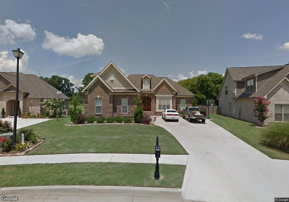
25441 Queensbury Dr Athens, AL 35613
Estimated Value: $413,000 - $470,000
4
Beds
4
Baths
2,750
Sq Ft
$163/Sq Ft
Est. Value
About This Home
This home is located at 25441 Queensbury Dr, Athens, AL 35613 and is currently estimated at $449,000, approximately $163 per square foot. 25441 Queensbury Dr is a home located in Limestone County with nearby schools including Creekside Elementary School, East Limestone High School, and Lindsay Lane Christian Academy.
Ownership History
Date
Name
Owned For
Owner Type
Purchase Details
Closed on
Dec 22, 2010
Sold by
Mooresville Capshaw Llc
Bought by
Perry Dennis L
Current Estimated Value
Home Financials for this Owner
Home Financials are based on the most recent Mortgage that was taken out on this home.
Original Mortgage
$150,000
Outstanding Balance
$52,842
Interest Rate
4.4%
Mortgage Type
Purchase Money Mortgage
Estimated Equity
$396,158
Purchase Details
Closed on
Mar 31, 2010
Sold by
Limestone Kingston Llc
Bought by
Mooresville Capshaw Llc
Home Financials for this Owner
Home Financials are based on the most recent Mortgage that was taken out on this home.
Original Mortgage
$240,000
Interest Rate
4.97%
Mortgage Type
Purchase Money Mortgage
Create a Home Valuation Report for This Property
The Home Valuation Report is an in-depth analysis detailing your home's value as well as a comparison with similar homes in the area
Home Values in the Area
Average Home Value in this Area
Purchase History
| Date | Buyer | Sale Price | Title Company |
|---|---|---|---|
| Perry Dennis L | $309,900 | -- | |
| Mooresville Capshaw Llc | -- | -- |
Source: Public Records
Mortgage History
| Date | Status | Borrower | Loan Amount |
|---|---|---|---|
| Open | Perry Dennis L | $150,000 | |
| Previous Owner | Mooresville Capshaw Llc | $240,000 |
Source: Public Records
Tax History Compared to Growth
Tax History
| Year | Tax Paid | Tax Assessment Tax Assessment Total Assessment is a certain percentage of the fair market value that is determined by local assessors to be the total taxable value of land and additions on the property. | Land | Improvement |
|---|---|---|---|---|
| 2024 | $1,293 | $43,860 | $0 | $0 |
| 2023 | $1,293 | $42,940 | $0 | $0 |
| 2022 | $1,055 | $35,820 | $0 | $0 |
| 2021 | $933 | $31,880 | $0 | $0 |
| 2020 | $867 | $29,680 | $0 | $0 |
| 2019 | $925 | $31,440 | $0 | $0 |
| 2018 | $842 | $28,820 | $0 | $0 |
| 2017 | $812 | $28,820 | $0 | $0 |
| 2016 | $812 | $288,200 | $0 | $0 |
| 2015 | $842 | $28,820 | $0 | $0 |
| 2014 | $827 | $0 | $0 | $0 |
Source: Public Records
Map
Nearby Homes
- Arlington - B Newby Chapel Rd
- Flagstaff B1 Capshaw Rd
- 14735 Commonwealth Dr
- 14806 Commonwealth Dr
- Thorton B Capshaw Rd
- Greenridge C Capshaw Rd
- McKinley A Capshaw Rd
- 1.6 Highway 72
- 25464 Craft Rd
- Charle Plan at Craft Springs
- Brio Plan at Craft Springs
- Halle Plan at Craft Springs
- Independence II Plan at Craft Springs
- Trevi Plan at Craft Springs
- 15769 Ruthie Lynn Dr
- 15717 Ruthie Lynn Dr
- 15692 Landview Ln
- 15825 Ruthie Lynn Dr
- 15781 Ruthie Lynn Dr
- 15809 Ruthie Lynn Dr
- 25449 Queensbury Dr
- 25433 Queensbury Dr
- 25459 Queensbury Dr
- 25436 Queensbury Dr
- 25469 Queensbury Dr
- 14908 Sabre Dr
- 25218 Capshaw Rd
- 25272 Capshaw Rd
- 14926 Sabre Dr
- 25481 Queensbury Dr
- 25199 Kingston Dr
- 25402 Queensbury Dr
- 25491 Queensbury Dr
- 25177 Kingston Dr
- 25187 Kingston Dr
- 25380 Queensbury Dr
- 14865 Maiden Ct
- 14932 Sabre Dr
- 25240 Capshaw Rd
- 25165 Kingston Dr