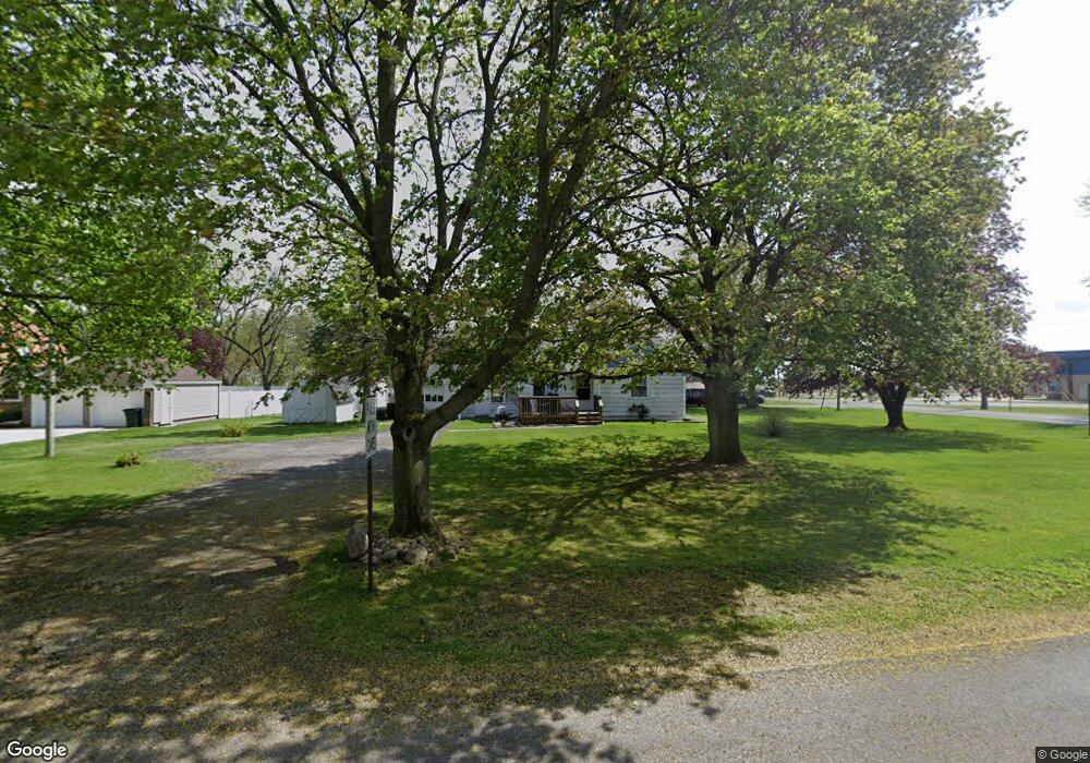
2545 Airport Rd Adrian, MI 49221
Estimated Value: $167,000 - $210,000
2
Beds
1
Bath
746
Sq Ft
$247/Sq Ft
Est. Value
About This Home
This home is located at 2545 Airport Rd, Adrian, MI 49221 and is currently estimated at $184,550, approximately $247 per square foot. 2545 Airport Rd is a home located in Lenawee County with nearby schools including Adrian High School, Berean Baptist Academy, and St. Stephen Lutheran School.
Ownership History
Date
Name
Owned For
Owner Type
Purchase Details
Closed on
Jun 9, 2010
Sold by
Secretary Of Hud
Bought by
Gushard Dale
Current Estimated Value
Home Financials for this Owner
Home Financials are based on the most recent Mortgage that was taken out on this home.
Original Mortgage
$36,800
Outstanding Balance
$24,530
Interest Rate
4.86%
Mortgage Type
New Conventional
Estimated Equity
$160,020
Purchase Details
Closed on
Apr 23, 2009
Sold by
Mortgage Electronic Registration Systems
Bought by
U S Department Of Hud
Purchase Details
Closed on
Mar 26, 2009
Sold by
Mccarty Dennis and Mccarty Sandy
Bought by
Mortgage Elecronic Registration Systems
Purchase Details
Closed on
Apr 11, 2005
Sold by
Hardy Matthew A
Bought by
Mccarty Dennis
Home Financials for this Owner
Home Financials are based on the most recent Mortgage that was taken out on this home.
Original Mortgage
$121,043
Interest Rate
5.89%
Mortgage Type
FHA
Create a Home Valuation Report for This Property
The Home Valuation Report is an in-depth analysis detailing your home's value as well as a comparison with similar homes in the area
Home Values in the Area
Average Home Value in this Area
Purchase History
| Date | Buyer | Sale Price | Title Company |
|---|---|---|---|
| Gushard Dale | $46,000 | None Available | |
| U S Department Of Hud | -- | None Available | |
| Mortgage Elecronic Registration Systems | $125,866 | None Available | |
| Mccarty Dennis | $122,000 | None Available |
Source: Public Records
Mortgage History
| Date | Status | Borrower | Loan Amount |
|---|---|---|---|
| Open | Gushard Dale | $36,800 | |
| Previous Owner | Mccarty Dennis | $121,043 |
Source: Public Records
Tax History Compared to Growth
Tax History
| Year | Tax Paid | Tax Assessment Tax Assessment Total Assessment is a certain percentage of the fair market value that is determined by local assessors to be the total taxable value of land and additions on the property. | Land | Improvement |
|---|---|---|---|---|
| 2025 | $1,670 | $86,300 | $0 | $0 |
| 2024 | $965 | $79,000 | $0 | $0 |
| 2022 | $874 | $58,800 | $0 | $0 |
| 2021 | $1,520 | $56,700 | $0 | $0 |
| 2020 | $1,519 | $56,700 | $0 | $0 |
| 2019 | $131,453 | $49,300 | $0 | $0 |
| 2018 | $1,473 | $49,266 | $0 | $0 |
| 2017 | $1,420 | $48,860 | $0 | $0 |
| 2016 | $1,661 | $46,368 | $0 | $0 |
| 2014 | -- | $43,322 | $0 | $0 |
Source: Public Records
Map
Nearby Homes
- 2682 Elmwood Dr
- 2018 Green Acres Dr
- 2029 Green Acres Dr
- 2023 Green Acres Dr
- 2027 Green Acres Dr
- 2015 Green Acres Dr
- 2012 Green Acres Dr
- 2010 Green Acres Dr
- 2008 Green Acres Dr
- 1692 Rivers Edge Ct
- 1902 W Cadmus Rd
- 1639 Rivers Edge Ct
- 1227 Sherman St
- 302 Lakewood Dr
- 802 Lakewood Dr
- 301 Ohio River Dr Unit LOT 52
- 3520 Crestone Way
- 1035 Scottdale Dr
- 421 S Madison St
- 3079 Hillview Dr
- 2549 Airport Rd
- 2551 Airport Rd
- 2535 Airport Rd
- 2533 Airport Rd
- 2548 Airport Rd
- 2524 Airport Rd
- 2522 Airport Rd
- 2525 Airport Rd
- 2558 Airport Rd
- 2523 Airport Rd
- 2576 Park Dr
- 2500 Airport Rd
- 2519 Airport Rd
- 2496 Airport Rd
- 2517 Airport Rd
- 2605 Airport Rd
- 2414 W Clearview Dr
- 2492 Airport Rd
- 2601 Airport Rd
- 2484 Adams Ct