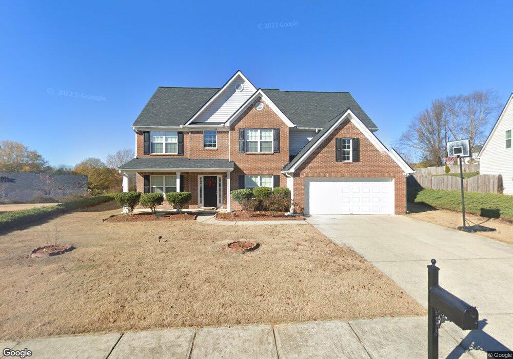
2546 Betty Sue Dr Unit 2 Buford, GA 30519
Estimated Value: $425,554 - $462,000
4
Beds
3
Baths
2,610
Sq Ft
$171/Sq Ft
Est. Value
About This Home
This home is located at 2546 Betty Sue Dr Unit 2, Buford, GA 30519 and is currently estimated at $446,139, approximately $170 per square foot. 2546 Betty Sue Dr Unit 2 is a home located in Gwinnett County with nearby schools including Freeman's Mill Elementary School, Twin Rivers Middle School, and Mountain View High School.
Ownership History
Date
Name
Owned For
Owner Type
Purchase Details
Closed on
Sep 22, 2004
Sold by
Winmark Homes Inc
Bought by
Lulseged Seble
Current Estimated Value
Home Financials for this Owner
Home Financials are based on the most recent Mortgage that was taken out on this home.
Original Mortgage
$185,800
Outstanding Balance
$90,480
Interest Rate
5.73%
Mortgage Type
New Conventional
Estimated Equity
$355,659
Create a Home Valuation Report for This Property
The Home Valuation Report is an in-depth analysis detailing your home's value as well as a comparison with similar homes in the area
Home Values in the Area
Average Home Value in this Area
Purchase History
| Date | Buyer | Sale Price | Title Company |
|---|---|---|---|
| Lulseged Seble | $206,500 | -- |
Source: Public Records
Mortgage History
| Date | Status | Borrower | Loan Amount |
|---|---|---|---|
| Open | Lulseged Seble | $185,800 |
Source: Public Records
Tax History Compared to Growth
Tax History
| Year | Tax Paid | Tax Assessment Tax Assessment Total Assessment is a certain percentage of the fair market value that is determined by local assessors to be the total taxable value of land and additions on the property. | Land | Improvement |
|---|---|---|---|---|
| 2025 | $4,726 | $160,000 | $30,000 | $130,000 |
| 2024 | $5,826 | $160,000 | $30,000 | $130,000 |
| 2023 | $5,826 | $167,640 | $30,000 | $137,640 |
| 2022 | $3,732 | $101,760 | $20,000 | $81,760 |
| 2021 | $3,779 | $113,960 | $20,000 | $93,960 |
| 2020 | $3,140 | $101,760 | $20,000 | $81,760 |
| 2019 | $3,031 | $83,520 | $12,800 | $70,720 |
| 2018 | $3,032 | $83,520 | $12,800 | $70,720 |
| 2016 | $2,229 | $60,000 | $11,200 | $48,800 |
| 2015 | $2,250 | $60,000 | $11,200 | $48,800 |
| 2014 | $2,165 | $57,320 | $11,200 | $46,120 |
Source: Public Records
Map
Nearby Homes
- 2431 Lance Ridge Way
- 2439 Canter Brook Ct Unit 1
- 2585 Braselton Hwy
- 1603 Fort Perry Way
- 2425 Fort Daniels Dr Unit 3A
- 2346 Hampton Park Dr Unit I
- 1720 Fort Daniels Trail
- 2032 Shin Ct NE
- 1827 Scouts Walk
- 2045 Amber Creek Dr
- 0 Hog Mountain Church Road and Auburn Rd
- 2305 Braselton Hwy
- 2706 Captain Ct
- 1655 Brisbane Dr
- 2416 Moultrie Ct
- 1717 Willoughby Dr
- 2375 Matlin Way
- 2228 Lakeview Bend Way
- 2556 Betty Sue Dr
- 2536 Betty Sue Dr
- 2082 Binnies Way
- 2074 Pierce Way
- 2064 Pierce Way
- 2064 Pierce Way Unit 2064
- 2084 Pierce Way
- 0 Betty Sue Dr NE Unit 7127082
- 0 Betty Sue Dr NE Unit 8651247
- 0 Betty Sue Dr NE Unit 8176426
- 0 Betty Sue Dr NE
- 2566 Betty Sue Dr
- 2526 Betty Sue Dr
- 2535 Betty Sue Dr
- 2603 Betty Dr
- 2054 Pierce Way
- 2054 Pierce Way
- 2613 Betty Dr
- 2094 Pierce Way
- 2555 Betty Sue Dr