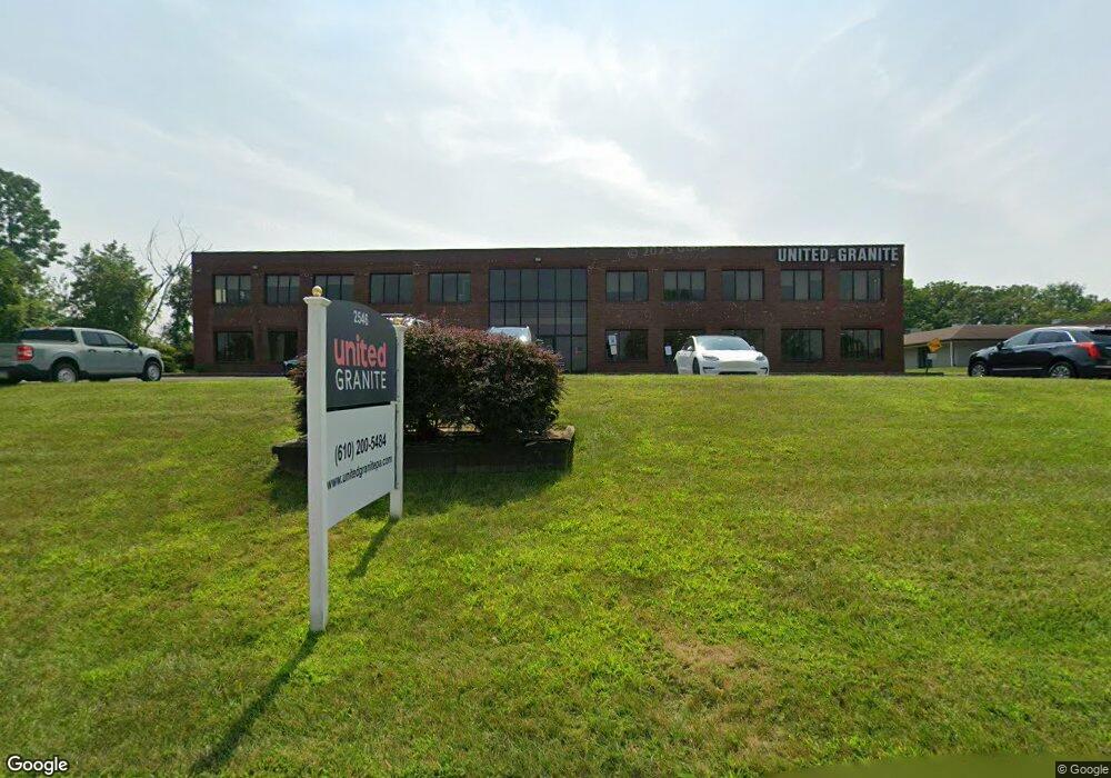
2546 General Armistead Ave Norristown, PA 19403
West Norriton Township NeighborhoodEstimated Value: $3,688,979
--
Bed
--
Bath
33,488
Sq Ft
$110/Sq Ft
Est. Value
About This Home
This home is located at 2546 General Armistead Ave, Norristown, PA 19403 and is currently estimated at $3,688,979, approximately $110 per square foot. 2546 General Armistead Ave is a home located in Montgomery County with nearby schools including Charles Blockson Middle School, Paul V Fly Elementary School, and East Norriton Middle School.
Ownership History
Date
Name
Owned For
Owner Type
Purchase Details
Closed on
Jun 9, 2008
Sold by
Wara Lp and Kiesel Cheryl
Bought by
Jade 2 Llc
Current Estimated Value
Home Financials for this Owner
Home Financials are based on the most recent Mortgage that was taken out on this home.
Original Mortgage
$1,730,400
Outstanding Balance
$1,113,226
Interest Rate
6.1%
Mortgage Type
Commercial
Estimated Equity
$2,606,957
Purchase Details
Closed on
Dec 29, 1995
Sold by
Jkf Inc
Bought by
Wara Lp and Wara Corp
Purchase Details
Closed on
Jun 15, 1995
Sold by
Spaventa Donato and Spaventa Lucy
Bought by
Jkf Inc
Create a Home Valuation Report for This Property
The Home Valuation Report is an in-depth analysis detailing your home's value as well as a comparison with similar homes in the area
Home Values in the Area
Average Home Value in this Area
Purchase History
| Date | Buyer | Sale Price | Title Company |
|---|---|---|---|
| Jade 2 Llc | $2,163,000 | None Available | |
| Wara Lp | -- | -- | |
| Jkf Inc | -- | -- |
Source: Public Records
Mortgage History
| Date | Status | Borrower | Loan Amount |
|---|---|---|---|
| Open | Jade 2 Llc | $1,730,400 |
Source: Public Records
Tax History Compared to Growth
Tax History
| Year | Tax Paid | Tax Assessment Tax Assessment Total Assessment is a certain percentage of the fair market value that is determined by local assessors to be the total taxable value of land and additions on the property. | Land | Improvement |
|---|---|---|---|---|
| 2025 | $58,966 | $1,206,880 | $336,850 | $870,030 |
| 2024 | $58,966 | $1,206,880 | $336,850 | $870,030 |
| 2023 | $58,301 | $1,206,880 | $336,850 | $870,030 |
| 2022 | $57,921 | $1,206,880 | $336,850 | $870,030 |
| 2021 | $57,569 | $1,206,880 | $336,850 | $870,030 |
| 2020 | $55,850 | $1,206,880 | $336,850 | $870,030 |
| 2019 | $54,603 | $1,206,880 | $336,850 | $870,030 |
| 2018 | $44,557 | $1,206,880 | $336,850 | $870,030 |
| 2017 | $51,549 | $1,206,880 | $336,850 | $870,030 |
| 2016 | $51,079 | $1,206,880 | $336,850 | $870,030 |
| 2015 | $47,322 | $1,206,880 | $336,850 | $870,030 |
| 2014 | $47,322 | $1,206,880 | $336,850 | $870,030 |
Source: Public Records
Map
Nearby Homes
- 2504 Grant Ct
- 1503 Reagan Ct
- 0 Roosevelt Blvd
- 2017 Yorktown S
- 2012 Yorktown S
- 526 Bassett Ln
- 2447 Hillside Dr
- 1914 Yorktown S
- 1905 Yorktown N
- 548 Susan Dr
- 143 Riversedge Dr Unit CONDO 143
- 2044 Mill Rd
- 176 Riversedge Dr
- 121 Woodstream Dr Unit CONDO 121
- 735 Champlain Dr
- 167 Woodstream Dr Unit CONDO 167
- 2039 Berkley Rd
- 213 River Trail Cir
- 254 River Trail Cir
- 307 Brandon Rd
- 293 Stone Ridge Dr
- 292 Stone Ridge Dr
- 290 Stone Ridge Dr
- 289 Stone Ridge Dr
- 288 Stone Ridge Dr
- 287 Stone Ridge Dr
- 286 Stone Ridge Dr
- 295 Stone Ridge Dr
- 284 Stone Ridge Dr Unit 284
- 284 Stone Ridge Dr
- 285 Stone Ridge Dr
- 296 Stone Ridge Dr
- 296 Stone Ridge Dr Unit 296
- 297 Stone Ridge Dr
- 298 Stone Ridge Dr
- 299 Stone Ridge Dr
- 282 Stone Ridge Dr
- 281 Stone Ridge Dr
- 283 Stone Ridge Dr
- 280 Stone Ridge Dr