Estimated Value: $632,000 - $671,318
4
Beds
4
Baths
1,922
Sq Ft
$343/Sq Ft
Est. Value
About This Home
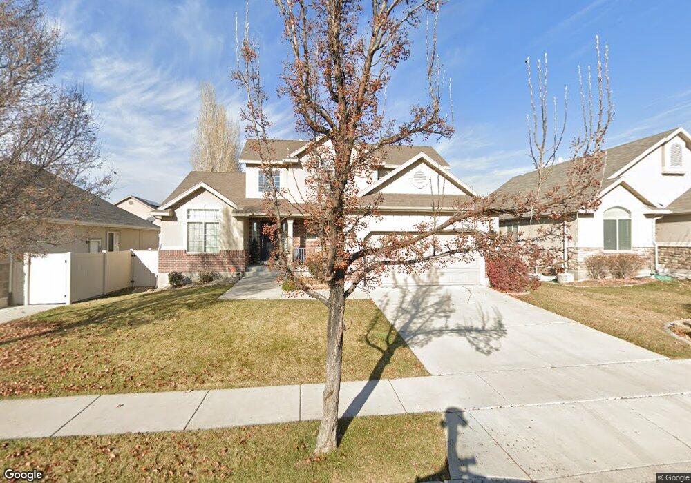
This home is located at 2546 W 2250 N, Lehi, UT 84043 and is currently estimated at $659,330, approximately $343 per square foot. 2546 W 2250 N is a home located in Utah County with nearby schools including Liberty Hills Elementary School, Skyridge High School, and Ascent Academies of Utah - Lehi Campus.
Ownership History
Date
Name
Owned For
Owner Type
Purchase Details
Closed on
May 13, 2024
Sold by
Dyer Revocable Trust and Dyer Richard C
Bought by
Ward Natalie C and Ward Nathan S
Current Estimated Value
Home Financials for this Owner
Home Financials are based on the most recent Mortgage that was taken out on this home.
Original Mortgage
$617,500
Outstanding Balance
$608,742
Interest Rate
6.82%
Mortgage Type
New Conventional
Estimated Equity
$50,588
Purchase Details
Closed on
Mar 25, 2021
Sold by
Lundwall Steven and Lundwall Jaime L
Bought by
Dyer Richard C and Dyer Revocable Trust
Purchase Details
Closed on
Jun 15, 2010
Sold by
Lundwall Steven and Lundwall Jaime
Bought by
Lundwall Steve and Lundwall Jaime L
Home Financials for this Owner
Home Financials are based on the most recent Mortgage that was taken out on this home.
Original Mortgage
$278,250
Interest Rate
4.5%
Mortgage Type
New Conventional
Create a Home Valuation Report for This Property
The Home Valuation Report is an in-depth analysis detailing your home's value as well as a comparison with similar homes in the area
Home Values in the Area
Average Home Value in this Area
Purchase History
| Date | Buyer | Sale Price | Title Company |
|---|---|---|---|
| Ward Natalie C | -- | Investors Title | |
| Dyer Richard C | -- | Cottonwood Title | |
| Lundwall Steve | -- | Investors Title Insurance A |
Source: Public Records
Mortgage History
| Date | Status | Borrower | Loan Amount |
|---|---|---|---|
| Open | Ward Natalie C | $617,500 | |
| Previous Owner | Lundwall Steve | $278,250 |
Source: Public Records
Tax History Compared to Growth
Tax History
| Year | Tax Paid | Tax Assessment Tax Assessment Total Assessment is a certain percentage of the fair market value that is determined by local assessors to be the total taxable value of land and additions on the property. | Land | Improvement |
|---|---|---|---|---|
| 2025 | $2,574 | $325,050 | $212,300 | $378,700 |
| 2024 | $2,574 | $301,180 | $0 | $0 |
| 2023 | $2,424 | $308,055 | $0 | $0 |
| 2022 | $2,308 | $284,350 | $0 | $0 |
| 2021 | $2,062 | $384,000 | $122,800 | $261,200 |
| 2020 | $1,944 | $357,800 | $113,700 | $244,100 |
| 2019 | $1,870 | $357,800 | $113,700 | $244,100 |
| 2018 | $1,831 | $331,300 | $107,200 | $224,100 |
| 2017 | $1,786 | $171,820 | $0 | $0 |
| 2016 | $1,810 | $161,480 | $0 | $0 |
| 2015 | $1,782 | $150,920 | $0 | $0 |
| 2014 | $1,744 | $146,850 | $0 | $0 |
Source: Public Records
Map
Nearby Homes
- 2464 W 2250 N
- 2189 N 2600 W
- 2196 N 2350 W
- Huntington Plan at Pioneer Meadows
- Silver Lake Plan at Pioneer Meadows
- Summit Plan at Pioneer Meadows
- Palisade Plan at Pioneer Meadows
- 1968 N 2040 W Unit 40
- 1990 N 2040 W
- 1990 N 2040 W Unit 41
- 1970 N 2090 St W
- 1854 N 2230 W
- 1842 N 2230 W
- 1870 N 2230 W
- 1870 N 2230 W Unit 23
- 1896 N 2230 W
- 1908 N 2230 W
- 1832 N 2230 W
- 1912 W 2250 N
- 2419 N 3130 W