Estimated Value: $38,000 - $88,000
--
Bed
2
Baths
1,744
Sq Ft
$38/Sq Ft
Est. Value
About This Home
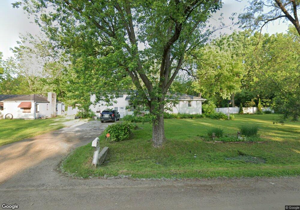
This home is located at 2547 Thornton Ave, Flint, MI 48504 and is currently estimated at $66,715, approximately $38 per square foot. 2547 Thornton Ave is a home located in Genesee County with nearby schools including Carman-Ainsworth High School, Greater Heights Academy, and Eagle's Nest Academy.
Ownership History
Date
Name
Owned For
Owner Type
Purchase Details
Closed on
Apr 17, 2013
Sold by
Price Della A
Bought by
Partners For Payment Relief De Iii Llc
Current Estimated Value
Purchase Details
Closed on
Aug 19, 2003
Sold by
Palmer Robert and Palmer Alison
Bought by
Price Della A
Home Financials for this Owner
Home Financials are based on the most recent Mortgage that was taken out on this home.
Original Mortgage
$46,800
Interest Rate
8.24%
Mortgage Type
Purchase Money Mortgage
Purchase Details
Closed on
Feb 9, 1999
Sold by
Grennay Raymond H and Grennay Lula Mae
Bought by
Palmer Robert
Create a Home Valuation Report for This Property
The Home Valuation Report is an in-depth analysis detailing your home's value as well as a comparison with similar homes in the area
Home Values in the Area
Average Home Value in this Area
Purchase History
| Date | Buyer | Sale Price | Title Company |
|---|---|---|---|
| Partners For Payment Relief De Iii Llc | $15,789 | None Available | |
| Price Della A | $58,500 | Greco Title | |
| Palmer Robert | $55,000 | Centennial Title & Abstract |
Source: Public Records
Mortgage History
| Date | Status | Borrower | Loan Amount |
|---|---|---|---|
| Previous Owner | Price Della A | $46,800 |
Source: Public Records
Tax History Compared to Growth
Tax History
| Year | Tax Paid | Tax Assessment Tax Assessment Total Assessment is a certain percentage of the fair market value that is determined by local assessors to be the total taxable value of land and additions on the property. | Land | Improvement |
|---|---|---|---|---|
| 2024 | $1,401 | $29,800 | $0 | $0 |
| 2023 | $1,290 | $28,100 | $0 | $0 |
| 2022 | $663 | $22,800 | $0 | $0 |
| 2021 | $650 | $20,700 | $0 | $0 |
| 2020 | $1,173 | $21,100 | $0 | $0 |
| 2019 | $1,170 | $20,900 | $0 | $0 |
| 2018 | $1,928 | $25,300 | $0 | $0 |
| 2017 | $2,126 | $25,300 | $0 | $0 |
| 2016 | $2,044 | $24,900 | $0 | $0 |
| 2015 | $1,434 | $24,900 | $0 | $0 |
| 2014 | $987 | $23,800 | $0 | $0 |
| 2012 | -- | $38,200 | $38,200 | $0 |
Source: Public Records
Map
Nearby Homes
- 2644 Clio Rd
- 2205 W Mcclellan St
- 2634 Seneca St
- 2495 Lavelle Rd
- 2214 Mack Ave
- 3030 Mccollum Ave
- 3360 W Dayton St
- 2631 Brownell Blvd
- 2331 Welch Blvd
- 3713 Wisner St
- 2407 Kellar Ave
- 3412 Comstock Ave
- 2208 Copeman Blvd
- 3145 Raywood St
- 3819 Brownell Blvd
- 3117 Burgess St
- 2429 Humboldt Ave
- 3384 Clement St
- 3106 Clement St
- 4201 Winona St
- 2547 Thornton Ave
- 2543 Thornton Ave
- 2569 Thornton Ave
- 2573 Thornton Ave
- 3044 W Dartmouth St
- 2546 Thornton Ave
- 2540 Thornton Ave
- 3018 W Dartmouth St
- 2554 Bertha Ave
- 2577 Thornton Ave
- 2544 Bertha Ave
- 2556 Bertha Ave
- 3010 W Dartmouth St
- 3060 W Dartmouth St
- 2566 Bertha Ave
- 2581 Thornton Ave
- 2572 Thornton Ave
- 2574 Bertha Ave
- 3031 W Dartmouth St
- 2585 Thornton Ave