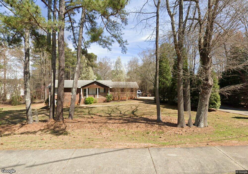
2548 Clay Rd Austell, GA 30106
Estimated Value: $257,552 - $301,000
3
Beds
2
Baths
1,213
Sq Ft
$236/Sq Ft
Est. Value
About This Home
This home is located at 2548 Clay Rd, Austell, GA 30106 and is currently estimated at $286,138, approximately $235 per square foot. 2548 Clay Rd is a home located in Cobb County with nearby schools including Clarkdale Elementary School, Cooper Middle School, and Cumberland Christian Academy PK-12.
Ownership History
Date
Name
Owned For
Owner Type
Purchase Details
Closed on
Apr 25, 2007
Sold by
Dickerson David B and Dickerson Susan M
Bought by
Franco Jose A
Current Estimated Value
Home Financials for this Owner
Home Financials are based on the most recent Mortgage that was taken out on this home.
Original Mortgage
$198,900
Outstanding Balance
$125,723
Interest Rate
6.1%
Mortgage Type
New Conventional
Estimated Equity
$172,334
Purchase Details
Closed on
Feb 13, 1998
Sold by
Boling Joseph L and Boling Maria
Bought by
Sheriff Robt E
Home Financials for this Owner
Home Financials are based on the most recent Mortgage that was taken out on this home.
Original Mortgage
$53,600
Interest Rate
6.89%
Mortgage Type
New Conventional
Create a Home Valuation Report for This Property
The Home Valuation Report is an in-depth analysis detailing your home's value as well as a comparison with similar homes in the area
Home Values in the Area
Average Home Value in this Area
Purchase History
| Date | Buyer | Sale Price | Title Company |
|---|---|---|---|
| Franco Jose A | $198,900 | -- | |
| Sheriff Robt E | $13,000 | -- |
Source: Public Records
Mortgage History
| Date | Status | Borrower | Loan Amount |
|---|---|---|---|
| Open | Franco Jose A | $198,900 | |
| Previous Owner | Sheriff Robt E | $53,600 |
Source: Public Records
Tax History Compared to Growth
Tax History
| Year | Tax Paid | Tax Assessment Tax Assessment Total Assessment is a certain percentage of the fair market value that is determined by local assessors to be the total taxable value of land and additions on the property. | Land | Improvement |
|---|---|---|---|---|
| 2024 | $2,075 | $87,980 | $32,488 | $55,492 |
| 2023 | $1,265 | $75,672 | $30,456 | $45,216 |
| 2022 | $1,599 | $65,520 | $20,304 | $45,216 |
| 2021 | $1,255 | $50,356 | $15,228 | $35,128 |
| 2020 | $1,255 | $50,356 | $15,228 | $35,128 |
| 2019 | $1,173 | $47,648 | $12,520 | $35,128 |
| 2018 | $1,069 | $44,252 | $11,504 | $32,748 |
| 2017 | $894 | $40,036 | $8,120 | $31,916 |
| 2016 | $895 | $40,036 | $8,120 | $31,916 |
| 2015 | $919 | $40,036 | $8,120 | $31,916 |
| 2014 | $718 | $33,000 | $0 | $0 |
Source: Public Records
Map
Nearby Homes
- 4821 Madison Point Cir
- 4790 Nature Trail
- 2718 Flintlock Place
- 6025 Park Wood Ct
- 2415 Wales Dr
- 2540 Park Ave
- 2705 Greystone Place
- 2711 Greystone Ct
- 2918 Egret Ln
- 4598 Flint Hill Rd
- 5069 Flint Hill Rd Unit AB
- 5069 A B Flint Hill Rd
- 2770 Park Ave
- 2125 Clay Rd SW
- 4872 Nature Trail
- 2373 Buckley Ct
- 4809 Hemlock Dr
- 2490 Wingfield Dr
- 4922 Jocks Ln
- 4922 Jocks Ln Unit 13
- L-108 Cureton Woods
- Lot 11 Cureton Woods
- Lot 10 Cureton Woods
- Lot 08 Cureton Woods
- 2494 Wingfield Dr
- 4869 Madison Point Cir
- 2498 Wingfield Dr
- 2486 Wingfield Dr
- 2482 Wingfield Dr
- 0 Wingfield Dr SW Unit 7371915
- 0 Wingfield Dr SW Unit 7218780
- 0 Wingfield Dr SW Unit 8521790
- 0 Wingfield Dr SW Unit 8515513
- 0 Wingfield Dr SW Unit 7604201
- 0 Wingfield Dr SW Unit 7593808
- 0 Wingfield Dr SW Unit 7577447
- 0 Wingfield Dr SW Unit 7494545