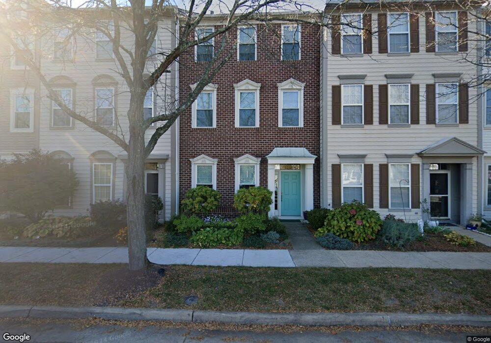
25489 Gover Dr Chantilly, VA 20152
Estimated Value: $618,000 - $639,000
3
Beds
3
Baths
2,144
Sq Ft
$294/Sq Ft
Est. Value
About This Home
This home is located at 25489 Gover Dr, Chantilly, VA 20152 and is currently estimated at $630,460, approximately $294 per square foot. 25489 Gover Dr is a home located in Loudoun County with nearby schools including Hutchison Farm Elementary School, J. Michael Lunsford Middle School, and Freedom High School.
Ownership History
Date
Name
Owned For
Owner Type
Purchase Details
Closed on
Jun 17, 2020
Sold by
Omland Omar K and Omland Leanne S
Bought by
Omland Omar Kenneth and Omland Leanne Smith
Current Estimated Value
Purchase Details
Closed on
Dec 7, 2006
Sold by
Casey Nancy Anne
Bought by
Omland Omar K
Home Financials for this Owner
Home Financials are based on the most recent Mortgage that was taken out on this home.
Original Mortgage
$364,000
Outstanding Balance
$218,712
Interest Rate
6.4%
Mortgage Type
New Conventional
Estimated Equity
$411,748
Purchase Details
Closed on
Mar 9, 1998
Sold by
Ii Llc Miller and Ii Llc Smith At South Riding
Bought by
Brown Nancy A
Home Financials for this Owner
Home Financials are based on the most recent Mortgage that was taken out on this home.
Original Mortgage
$163,900
Interest Rate
6.93%
Mortgage Type
New Conventional
Create a Home Valuation Report for This Property
The Home Valuation Report is an in-depth analysis detailing your home's value as well as a comparison with similar homes in the area
Home Values in the Area
Average Home Value in this Area
Purchase History
| Date | Buyer | Sale Price | Title Company |
|---|---|---|---|
| Omland Omar Kenneth | -- | None Available | |
| Omland Omar K | $455,000 | -- | |
| Brown Nancy A | $204,870 | -- |
Source: Public Records
Mortgage History
| Date | Status | Borrower | Loan Amount |
|---|---|---|---|
| Open | Omland Omar K | $364,000 | |
| Previous Owner | Brown Nancy A | $163,900 |
Source: Public Records
Tax History
| Year | Tax Paid | Tax Assessment Tax Assessment Total Assessment is a certain percentage of the fair market value that is determined by local assessors to be the total taxable value of land and additions on the property. | Land | Improvement |
|---|---|---|---|---|
| 2025 | $4,777 | $593,440 | $200,000 | $393,440 |
| 2024 | $4,934 | $570,450 | $180,000 | $390,450 |
| 2023 | $4,755 | $543,470 | $180,000 | $363,470 |
| 2022 | $4,763 | $535,120 | $170,000 | $365,120 |
| 2021 | $4,599 | $469,260 | $130,000 | $339,260 |
| 2020 | $4,377 | $422,860 | $130,000 | $292,860 |
| 2019 | $4,394 | $420,450 | $130,000 | $290,450 |
| 2018 | $4,349 | $400,830 | $115,000 | $285,830 |
| 2017 | $4,187 | $372,200 | $115,000 | $257,200 |
| 2016 | $4,074 | $355,810 | $0 | $0 |
| 2015 | $4,000 | $237,450 | $0 | $237,450 |
| 2014 | $4,106 | $240,540 | $0 | $240,540 |
Source: Public Records
Map
Nearby Homes
- 43078 Francis Square
- 43003 Golf View Dr
- 25670 S Village Dr
- 25730 S Village Dr
- 25488 Crossfield Dr
- 25280 Lake Shore Square Unit 102
- 25240 Lake Shore Square Unit 200
- 42811 Sykes Terrace
- 42714 Freedom St
- 43441 Bettys Farm Dr
- 25382 Whippoorwill Terrace
- 42824 Nations St
- 25121 Monteith Terrace
- 42923 Pamplin Terrace
- 42919 Pamplin Terrace
- 43372 Burke Dale St
- 25236 Orchard View Terrace
- 43140 Town Hall Plaza
- 42602 Suny Bay Ct
- 0 Braddock Rd Unit VALO2086014
- 25491 Gover Dr
- 25493 Gover Dr
- 25495 Gover Dr
- 25487 Gover Dr
- 25497 Gover Dr
- 25485 Gover Dr
- 25483 Gover Dr
- 25499 Gover Dr
- 43103 Demerrit St
- 43068 Eustis St
- 43101 Demerrit St
- 43066 Eustis St
- 43099 Demerrit St
- 43064 Eustis St
- 43097 Demerrit St
- 43062 Eustis St
- 43095 Demerrit St
- 43060 Eustis St
- 43093 Demerrit St
- 43073 Eustis St
Your Personal Tour Guide
Ask me questions while you tour the home.