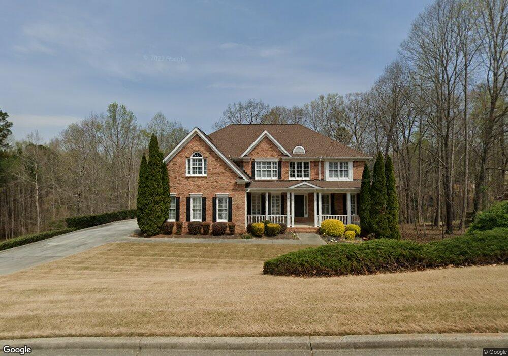
255 Amberbrook Cir Unit 2 Grayson, GA 30017
Estimated Value: $583,000 - $649,000
5
Beds
4
Baths
3,896
Sq Ft
$156/Sq Ft
Est. Value
About This Home
This home is located at 255 Amberbrook Cir Unit 2, Grayson, GA 30017 and is currently estimated at $608,155, approximately $156 per square foot. 255 Amberbrook Cir Unit 2 is a home located in Gwinnett County with nearby schools including Grayson Elementary School, Bay Creek Middle School, and Grayson High School.
Ownership History
Date
Name
Owned For
Owner Type
Purchase Details
Closed on
Dec 12, 2002
Sold by
Donahue Homes Inc
Bought by
Pitt Michael C and Pitt Clare E
Current Estimated Value
Home Financials for this Owner
Home Financials are based on the most recent Mortgage that was taken out on this home.
Original Mortgage
$210,000
Outstanding Balance
$95,348
Interest Rate
6.08%
Mortgage Type
New Conventional
Estimated Equity
$512,807
Create a Home Valuation Report for This Property
The Home Valuation Report is an in-depth analysis detailing your home's value as well as a comparison with similar homes in the area
Home Values in the Area
Average Home Value in this Area
Purchase History
| Date | Buyer | Sale Price | Title Company |
|---|---|---|---|
| Pitt Michael C | $316,200 | -- |
Source: Public Records
Mortgage History
| Date | Status | Borrower | Loan Amount |
|---|---|---|---|
| Open | Pitt Michael C | $210,000 |
Source: Public Records
Tax History Compared to Growth
Tax History
| Year | Tax Paid | Tax Assessment Tax Assessment Total Assessment is a certain percentage of the fair market value that is determined by local assessors to be the total taxable value of land and additions on the property. | Land | Improvement |
|---|---|---|---|---|
| 2025 | $7,544 | $267,680 | $36,000 | $231,680 |
| 2024 | $7,171 | $241,000 | $36,000 | $205,000 |
| 2023 | $7,171 | $242,120 | $40,000 | $202,120 |
| 2022 | $6,739 | $221,440 | $32,800 | $188,640 |
| 2021 | $5,786 | $170,760 | $25,600 | $145,160 |
| 2020 | $5,667 | $163,400 | $25,600 | $137,800 |
| 2019 | $5,235 | $151,760 | $20,000 | $131,760 |
| 2018 | $5,246 | $151,760 | $20,000 | $131,760 |
| 2016 | $4,995 | $139,360 | $16,000 | $123,360 |
| 2015 | $5,048 | $139,360 | $16,000 | $123,360 |
| 2014 | -- | $139,360 | $16,000 | $123,360 |
Source: Public Records
Map
Nearby Homes
- 2249 Cluster Ln
- 520 Herring Rd
- 390 Herring Rd
- 545 Herring Rd
- 1518 High Falls Ln
- 1478 High Falls Ln
- 1498 High Falls Ln
- 1488 High Falls Ln
- 1458 High Falls Ln
- 1489 High Falls Ln
- 1499 High Falls Ln
- 391 Tallulah Ln
- 1438 High Falls Ln
- 2380 Camp Mitchell Rd
- 401 Tallulah Ln
- 2422 Camp Mitchell Rd
- 1428 High Falls Ln
- 411 Tallulah Ln
- 2474 Starfire Ln Unit 2
- 406 Tallulah Ln
- 265 Amberbrook Cir Unit 29
- 245 Amberbrook Cir Unit 2
- 245 Amberbrook Cir
- 475 Tennyson Knoll Unit 3
- 460 Tennyson Knoll
- 275 Amberbrook Cir Unit 2
- 250 Amberbrook Cir
- 280 Amberbrook Cir
- 465 Tennyson Knoll
- 235 Amberbrook Cir
- 240 Amberbrook Cir Unit 2
- 285 Amberbrook Cir
- 230 Amberbrook Cir
- 450 Tennyson Knoll Unit 3
- 295 Amberbrook Cir Unit 2
- 290 Amberbrook Cir
- 218 Trentwood Ct
- 225 Amberbrook Cir
- 220 Amberbrook Cir
- 330 Amberbrook Cir