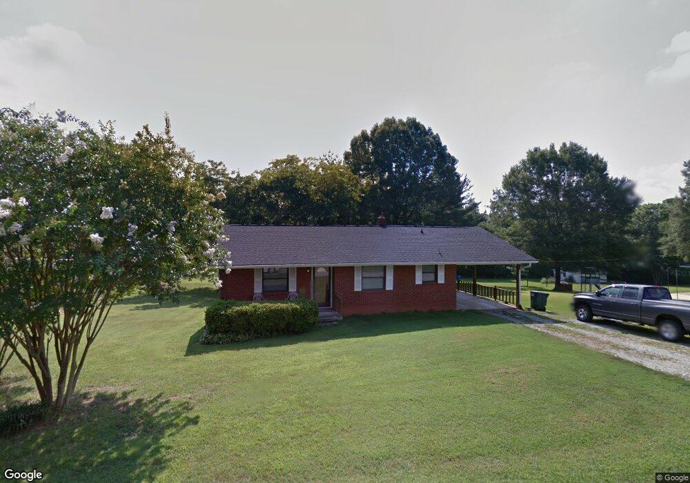
255 Arant Rd China Grove, NC 28023
Estimated Value: $210,694 - $253,000
--
Bed
1
Bath
1,153
Sq Ft
$206/Sq Ft
Est. Value
About This Home
This home is located at 255 Arant Rd, China Grove, NC 28023 and is currently estimated at $237,424, approximately $205 per square foot. 255 Arant Rd is a home located in Rowan County with nearby schools including Bostian Elementary School, China Grove Middle School, and Jesse C Carson High School.
Ownership History
Date
Name
Owned For
Owner Type
Purchase Details
Closed on
Jul 17, 2018
Sold by
Crainshaw Jennifer A
Bought by
Crainshaw Scott Lane
Current Estimated Value
Purchase Details
Closed on
Nov 30, 2006
Sold by
Crainshaw Chad M and Crainshaw Brandi K
Bought by
Crainshaw Scott Lane and Crainshaw Jennifer A
Home Financials for this Owner
Home Financials are based on the most recent Mortgage that was taken out on this home.
Original Mortgage
$90,000
Interest Rate
5.75%
Mortgage Type
Purchase Money Mortgage
Create a Home Valuation Report for This Property
The Home Valuation Report is an in-depth analysis detailing your home's value as well as a comparison with similar homes in the area
Home Values in the Area
Average Home Value in this Area
Purchase History
| Date | Buyer | Sale Price | Title Company |
|---|---|---|---|
| Crainshaw Scott Lane | -- | None Available | |
| Crainshaw Scott Lane | $59,000 | None Available |
Source: Public Records
Mortgage History
| Date | Status | Borrower | Loan Amount |
|---|---|---|---|
| Closed | Crainshaw Scott Lane | $90,000 |
Source: Public Records
Tax History Compared to Growth
Tax History
| Year | Tax Paid | Tax Assessment Tax Assessment Total Assessment is a certain percentage of the fair market value that is determined by local assessors to be the total taxable value of land and additions on the property. | Land | Improvement |
|---|---|---|---|---|
| 2025 | $1,055 | $157,498 | $33,411 | $124,087 |
| 2024 | $1,055 | $157,498 | $33,411 | $124,087 |
| 2023 | $1,055 | $157,498 | $33,411 | $124,087 |
| 2022 | $792 | $105,966 | $27,206 | $78,760 |
| 2021 | $786 | $105,966 | $27,206 | $78,760 |
| 2020 | $786 | $105,966 | $27,206 | $78,760 |
| 2019 | $786 | $105,966 | $27,206 | $78,760 |
| 2018 | $663 | $90,158 | $27,206 | $62,952 |
| 2017 | $663 | $90,158 | $27,206 | $62,952 |
| 2016 | $663 | $90,158 | $27,206 | $62,952 |
| 2015 | $673 | $90,158 | $27,206 | $62,952 |
| 2014 | $664 | $93,292 | $27,206 | $66,086 |
Source: Public Records
Map
Nearby Homes
- 1660 Lentz Rd
- 2570 Lentz Rd
- 1280 Elm Forest Ln
- 1307 Elm Forest Ln
- 1306 Elm Forest Ln
- 1274 Elm Forest Ln
- 0 Highway 152 E Unit 1200411
- 1256 Elm Forest Ln
- 2720 Lentz Rd
- 2510 Lentz Rd
- 1202 Elm Forest Ln
- 1231 Elm Forest Ln
- 2143 Stephens Farm Dr
- 215 Ketchie Estates Rd
- 175 Ketchie Estates Rd
- 1213 Elm Forest Ln
- Fairview Plan at Liberty Grove - Single Family Homes
- Woodford Plan at Liberty Grove - Single Family Homes
- Poplar Plan at Liberty Grove - Single Family Homes
- Lily Plan at Liberty Grove - Single Family Homes