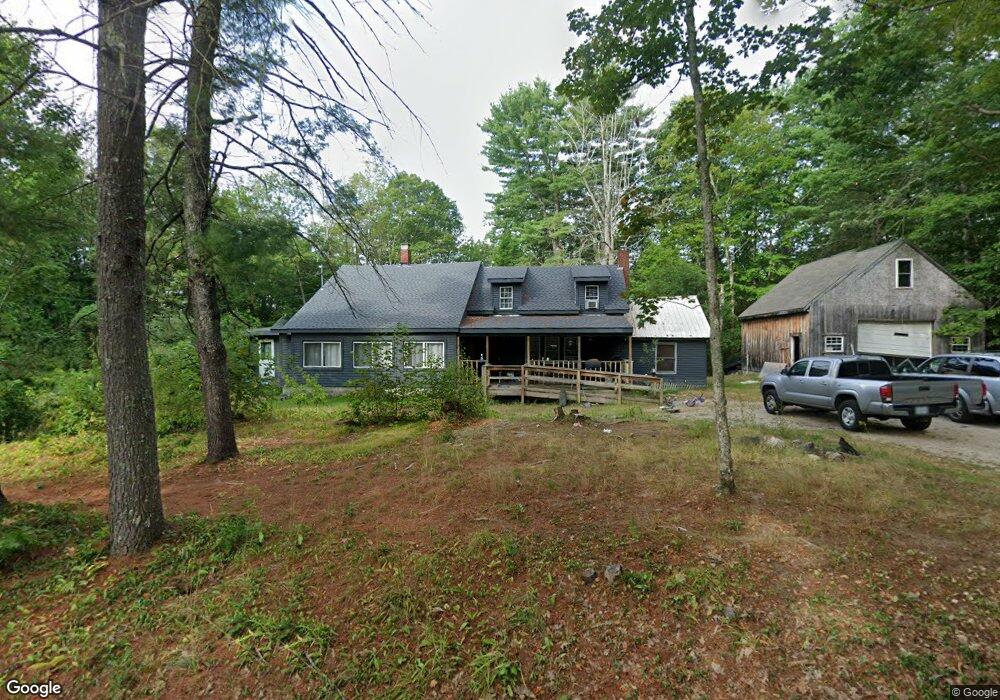
255 Garland Rd West Newfield, ME 04095
Newfield NeighborhoodEstimated Value: $384,000 - $474,000
2
Beds
2
Baths
1,900
Sq Ft
$221/Sq Ft
Est. Value
About This Home
This home is located at 255 Garland Rd, West Newfield, ME 04095 and is currently estimated at $419,726, approximately $220 per square foot. 255 Garland Rd is a home located in York County with nearby schools including Massabesic High School.
Ownership History
Date
Name
Owned For
Owner Type
Purchase Details
Closed on
Sep 4, 2009
Sold by
Rummery Doris M and Boucher Dwight P
Bought by
Norton Heather
Current Estimated Value
Home Financials for this Owner
Home Financials are based on the most recent Mortgage that was taken out on this home.
Original Mortgage
$160,816
Outstanding Balance
$105,280
Interest Rate
5.21%
Mortgage Type
FHA
Estimated Equity
$314,446
Create a Home Valuation Report for This Property
The Home Valuation Report is an in-depth analysis detailing your home's value as well as a comparison with similar homes in the area
Home Values in the Area
Average Home Value in this Area
Purchase History
| Date | Buyer | Sale Price | Title Company |
|---|---|---|---|
| Norton Heather | -- | -- |
Source: Public Records
Mortgage History
| Date | Status | Borrower | Loan Amount |
|---|---|---|---|
| Open | Norton Heather | $160,816 |
Source: Public Records
Tax History Compared to Growth
Tax History
| Year | Tax Paid | Tax Assessment Tax Assessment Total Assessment is a certain percentage of the fair market value that is determined by local assessors to be the total taxable value of land and additions on the property. | Land | Improvement |
|---|---|---|---|---|
| 2024 | $2,971 | $251,800 | $68,900 | $182,900 |
| 2023 | $2,750 | $251,800 | $68,900 | $182,900 |
| 2022 | $2,458 | $251,800 | $68,900 | $182,900 |
| 2021 | $2,292 | $201,400 | $55,100 | $146,300 |
| 2020 | $2,292 | $201,400 | $55,100 | $146,300 |
| 2019 | $2,244 | $201,400 | $55,100 | $146,300 |
| 2018 | $2,203 | $201,400 | $55,100 | $146,300 |
| 2017 | $2,466 | $201,400 | $55,100 | $146,300 |
| 2016 | $2,117 | $201,400 | $55,100 | $146,300 |
| 2015 | $1,962 | $201,400 | $55,100 | $146,300 |
| 2014 | $1,495 | $160,700 | $65,400 | $95,300 |
| 2013 | $1,446 | $160,700 | $65,400 | $95,300 |
Source: Public Records
Map
Nearby Homes
- 315 Libby Rd
- 367 Shady Nook Rd
- 174 Wakefield Rd
- 00 Libby Rd Unit Lot 9
- 1089 Maplewood Rd
- 0 Island Dr
- 57 Green Bay Rd
- Parcel #1 Sanborn Rd
- 122 Onamor Dr
- 20 Shepard's Island Rd
- 1 Corson Rd
- 0 Whitehouse Rd
- 84 Shady Nook Rd
- 220 Bond Spring Rd
- 112 Gile Rd
- TBD Wakefield Rd
- 00 Carter Ln
- 253 Asbury Ln
- 51 Mill Pond Rd
- 350 Concord Ln Unit 20