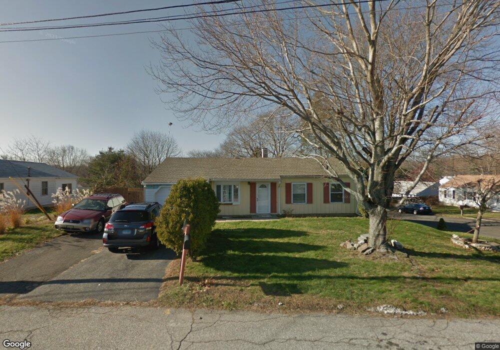
255 Little Deer Rd Bridgeport, CT 06606
North End NeighborhoodEstimated Value: $413,000 - $448,000
3
Beds
2
Baths
1,200
Sq Ft
$363/Sq Ft
Est. Value
About This Home
This home is located at 255 Little Deer Rd, Bridgeport, CT 06606 and is currently estimated at $435,107, approximately $362 per square foot. 255 Little Deer Rd is a home located in Fairfield County with nearby schools including John Winthrop School, Central High School, and St Andrew School.
Ownership History
Date
Name
Owned For
Owner Type
Purchase Details
Closed on
Sep 1, 2009
Sold by
Us Bk
Bought by
Lucero Estivaliz
Current Estimated Value
Purchase Details
Closed on
Feb 4, 1991
Sold by
Baker Matthew and Baker June
Bought by
Diagne Dusman and Diagne Sohna
Home Financials for this Owner
Home Financials are based on the most recent Mortgage that was taken out on this home.
Original Mortgage
$129,550
Interest Rate
9.52%
Mortgage Type
Unknown
Create a Home Valuation Report for This Property
The Home Valuation Report is an in-depth analysis detailing your home's value as well as a comparison with similar homes in the area
Home Values in the Area
Average Home Value in this Area
Purchase History
| Date | Buyer | Sale Price | Title Company |
|---|---|---|---|
| Lucero Estivaliz | -- | -- | |
| Lucero Estivaliz | -- | -- | |
| Diagne Dusman | $133,000 | -- | |
| Diagne Dusman | $133,000 | -- |
Source: Public Records
Mortgage History
| Date | Status | Borrower | Loan Amount |
|---|---|---|---|
| Previous Owner | Diagne Dusman | $20,368 | |
| Previous Owner | Diagne Dusman | $129,550 | |
| Previous Owner | Diagne Dusman | $88,500 |
Source: Public Records
Tax History Compared to Growth
Tax History
| Year | Tax Paid | Tax Assessment Tax Assessment Total Assessment is a certain percentage of the fair market value that is determined by local assessors to be the total taxable value of land and additions on the property. | Land | Improvement |
|---|---|---|---|---|
| 2025 | $6,678 | $153,690 | $78,440 | $75,250 |
| 2024 | $6,678 | $153,690 | $78,440 | $75,250 |
| 2023 | $6,678 | $153,690 | $78,440 | $75,250 |
| 2022 | $6,678 | $153,690 | $78,440 | $75,250 |
| 2021 | $6,678 | $153,690 | $78,440 | $75,250 |
| 2020 | $6,626 | $122,720 | $61,450 | $61,270 |
| 2019 | $6,626 | $122,720 | $61,450 | $61,270 |
| 2018 | $6,672 | $122,720 | $61,450 | $61,270 |
| 2017 | $6,672 | $122,720 | $61,450 | $61,270 |
| 2016 | $6,672 | $122,720 | $61,450 | $61,270 |
| 2015 | $5,858 | $138,810 | $60,480 | $78,330 |
| 2014 | $5,858 | $138,810 | $60,480 | $78,330 |
Source: Public Records
Map
Nearby Homes
- 173 Anton Dr
- 394 Anton Dr
- 50 Greenhouse Rd Unit 65D
- 50 Greenhouse Rd Unit 42C
- 64 Dobson St
- 65 Dobson St
- 87 Oliver St
- 236 Edgemoor Rd Unit D
- 2851 Old Town Rd
- 9 Patricia Rd Unit C
- 114 Oxford St
- 344 Cambridge St
- 72 Herald Ave
- 84 Oxford St
- 265 Vincellette St
- 2998 Madison Ave Unit C
- 90 Sequoia Rd
- 153 Seaver Cir
- 15 Cherry Hill Dr Unit 2A
- 230 Cherry Hill Dr Unit 2B
- 241 Little Deer Rd
- 204 Sunburst Rd
- 108 Indian Field Rd
- 138 Indian Field Rd
- 225 Little Deer Rd
- 238 Little Deer Rd
- 184 Sunburst Rd
- 80 Indian Field Rd
- 92 Indian Field Rd
- 170 Sunburst Rd
- 152 Indian Field Rd
- 220 Little Deer Rd
- 147 Bear Paw Rd
- 131 Bear Paw Rd
- 209 Little Deer Rd
- 181 Indian Field Rd
- 115 Bear Paw Rd
- 26 Little Deer Rd
- 166 Indian Field Rd
- 63 Indian Field Rd