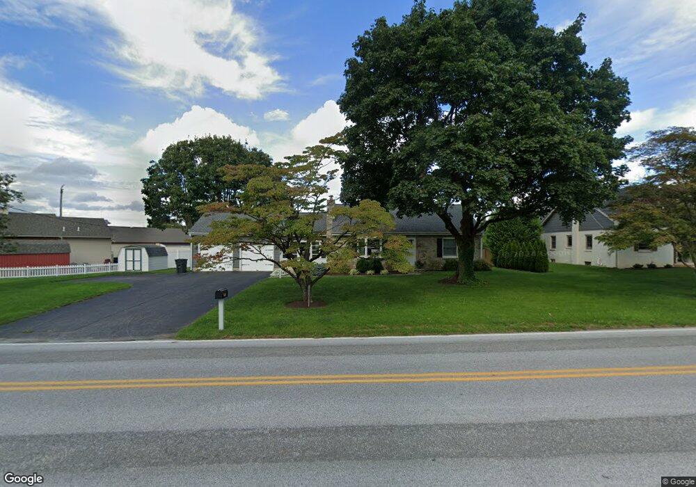
255 Maple Ave Bird In Hand, PA 17505
Estimated Value: $334,949 - $398,000
2
Beds
2
Baths
1,204
Sq Ft
$300/Sq Ft
Est. Value
About This Home
This home is located at 255 Maple Ave, Bird In Hand, PA 17505 and is currently estimated at $360,987, approximately $299 per square foot. 255 Maple Ave is a home located in Lancaster County with nearby schools including Smoketown Elementary School, Gerald G. Huesken Middle School, and Conestoga Valley High School.
Ownership History
Date
Name
Owned For
Owner Type
Purchase Details
Closed on
Apr 23, 2020
Sold by
255 Maple Bih Llc
Bought by
House On Maple Llc
Current Estimated Value
Purchase Details
Closed on
Oct 27, 2015
Sold by
Andews Judy A and Wolfe Robert C
Bought by
255 Maple B I H Llc
Purchase Details
Closed on
Jun 21, 2010
Sold by
Wolfe Robert C
Bought by
Wolfe Robert C
Purchase Details
Closed on
Jun 22, 2006
Sold by
Wolfe Dorothy
Bought by
Wolfe Dorothy
Create a Home Valuation Report for This Property
The Home Valuation Report is an in-depth analysis detailing your home's value as well as a comparison with similar homes in the area
Home Values in the Area
Average Home Value in this Area
Purchase History
| Date | Buyer | Sale Price | Title Company |
|---|---|---|---|
| House On Maple Llc | $250,000 | Red Rose Abstract Co | |
| 255 Maple B I H Llc | $190,000 | None Available | |
| Wolfe Robert C | -- | None Available | |
| Wolfe Dorothy | -- | None Available |
Source: Public Records
Tax History Compared to Growth
Tax History
| Year | Tax Paid | Tax Assessment Tax Assessment Total Assessment is a certain percentage of the fair market value that is determined by local assessors to be the total taxable value of land and additions on the property. | Land | Improvement |
|---|---|---|---|---|
| 2025 | $3,434 | $169,600 | $60,700 | $108,900 |
| 2024 | $3,434 | $169,600 | $60,700 | $108,900 |
| 2023 | $3,354 | $169,600 | $60,700 | $108,900 |
| 2022 | $3,271 | $169,600 | $60,700 | $108,900 |
| 2021 | $3,155 | $169,600 | $60,700 | $108,900 |
| 2020 | $3,155 | $169,600 | $60,700 | $108,900 |
| 2019 | $3,088 | $169,600 | $60,700 | $108,900 |
| 2018 | $4,543 | $169,600 | $60,700 | $108,900 |
| 2017 | $3,148 | $145,400 | $52,200 | $93,200 |
| 2016 | $3,110 | $145,400 | $52,200 | $93,200 |
| 2015 | $795 | $145,400 | $52,200 | $93,200 |
| 2014 | $2,061 | $145,400 | $52,200 | $93,200 |
Source: Public Records
Map
Nearby Homes
- 323 Enterprise Dr
- 339 Enterprise Dr
- 2596 Old Philadelphia Pike
- 2498 Old Philadelphia Park
- 425 Mill Creek Rd
- 2453 Lincoln Hwy E
- 7 Pleasant Dr
- 103 Fairhill Dr
- 2472 Leaman Rd
- 26 Ruth Dr
- 31 Jere Rd
- 0 - Lot #2 Paradise Ln
- 439 Coreopsis Dr
- 15 S Singer Ave
- 3088 Lincoln Hwy E
- 305 Greenland Dr Unit 385
- 347 Greenland Dr
- 33 Black Oak Dr
- 68 Horseshoe Rd
- 37 Black Oak Dr
- 251 Maple Ave
- 249 Maple Ave
- 250 Maple Ave
- 247 Maple Ave
- 248 Maple Ave
- 264 Maple Ave
- 243 Maple Ave
- 242 Maple Ave
- 236 Maple Ave
- 239 Maple Ave
- 2688 Old Philadelphia Pike
- 224 Maple Ave
- 2727 Old Philadelphia Pike
- 2686 Old Philadelphia Pike
- 2689 Old Philadelphia Pike
- 2684 Old Philadelphia Pike
- 2680 Old Philadelphia Pike
- 2678 Old Philadelphia Pike
- 2683 Old Philadelphia Pike
- 238 Railroad Ave