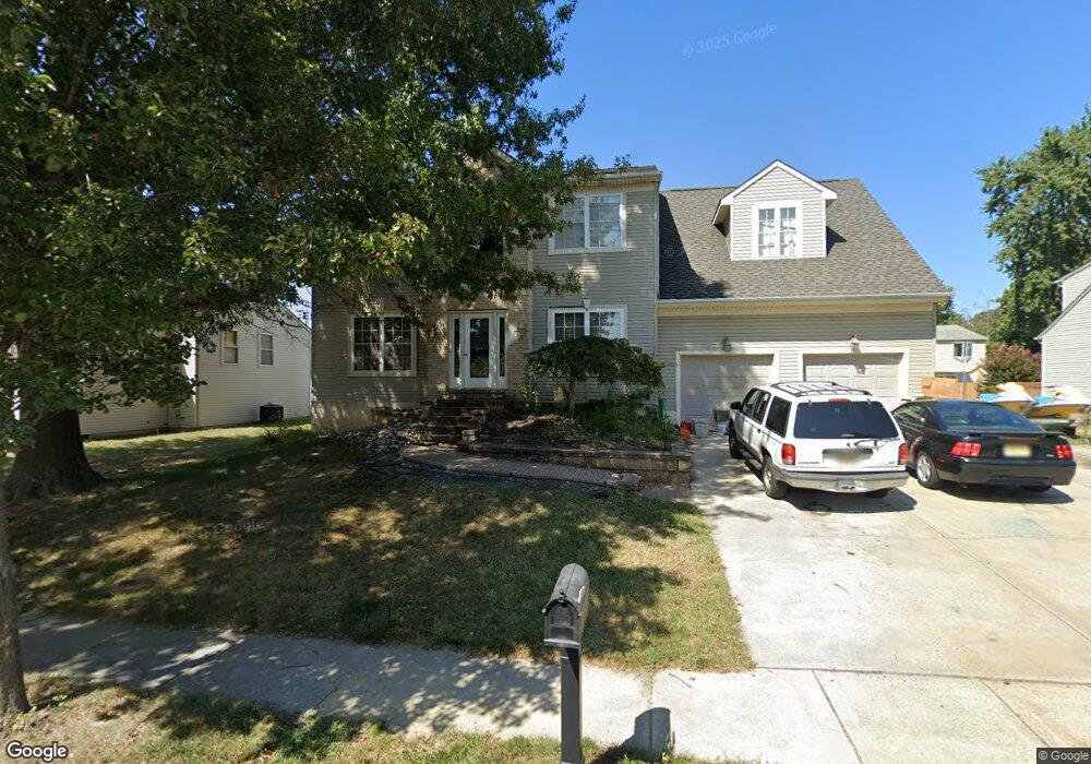
255 Middlesex Ave Thorofare, NJ 08086
Estimated Value: $415,000 - $542,000
Studio
--
Bath
2,656
Sq Ft
$183/Sq Ft
Est. Value
About This Home
This home is located at 255 Middlesex Ave, Thorofare, NJ 08086 and is currently estimated at $485,883, approximately $182 per square foot. 255 Middlesex Ave is a home located in Gloucester County with nearby schools including Red Bank Elementary School, Oakview Elementary School, and Green-Fields Elementary School.
Ownership History
Date
Name
Owned For
Owner Type
Purchase Details
Closed on
Nov 15, 2023
Sold by
Palese Michelle M and Darino Michelle M
Bought by
Palese Joseph W
Current Estimated Value
Purchase Details
Closed on
May 26, 1998
Sold by
Noce Philip A
Bought by
Palese Joseph W and Palese Michelle M
Purchase Details
Closed on
May 18, 1998
Sold by
Noce Susanna V
Bought by
Noce Philip A
Create a Home Valuation Report for This Property
The Home Valuation Report is an in-depth analysis detailing your home's value as well as a comparison with similar homes in the area
Home Values in the Area
Average Home Value in this Area
Purchase History
| Date | Buyer | Sale Price | Title Company |
|---|---|---|---|
| Palese Joseph W | -- | None Listed On Document | |
| Palese Joseph W | $33,500 | Congress Title Corp | |
| Noce Philip A | -- | Congress Title Corp |
Source: Public Records
Tax History
| Year | Tax Paid | Tax Assessment Tax Assessment Total Assessment is a certain percentage of the fair market value that is determined by local assessors to be the total taxable value of land and additions on the property. | Land | Improvement |
|---|---|---|---|---|
| 2025 | $10,647 | $304,900 | $56,800 | $248,100 |
| 2024 | $10,510 | $304,900 | $56,800 | $248,100 |
| 2023 | $10,510 | $304,900 | $56,800 | $248,100 |
| 2022 | $10,461 | $304,900 | $56,800 | $248,100 |
| 2021 | $10,425 | $304,900 | $56,800 | $248,100 |
| 2020 | $10,400 | $304,900 | $56,800 | $248,100 |
| 2019 | $11,384 | $304,900 | $56,800 | $248,100 |
| 2018 | $11,075 | $343,300 | $56,800 | $286,500 |
| 2017 | $10,817 | $343,300 | $56,800 | $286,500 |
| 2016 | $10,515 | $343,300 | $56,800 | $286,500 |
| 2015 | $10,017 | $343,300 | $56,800 | $286,500 |
| 2014 | $9,520 | $343,300 | $56,800 | $286,500 |
Source: Public Records
Map
Nearby Homes
- 187 Bergen Ave
- 55 Riverview Ave
- 170 Frederic Ct
- 401 Woodbury Terrace
- 439 Crown Point Rd
- 126 Brent Ct
- 113 Brent Ct
- 433 Crown Point Rd
- 44 N Warren St
- 543 High St
- 8 Rothschild Ct
- 61 N Columbia St
- 443 High St
- 20 N Columbia St
- 132 Avocet Ln
- 112 Blue Heron Dr
- 6 Phoebe Terrace
- 419 High St
- 420 S Girard St
- 220 S Jefferson Ave
- 257 Middlesex Ave
- 254 Monmouth Ave
- 251 Middlesex Ave
- 256 Monmouth Ave
- 252 Middlesex Ave
- 252 Monmouth Ave
- 258 Middlesex Ave
- 261 Middlesex Ave
- 260 Monmouth Ave
- 262 Middlesex Ave
- 250 Monmouth Ave
- 255 Roosevelt Blvd
- 255 Monmouth Ave
- 253 Monmouth Ave
- 266 Monmouth Ave
- 265 Middlesex Ave
- 266 Middlesex Ave
- 259 Monmouth Ave
- 261 Roosevelt Blvd
- 263 Monmouth Ave
Your Personal Tour Guide
Ask me questions while you tour the home.