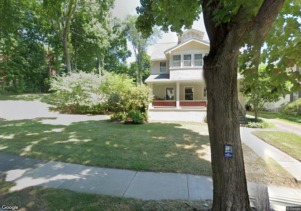
255 Mill St Newtonville, MA 02460
Newtonville NeighborhoodEstimated Value: $1,944,000 - $2,186,000
4
Beds
4
Baths
3,033
Sq Ft
$684/Sq Ft
Est. Value
About This Home
This home is located at 255 Mill St, Newtonville, MA 02460 and is currently estimated at $2,073,641, approximately $683 per square foot. 255 Mill St is a home located in Middlesex County with nearby schools including Cabot Elementary School, F.A. Day Middle School, and Newton North High School.
Ownership History
Date
Name
Owned For
Owner Type
Purchase Details
Closed on
Mar 17, 1987
Sold by
Fazio Giovanni
Bought by
Campbell Marilyn
Current Estimated Value
Home Financials for this Owner
Home Financials are based on the most recent Mortgage that was taken out on this home.
Original Mortgage
$200,000
Interest Rate
9.01%
Mortgage Type
Purchase Money Mortgage
Create a Home Valuation Report for This Property
The Home Valuation Report is an in-depth analysis detailing your home's value as well as a comparison with similar homes in the area
Home Values in the Area
Average Home Value in this Area
Purchase History
| Date | Buyer | Sale Price | Title Company |
|---|---|---|---|
| Campbell Marilyn | $340,000 | -- |
Source: Public Records
Mortgage History
| Date | Status | Borrower | Loan Amount |
|---|---|---|---|
| Closed | Campbell Marilyn | $60,000 | |
| Closed | Campbell Marilyn | $202,500 | |
| Closed | Campbell Marilyn | $200,000 |
Source: Public Records
Tax History Compared to Growth
Tax History
| Year | Tax Paid | Tax Assessment Tax Assessment Total Assessment is a certain percentage of the fair market value that is determined by local assessors to be the total taxable value of land and additions on the property. | Land | Improvement |
|---|---|---|---|---|
| 2025 | $16,776 | $1,711,800 | $1,414,600 | $297,200 |
| 2024 | $12,468 | $1,277,500 | $1,180,900 | $96,600 |
| 2023 | $11,900 | $1,169,000 | $901,600 | $267,400 |
| 2022 | $11,387 | $1,082,400 | $834,800 | $247,600 |
| 2021 | $10,987 | $1,021,100 | $787,500 | $233,600 |
| 2020 | $10,660 | $1,021,100 | $787,500 | $233,600 |
| 2019 | $10,360 | $991,400 | $764,600 | $226,800 |
| 2018 | $9,980 | $922,400 | $689,200 | $233,200 |
| 2017 | $9,677 | $870,200 | $650,200 | $220,000 |
| 2016 | $9,031 | $793,600 | $607,700 | $185,900 |
| 2015 | $8,611 | $741,700 | $567,900 | $173,800 |
Source: Public Records
Map
Nearby Homes
- 3 Cedar St
- 95 Blake St
- 61 Lakeview Ave
- 154 Beaumont Ave
- 110 Harvard St
- 22 Walnut Place Unit 1
- 206-208 Cabot St
- 112 Washington Park Unit 1
- 59 Charlotte Rd
- 20 Birch Hill Rd
- 90 Highland Ave
- 50 Crestwood Rd
- 33 Birch Hill Rd
- 48 Harvard St Unit 1
- 34 Winchester Rd Unit 34
- 28 Laudholm Rd
- Lots 2 & 3 Chapin Rd
- Lot 3 Chapin Rd
- Lot 2 Chapin Rd
- 1004 Centre St