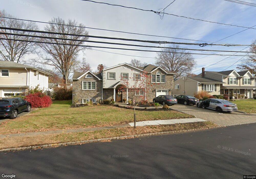
255 Milltown Rd Springfield, NJ 07081
Estimated Value: $721,000 - $952,000
Studio
--
Bath
3,200
Sq Ft
$269/Sq Ft
Est. Value
About This Home
This home is located at 255 Milltown Rd, Springfield, NJ 07081 and is currently estimated at $860,123, approximately $268 per square foot. 255 Milltown Rd is a home located in Union County with nearby schools including Jonathan Dayton High School and St James The Apostle School.
Ownership History
Date
Name
Owned For
Owner Type
Purchase Details
Closed on
Nov 29, 2005
Sold by
Shriky Ranit
Bought by
Toledo Jesse and Toledo Marlene
Current Estimated Value
Home Financials for this Owner
Home Financials are based on the most recent Mortgage that was taken out on this home.
Original Mortgage
$359,920
Outstanding Balance
$199,579
Interest Rate
6.14%
Mortgage Type
New Conventional
Estimated Equity
$660,544
Purchase Details
Closed on
Jan 30, 2001
Sold by
Weinman Seymour
Bought by
Shriky Ranit and Shriky Hinda
Home Financials for this Owner
Home Financials are based on the most recent Mortgage that was taken out on this home.
Original Mortgage
$150,000
Interest Rate
6.84%
Mortgage Type
Stand Alone First
Create a Home Valuation Report for This Property
The Home Valuation Report is an in-depth analysis detailing your home's value as well as a comparison with similar homes in the area
Home Values in the Area
Average Home Value in this Area
Purchase History
| Date | Buyer | Sale Price | Title Company |
|---|---|---|---|
| Toledo Jesse | $449,900 | -- | |
| Shriky Ranit | $275,000 | -- |
Source: Public Records
Mortgage History
| Date | Status | Borrower | Loan Amount |
|---|---|---|---|
| Open | Toledo Jesse | $359,920 | |
| Previous Owner | Shriky Ranit | $150,000 |
Source: Public Records
Tax History
| Year | Tax Paid | Tax Assessment Tax Assessment Total Assessment is a certain percentage of the fair market value that is determined by local assessors to be the total taxable value of land and additions on the property. | Land | Improvement |
|---|---|---|---|---|
| 2025 | $16,226 | $683,200 | $234,300 | $448,900 |
| 2024 | $15,960 | $683,200 | $234,300 | $448,900 |
| 2023 | $15,960 | $683,200 | $234,300 | $448,900 |
| 2022 | $14,819 | $683,200 | $234,300 | $448,900 |
| 2021 | $16,200 | $217,600 | $68,400 | $149,200 |
| 2020 | $15,948 | $217,600 | $68,400 | $149,200 |
| 2019 | $15,732 | $217,600 | $68,400 | $149,200 |
| 2018 | $15,450 | $217,600 | $68,400 | $149,200 |
| 2017 | $15,025 | $217,600 | $68,400 | $149,200 |
| 2016 | $14,734 | $217,600 | $68,400 | $149,200 |
| 2015 | $14,562 | $217,600 | $68,400 | $149,200 |
| 2014 | $14,288 | $217,600 | $68,400 | $149,200 |
Source: Public Records
Map
Nearby Homes
- 20 Archbridge Ln
- 13 Evergreen Ave
- 559 S Springfield Ave Unit 559
- 148 Locust Dr
- 294 Mountain Ave
- 23 Diven St
- 238 Riverside Dr
- 750 Andover Rd
- 798 Pinewood Rd
- 105 Battle Hill Ave
- 2705 Andrea Rd
- 787 Liberty Ave
- 67 Battle Hill Ave
- 701 Mountain Ave
- 24 Brook St
- 2670 Bancroft Ave
- 2469 Macarthur Dr
- 2 S Audlen Terrace
- 960 Moessner Ave
- 20 Maple Ave
Your Personal Tour Guide
Ask me questions while you tour the home.