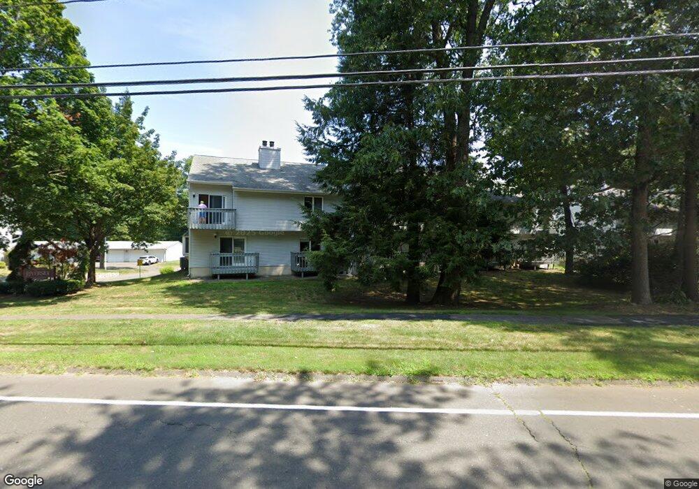
255 New Britain Ave Unit 255 Unionville, CT 06085
Estimated Value: $270,000 - $322,000
2
Beds
2
Baths
1,279
Sq Ft
$224/Sq Ft
Est. Value
About This Home
This home is located at 255 New Britain Ave Unit 255, Unionville, CT 06085 and is currently estimated at $286,435, approximately $223 per square foot. 255 New Britain Ave Unit 255 is a home located in Hartford County with nearby schools including Union School, West Woods Upper Elementary School, and Irving A. Robbins Middle School.
Ownership History
Date
Name
Owned For
Owner Type
Purchase Details
Closed on
Jul 25, 2011
Sold by
Warner Robert W and Warner Janice J
Bought by
Jones Sandra L
Current Estimated Value
Home Financials for this Owner
Home Financials are based on the most recent Mortgage that was taken out on this home.
Original Mortgage
$116,625
Outstanding Balance
$80,159
Interest Rate
4.49%
Estimated Equity
$206,276
Purchase Details
Closed on
Jan 24, 2002
Sold by
Mitchell Margaret M
Bought by
Foint Michael J and Scafiri Michelle L
Home Financials for this Owner
Home Financials are based on the most recent Mortgage that was taken out on this home.
Original Mortgage
$113,300
Interest Rate
7.08%
Create a Home Valuation Report for This Property
The Home Valuation Report is an in-depth analysis detailing your home's value as well as a comparison with similar homes in the area
Home Values in the Area
Average Home Value in this Area
Purchase History
| Date | Buyer | Sale Price | Title Company |
|---|---|---|---|
| Jones Sandra L | $155,500 | -- | |
| Foint Michael J | $116,000 | -- |
Source: Public Records
Mortgage History
| Date | Status | Borrower | Loan Amount |
|---|---|---|---|
| Open | Jones Sandra L | $116,625 | |
| Previous Owner | Foint Michael J | $22,800 | |
| Previous Owner | Foint Michael J | $10,000 | |
| Previous Owner | Foint Michael J | $113,300 |
Source: Public Records
Tax History Compared to Growth
Tax History
| Year | Tax Paid | Tax Assessment Tax Assessment Total Assessment is a certain percentage of the fair market value that is determined by local assessors to be the total taxable value of land and additions on the property. | Land | Improvement |
|---|---|---|---|---|
| 2025 | $3,840 | $144,270 | $0 | $144,270 |
| 2024 | $3,672 | $144,270 | $0 | $144,270 |
| 2023 | $3,493 | $144,270 | $0 | $144,270 |
| 2022 | $3,060 | $104,370 | $0 | $104,370 |
| 2021 | $3,007 | $104,370 | $0 | $104,370 |
| 2020 | $2,919 | $104,370 | $0 | $104,370 |
| 2019 | $2,919 | $104,370 | $0 | $104,370 |
| 2018 | $2,837 | $104,370 | $0 | $104,370 |
| 2017 | $2,854 | $106,960 | $0 | $106,960 |
| 2016 | $2,757 | $106,960 | $0 | $106,960 |
| 2015 | $2,675 | $106,960 | $0 | $106,960 |
| 2014 | $2,614 | $106,960 | $0 | $106,960 |
Source: Public Records
Map
Nearby Homes
- 267 New Britain Ave
- 243 New Britain Ave Unit 243
- 1622 Farmington Ave Unit 4
- 54 Westview Terrace
- 55 Depot Place
- 27 Westview Terrace
- 20 Briarwood Rd
- 31 Railroad Ave
- 6 Burlington Rd
- 115 W Avon Rd
- 14 Springwood Rd
- 54 Pinewood Dr
- 3 Heritage Dr
- 5 Le Jardin Way
- 6 Le Jardin Way
- 49 Northwoods Rd
- 94 Sanford Ave
- 50 Northwoods Rd
- 22 Heritage Dr Unit 22
- 2 Muirfield Ln
- 255 New Britain Ave
- 261 New Britain Ave
- 257 New Britain Ave
- 257 New Britain Ave Unit 257
- 265 New Britain Ave
- 263 New Britain Ave
- 260 New Britain Ave
- 277 New Britain Ave
- 275 New Britain Ave
- 273 New Britain Ave
- 271 New Britain Ave
- 269 New Britain Ave
- 277 New Britain Ave Unit 277
- 259 New Britain Ave
- 270 New Britain Ave
- 270 New Britain Ave Unit 270 NB AVE Unit 2
- 253 New Britain Ave
- 249 New Britain Ave
- 247 New Britain Ave
- 243 New Britain Ave