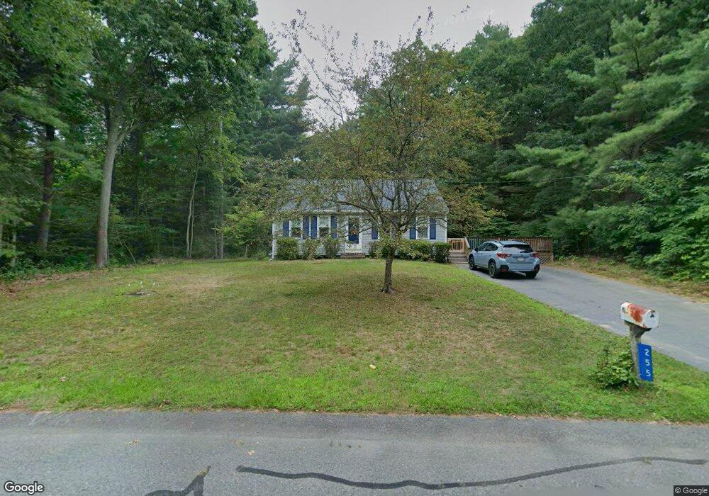
255 Princess Kate Cir Taunton, MA 02780
Weir Village NeighborhoodEstimated Value: $432,000 - $475,605
3
Beds
2
Baths
952
Sq Ft
$478/Sq Ft
Est. Value
About This Home
This home is located at 255 Princess Kate Cir, Taunton, MA 02780 and is currently estimated at $454,901, approximately $477 per square foot. 255 Princess Kate Cir is a home located in Bristol County with nearby schools including Elizabeth Pole School, Taunton High School, and John F. Parker Middle School.
Ownership History
Date
Name
Owned For
Owner Type
Purchase Details
Closed on
Nov 20, 1991
Sold by
Jnk Constr Corp Inc
Bought by
Flanagan Mark L and Flanagan Barbara J
Current Estimated Value
Home Financials for this Owner
Home Financials are based on the most recent Mortgage that was taken out on this home.
Original Mortgage
$98,900
Interest Rate
8.7%
Mortgage Type
Purchase Money Mortgage
Create a Home Valuation Report for This Property
The Home Valuation Report is an in-depth analysis detailing your home's value as well as a comparison with similar homes in the area
Home Values in the Area
Average Home Value in this Area
Purchase History
| Date | Buyer | Sale Price | Title Company |
|---|---|---|---|
| Flanagan Mark L | $109,900 | -- |
Source: Public Records
Mortgage History
| Date | Status | Borrower | Loan Amount |
|---|---|---|---|
| Closed | Flanagan Mark L | $97,000 | |
| Closed | Flanagan Mark L | $98,900 |
Source: Public Records
Tax History Compared to Growth
Tax History
| Year | Tax Paid | Tax Assessment Tax Assessment Total Assessment is a certain percentage of the fair market value that is determined by local assessors to be the total taxable value of land and additions on the property. | Land | Improvement |
|---|---|---|---|---|
| 2025 | $4,594 | $419,900 | $146,500 | $273,400 |
| 2024 | $4,273 | $381,900 | $146,500 | $235,400 |
| 2023 | $4,001 | $332,000 | $139,900 | $192,100 |
| 2022 | $4,157 | $315,400 | $127,800 | $187,600 |
| 2021 | $3,955 | $278,500 | $116,300 | $162,200 |
| 2020 | $3,916 | $263,500 | $116,300 | $147,200 |
| 2019 | $4,173 | $264,800 | $122,100 | $142,700 |
| 2018 | $3,815 | $242,700 | $123,200 | $119,500 |
| 2017 | $3,609 | $229,700 | $117,500 | $112,200 |
| 2016 | $3,479 | $221,900 | $113,900 | $108,000 |
| 2015 | $3,352 | $223,300 | $113,900 | $109,400 |
| 2014 | $3,347 | $229,100 | $113,900 | $115,200 |
Source: Public Records
Map
Nearby Homes
- 165 King James Blvd
- 31 Bruno's Way Unit A
- 26 Maynard St Unit A
- 147 Colonial Dr
- 28 Barbara Rd
- 106 Alicia Dr
- 55 Donna Terrace
- 218R Hart St Unit B
- 218R Hart St Unit A
- 168 Hart St Unit 22
- 73 Raymond Ave
- 15 Carlton St
- 170 Hart St Unit B
- 600 County St Lot A
- 600
- 600 County St
- 138 Pine Tree Ln
- 23 Johnson St Unit A
- 23 Johnson St Unit C
- 96 Old Colony Ave Unit 264
- 235 Princess Kate Cir
- 250 Princess Kate Cir
- 220 Princess Kate Cir
- 220 Princess Kate Cir Unit 1
- 280 Princess Kate Cir
- 285 Princess Kate Cir
- 160 Princess Kate Cir
- 170 Princess Kate Cir
- 265 Princess Kate Cir
- 275 Princess Kate Cir
- 215 Princess Kate Cir
- 145 Princess Kate Cir
- 130 Princess Kate Cir
- 155 Princess Kate Cir
- 165 Princess Kate Cir
- 135 Princess Kate Cir
- 185 Princess Kate Cir
- 125 Princess Kate Cir
- 195 Princess Kate Cir
- 100 Princess Kate Cir